Category Archives: Nature

My Nature Photography: MAUI Hawaii, May 1988.

FEATURE image: West Maui Mountains, Maui, Hawaii, May 13, 1988. Photographs and Text ©John P. Walsh

May 1988 — Ka’anapali Beach, Maui, Hawaii. Along the distant shoreline sits the Hyatt Regency Maui Resort and Spa, its low, terraced profile set against the cloud‑laden ridges of the West Maui Mountains (Mauna Kahalawai).
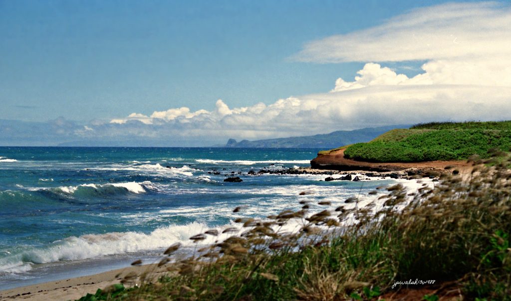
May 1988 — Road to Hana, Maui, Hawaii. The stunning North Shore of Maui at Hoʻokipa Beach Park, a renowned windsurfing destination marking the informal start of the legendary Road to Hāna. This is classic windward Hawaiian coastline, looking west toward the distant West Maui Mountains. Offshore reef systems break the incoming surf into turquoise water capped with white sea foam. The foreground shows a sandy beach edged with native coastal grasses blowing in the wind, while to the right a red‑brown, terraced cliff rises, densely covered in vibrant tropical vegetation. Above, a crisp blue sky is filled with building trade‑wind cumulus clouds.

The Road to Hāna—a world‑famous, 64‑mile scenic highway (Hwy 36 & 360) tracing Maui’s rugged northeastern shore—contains roughly 620 curves and 59 narrow, one‑lane bridges. It passes soaring sea cliffs, black‑sand beaches, bamboo forests, and dozens of cascading roadside waterfalls. Hāna, the small, isolated town at Maui’s eastern tip, was once home to Hawaiian high chiefs and is the birthplace of Queen Kaʻahumanu.

The dramatic landscape rests on dark volcanic rock and coastal shelves of hardened basalt, formed by ancient lava flows from Haleakalā over hundreds of thousands of years. Persistent wave and wind action undercuts the volcanic formations, collapsing sections into sheer sea cliffs or carving flat‑topped coastal terraces. The deep red and orange tones in the exposed cliffside reflect highly weathered, iron‑rich volcanic soils (laterite).

May 1988 — Road to Hana, Maui, Hawaii. This stretch of the scenic highway overlooks Honomanū Bay, an iconic black‑sand coastal cove situated between mile markers 13 and 14 on the Road to Hāna. The bay forms a steep, amphitheater‑like valley where the fresh water of Honomanū Stream meets the Pacific Ocean. It lies along the rugged northeast windward coast of East Maui, roughly halfway between the surf town of Pāʻia and remote Hāna.

The view looks into the deep, lush valley and the massive sea cliffs rising around it, all covered in dense tropical vegetation and native hala trees (Pandanus tectorius). Below, a dark, rocky shoreline frames the cove. Unlike Maui’s sandy swimming beaches, the waters here break heavily over submerged boulders and volcanic reefs, giving the bay its distinctive, rough‑water character.

May 1988 — Cockatoo, Hyatt Regency Maui, Maui, Hawaii. A woman interacts with an Alba Cockatoo, a large white parrot, as it watches the photographer from its polished brass perch in the lush, resort setting. She wears a vibrant, stylized sailboat motif top as she reaches out to pet the bird. Fitted with feeding bowls and a decorative overhead hoop, the cockatoo sits comfortably on its circular brass stand. Behind them, dense tropical foliage, architectural columns, and a hint of a water feature create the luxury Hawaiian resort atrium backdrop.

Native to the rainforests of Indonesia, these intelligent parrots are widely kept in captivity for their striking appearance and highly social nature. Cockatoos are intensely affectionate “velcro birds,” bonding through long sessions of mutual preening in the wild. This bird’s posture shows complete ease: its crest lies flat, its feathers are lightly fluffed, and its weight is evenly balanced on the perch — all signs of a relaxed, trusting interaction.
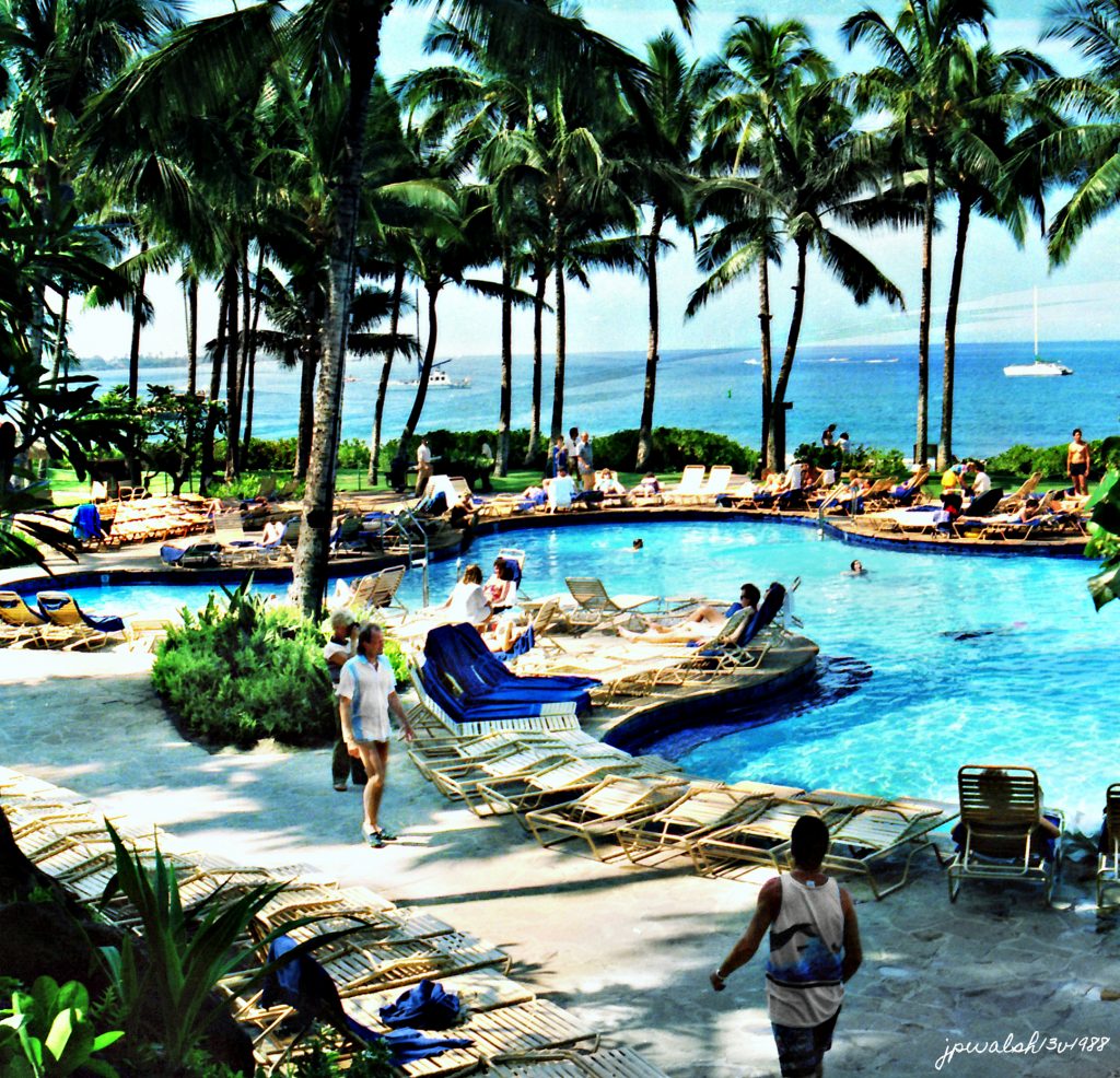
May 1988 — Free Form Pool, Hyatt Regency Maui, Maui, Hawaii. The free‑form swimming pool at the Hyatt Regency Maui Resort and Spa, completed in 1980, remains a central feature of the property, though it has since undergone major modern renovations. Spanning roughly half an acre, the lagoon‑style design was intended to evoke a natural tropical oasis. In its original 1988 configuration shown here, the pool followed a classic winding “paradise lagoon” layout, bordered by volcanic rock, divided by lush island planters, and surrounded by tiered sundecks furnished with vintage woven lounge chairs. When it debuted in 1980, it was celebrated as the largest, most elaborate, and most technologically advanced resort swimming pool in the state of Hawaii.
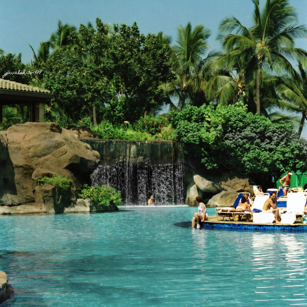
May 1988 — Main Pool, Hyatt Regency Maui, Maui. The photograph shows the western side of the main lagoon pool at the Hyatt Regency Maui Resort and Spa, centered on its defining 10‑foot artificial volcanic‑rock waterfall, once the entryway to the resort’s famous Grotto. Swimming beneath the cascading water led guests into a dark, cavernous man‑made lava‑rock cave housing the iconic Grotto Bar, a shaded swim‑up bar with submerged stools, televisions, and tropical cocktails. The grotto also functioned as a tunnel, allowing swimmers to pass under the rocks and move between the two halves of the expansive pool complex.

Completed in 1980, the pool’s core design philosophy was fantasy‑driven escapism, expressed through waterfalls, caves, and immersive tropical staging. The historic grotto, waterfall, and swim‑up bar have since been fully demolished. In their place now stands a redesigned, expanded open‑air pool layout with a contemporary sundeck and enlarged dining areas — the original 1980s cavern‑like aesthetic entirely gone.
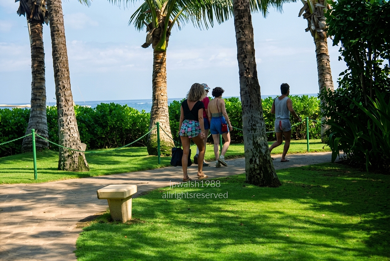
May 1988 — A small group of resort guests walking along the paved Kāʻanapali Beach Walk, the coastal pedestrian path that runs between the ocean and the major beachfront hotels on West Maui. From a shaded lawn, the view looks past tall coconut palms toward the bright Pacific, where sharp sunlight cuts across the grass and the curving walkway. A low concrete bench anchors the foreground, while the vertical palm trunks frame the path and draw the eye toward the travelers.

At the center, a woman in a black top and pastel geometric swimsuit carries a dark canvas beach tote. Beside her, another woman walks in a blue sun‑suit with a red shoulder bag, and ahead of them a man leads the group in a gray 1980s muscle tank and athletic shorts. Beyond the naupaka hedge, the calm blue waters of the ʻAuʻau Channel complete the serene coastal setting.
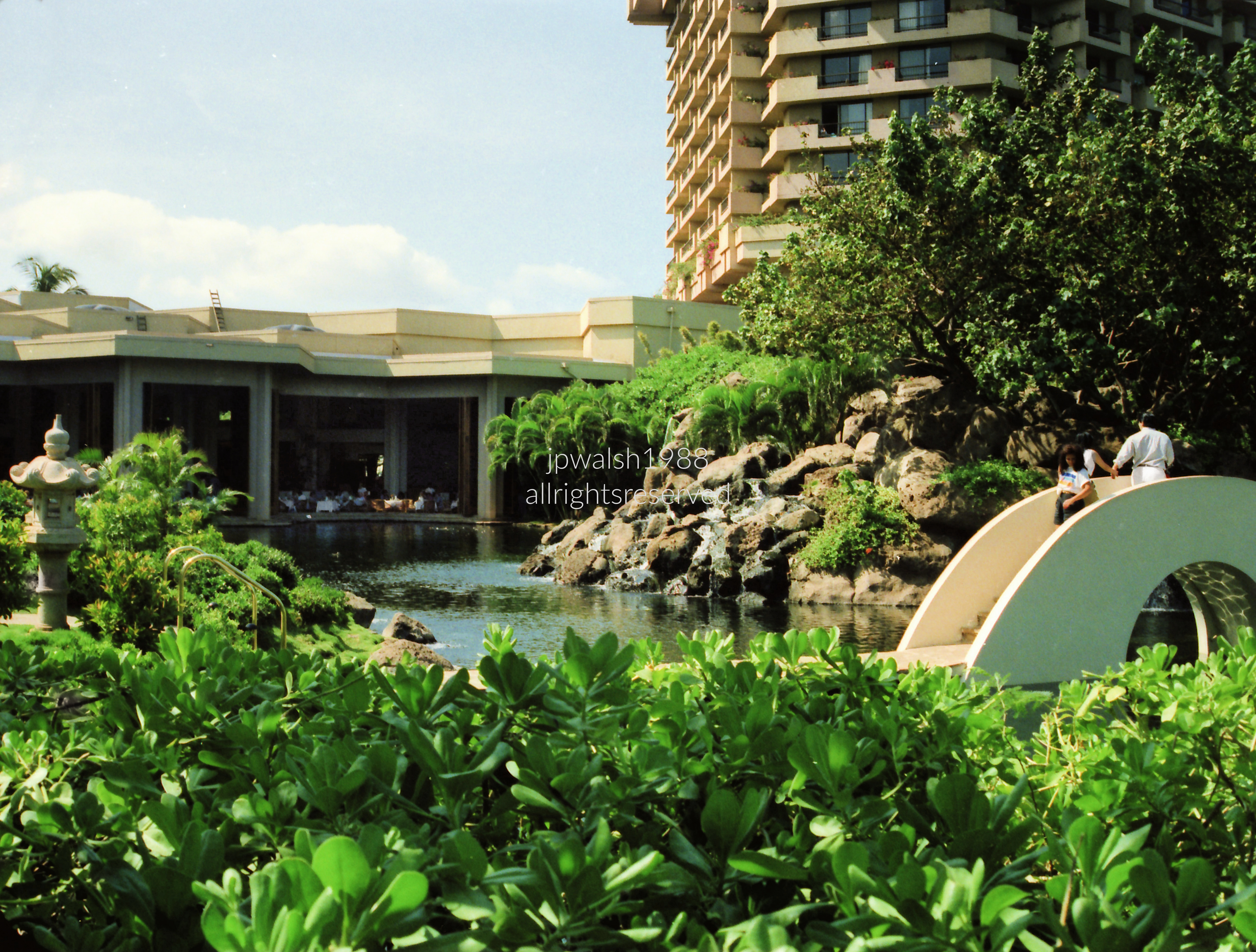
May 1988 — Open‑air Swan Court at the Hyatt Regency Maui Resort and Spa, framed by lush Oriental gardens, cascading rock waterfalls, and a scenic arched footbridge. In 1988, Swan Court operated as a fine‑dining restaurant for dinner and an elegant upscale buffet for breakfast. The space is famous for its absence of traditional exterior walls; tall columns open directly onto a large, manicured lagoon where white and black swans glided beside diners’ tables. The water feature is not a swimming pool but the Swan Lagoon, a deep freshwater habitat designed exclusively for wildlife.

On the far left, a traditional Japanese stone lantern (tōrō) sits in the grass, reinforcing the garden’s Zen aesthetic. The dense green shrubs in the foreground are native Naupaka Kahakai (Scaevola taccada). This architectural layout and its signature scenery remain fully intact and continue to operate today.

Bronze Buddha, Thailand, 19th Century, Maui, Hawaii, May 13, 1988.
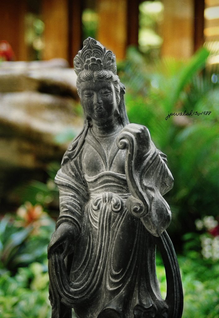
Bodhisattva, Hyatt Regency Maui, Maui, Hawaii, May 13, 1988.
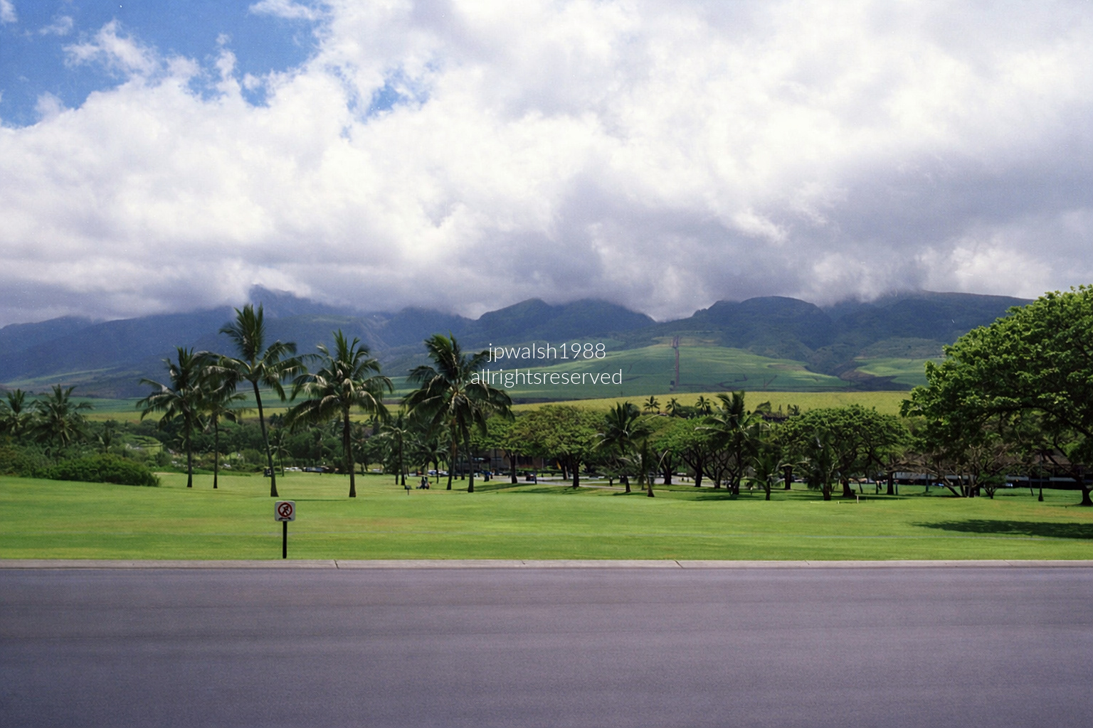
May 1988 — In Kīhei, Maui, the newly opened Silversword Golf Club lay beneath the slopes of Haleakalā. Designed by Bill Newis and completed in 1987, its 18‑hole, par‑71 layout transformed former coastal pasture into a lush, irrigated course of Bermuda grass. Later renamed Elleair Maui Golf Club (1999) and Maui Nui Golf Club (2014), it remains a welcoming, value‑oriented fixture in South Maui’s golf landscape.
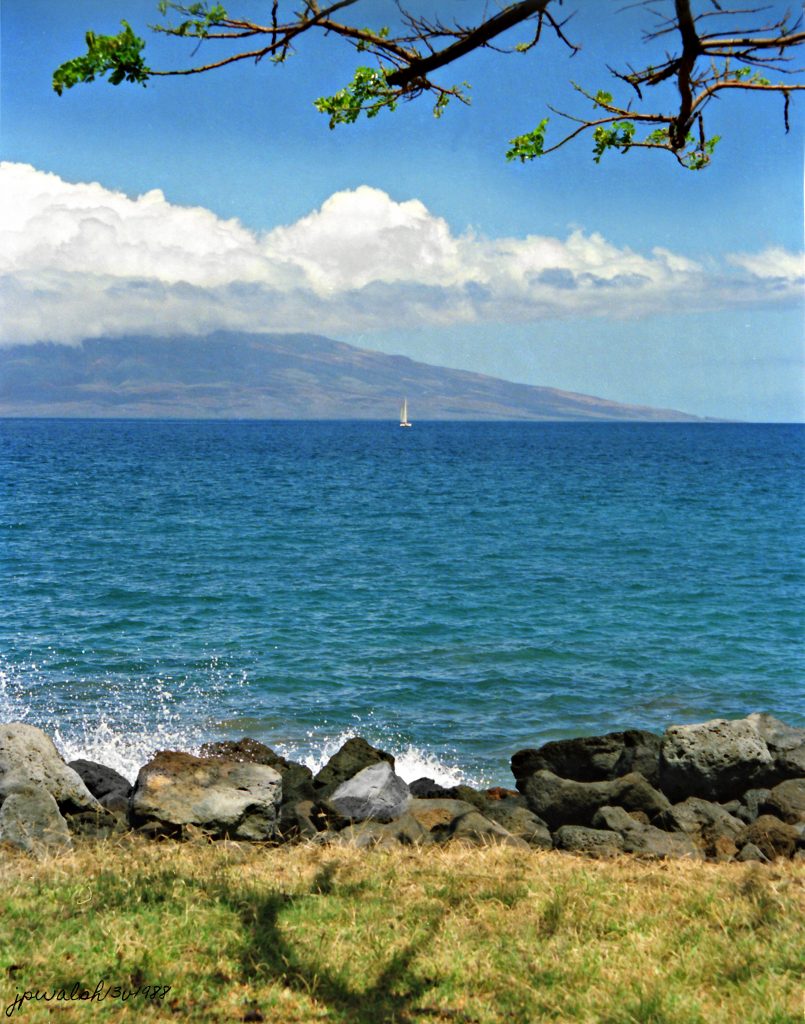
May 1988 — Lahaina Roads, Maui, Hawaii. Scenic view of West Maui’s coast near Lahaina, looking across the ʻAuʻau Channel toward the island of Lānaʻi. A thick blanket of white trade‑wind clouds clings to Lānaʻi’s upper slopes and ridges. The channel’s waters, sheltered by Maui, Lānaʻi, Molokaʻi, and Kahoʻolawe, are famously calm, clear, and blue.

Because of its shallow, warm conditions, this channel forms the core of the Hawaiian Islands Humpback Whale National Marine Sanctuary. The sailboat in the frame moves steadily under the trade winds, capturing the classic, unhurried maritime rhythm of the islands.

May 1988 — Hookipa Beach, Wind Surfing, Maui, Hawaii. A classic high‑energy day at Hoʻokipa Beach Park on Maui’s North Shore during the vibrant “Golden Era” of modern windsurfing. Several sailors carve across the deep blue Pacific, with two prominent riders in the mid‑ground carrying bright neon orange and hot‑pink sails — the defining palette of late‑1980s beach culture. Though windsurfing originated in California in the late 1960s, early pioneers brought the sport to Oʻahu in the 1970s. By the mid‑1970s, nomadic watermen migrated to Maui seeking harsher, more radical conditions. In 1979, the sport cemented its competitive presence here with the launch of the annual Aloha Classic. By 1988, Maui had become a major industry hub, home to board shapers, sail designers, and world‑champion athletes such as Robby Naish, who used Hoʻokipa as their personal proving grounds.

The Hawaii Five‑O theme stands as Hawaii’s global musical signature, a burst of energy and cinematic force. Morton Stevens wrote it for the 1968 CBS debut, crafting a relentless rhythm that echoed pounding surf and Honolulu’s growing urban momentum. Its cultural impact was so deep that the University of Hawaii embraced it as an unofficial fight song, sealing its place as a true emblem of island identity and pride.
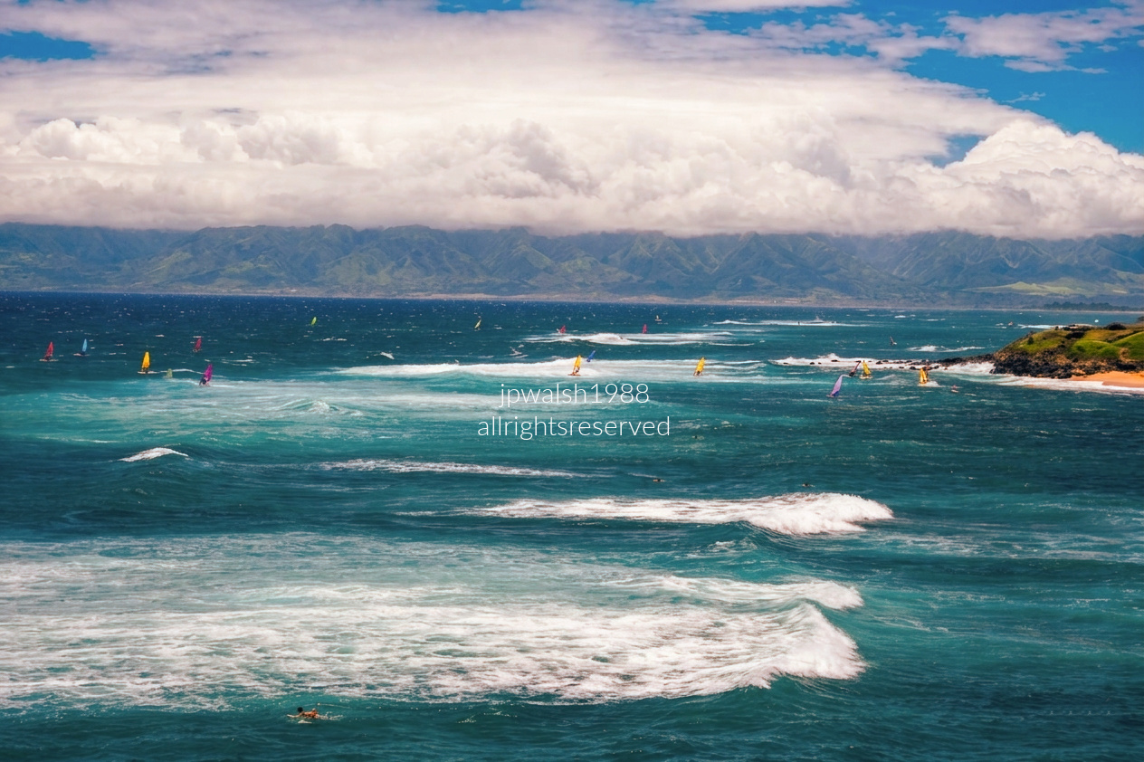
May 1988 — Ho‘okipa Beach Park, on the North Shore of Maui, Hawaii—a coastal scene alive with motion and color. The photograph captures a balance of human activity and natural power. Several windsurfers cut across deep blue‑green water under strong wind, their yellow, blue, and purple sails flashing against the sea as they navigate the surf zone. Whitecaps break across a series of outer reefs, marking the gusty conditions that make Ho‘okipa globally renowned as a premier destination for professional windsurfing.

In the background a massive, thick blanket of white stratocumulus clouds hovers over the West Maui Mountains. This is a classic Hawaiian weather pattern: moisture‑rich trade winds strike the steep mountain slopes, forcing air upward until it cools and condenses into a persistent cloud wall. Above that dense deck, the sky opens into bright blue with scattered cirrus clouds drifting across.

Kaʻahumanu Church (1876), Wailuku, Maui, Hawaii, May 13, 1988.

Origins of the Congregation

The original congregation, organized under Rev. Green in 1832, held its earliest worship meetings in a simple shed.

Queen Kaʻahumanu’s 1832 Visit

In 1832, Queen Kaʻahumanu (1768–1832), the Kuhina Nui of the Hawaiian Kingdom and an early convert to Christianity, visited Maui. At the site of the newly established Kaʻahumanu Church, she observed services led by founding pastor Reverend Jonathan Smith Green (1796–1878). Impressed by the congregation, she asked the Congregationalist mission to name the permanent church structure after her.

Construction of the Present Church (1876)

The current structure—the fourth built on the site—was completed in 1876. It honored Queen Kaʻahumanu’s earlier request and was constructed using native materials in an adaptation of the New England Gothic architectural style brought to Hawaiʻi. The building was executed by Edward Bailey in association with the Wailuku Sugar Company.

Clock and Bell Installation (1884)

The church’s bell and its three clock faces were manufactured by American clockmaker Seth Thomas and transported to Maui in 1884, traveling around Cape Horn.

Please visit the church’s website– https://www.kaahumanuchurch.org/ -retrieved March 22, 2020.

James Michener’s epic historical novel Hawaii (1959) and its subsequent film, Hawaii (1966):

Real Congregation, Real History

The congregation founded in 1832 under Reverend Jonathan Smith Green directly intersects with the world of James Michener. Green’s early ministry in Hawaiʻi — including his relationship with Queen Kaʻahumanu — provided core historical DNA for Michener’s fictional mission community and the 1966 Hollywood film that came afterward.

From Wailuku to Michener’s Pages

In Hawaii, the zealous Reverend Abner Hale (played by Max von Sydow in the 1966 film) is a composite of early missionaries such as Hiram Bingham and Rev. Green. Hale’s rigid faith, cultural blind spots, and moral intensity all echo the real tensions faced by the first Congregationalist missionaries.

Historical Relationship → Fictional Drama

Just as Rev. Green forged a complicated bond with Queen Kaʻahumanu, Michener mirrors that dynamic through Hale’s emotionally charged relationship with High Chiefess Malama Kanakoa (portrayed in the film by Jocelyne LaGarde). Malama becomes Hale’s most significant royal convert, embodying the collision between traditional Hawaiian culture and Western Christian doctrine — the same cultural fault line the real congregation navigated in the 1830s.
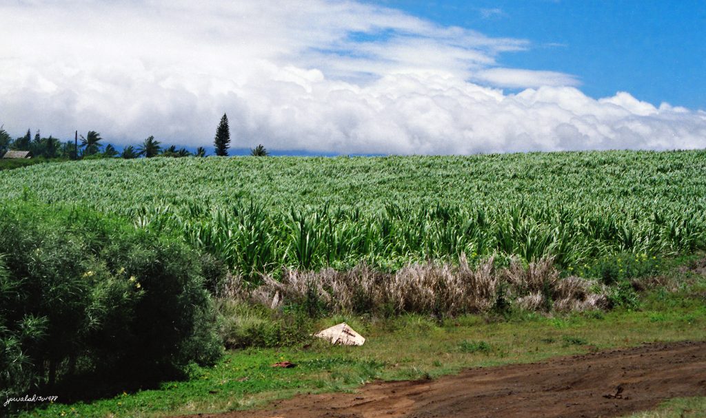
May 1988 — Sugar Cane, Maui, Hawaii. A sprawling sugarcane field in the central valley of Maui, Hawaiʻi. These broad lowlands lie between Maui’s two volcanic shield systems — the West Maui Mountains and Haleakalā — the geography that gives the island its enduring moniker, the “Valley Isle.” The plant shown is Saccharum officinarum (sugarcane), and for more than a century this fertile plain was dominated by its shimmering green expanse.

Commercial sugar production surged in the mid‑19th century under Western business interests. Fields like this were meticulously cultivated and irrigated through massive ditch networks carved into the mountains, then burned to remove leaves before the cane stalks were harvested and hauled to nearby mills such as the one in Pāʻia. Because plantations required immense labor, companies imported workers from China, Portugal, Japan, the Philippines, and Korea — migrations that helped shape Hawaiʻi’s modern multicultural identity.

By 1988, the industry was already in steep global decline. In 2016, the Hawaiian Commercial & Sugar Company (HC&S) shut down operations on Maui, marking the end of commercial sugarcane farming in Hawaiʻi. Today, former fields have been cleared, converted to diversified agriculture, or absorbed by expanding urban development. The photo stands as a nostalgic window into an agricultural era that defined Maui’s landscape for over 175 years.
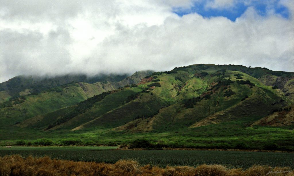
May 1988 — West Maui Mountains, Maui, Hawaii. Lower slopes of the West Maui Mountains near Kapalua on Maui’s northwest coast, looking inland from the Honolua pineapple fields. This perspective faces directly up the ridges of the northwest flank toward the cloud‑shielded high peaks. The uniform green carpet across the valley floor in the foreground consists of commercial pineapple plants, which dominated this region of northwest Maui for more than a century.

The West Maui Mountains — traditionally known as Kahālani or Mauna Kahālāwai (“the house of water”) — form the deeply eroded western massif of the island. The tallest summit, Puʻu Kukui, rises to 5,788 feet and ranks among the wettest places on Earth, receiving over 360 inches of rainfall annually. More than one million years old, Mauna Kahālāwai holds a profound place in Hawaiian history, spirituality, and culture. Tucked within its eastern folds lies ʻĪao Valley, a sacred burial ground for Hawaiian high chiefs and a site central to traditional Hawaiian identity.
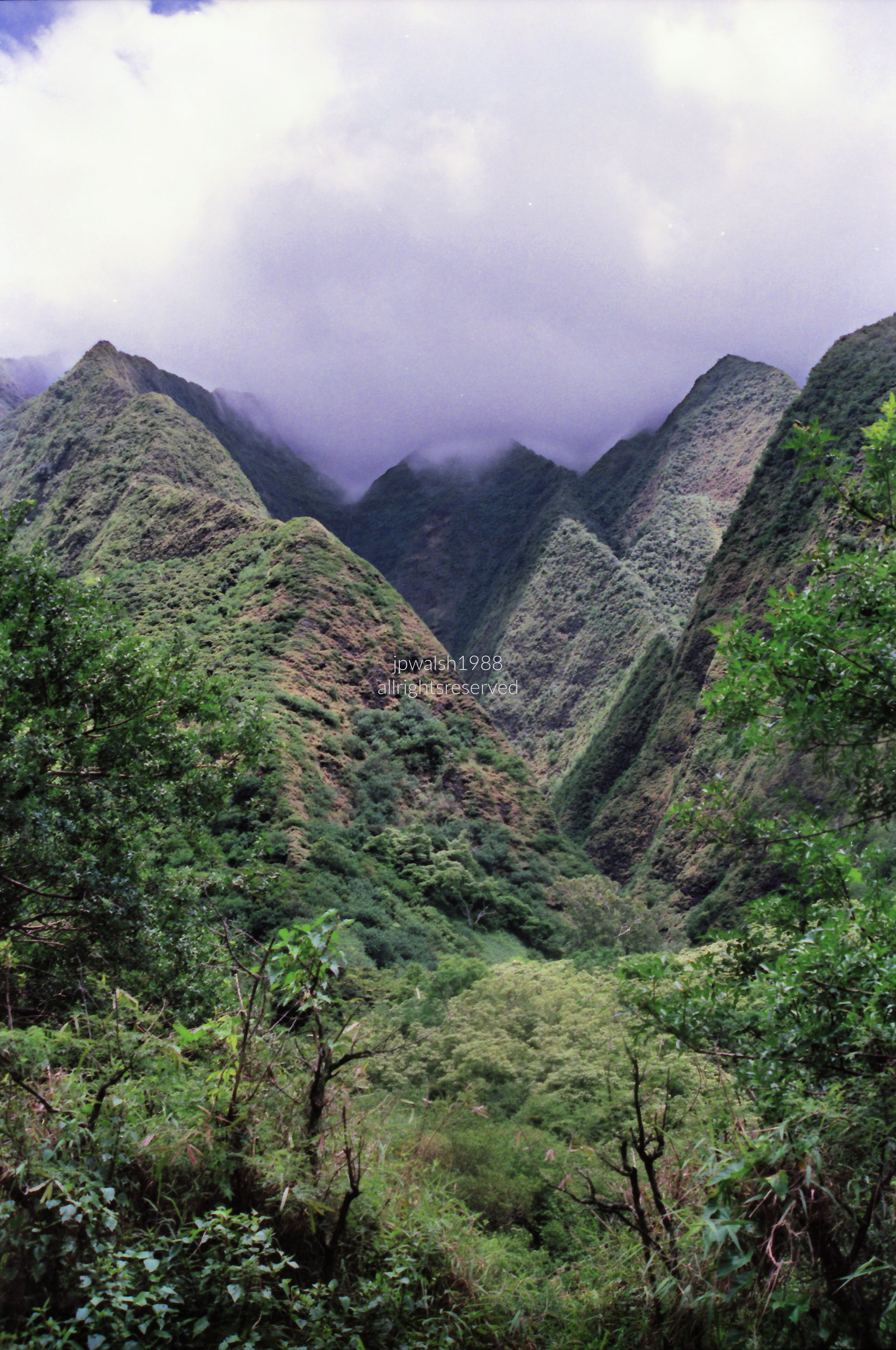
May 1988 — A sweeping view of the immense, sheer caldera walls of the West Maui Mountains (Mauna Kahālāwai), looking deep into the sacred interior of ʻĪao Valley State Monument. The scene highlights the incredibly sharp, razor‑thin ridges — the remaining skeleton of the ancient West Maui volcanic dome after more than a million years of erosion.

The lower slopes form a dense, multi‑tiered carpet of vibrant green vegetation, while low‑hanging trade‑wind clouds and heavy mist tumble over the highest crests. This constant cloud cover acts like a sponge, trapping moisture and feeding the continuous freshwater streams that sustain the island below.

May 1988 — Iao Needle, Iao Valley State Park Monument, Maui, Hawaii. Taken from the banks of the ʻĪao Stream, this view reveals the towering scale of Kūkaʻemoku, the ʻĪao Needle, rising above the lush canopy and rocky streambed of ʻĪao Valley State Monument. Mist‑laden trade‑wind clouds gather over the peaks, evoking the rain‑shrouded atmosphere that continuously feeds this ancient valley.

To Native Hawaiians, ʻĪao Valley is a sacred sanctuary — Wao Akua, the “realm of the gods” — imbued with spiritual power (mana), royalty, and history. The spire, natively named Kūkaʻemoku, represents the phallic stone monument of Kanaloa, god of the ocean, navigation, and life‑giving fresh water. For centuries, the valley served as a secret burial site (heiau) for high chiefs (aliʻi).

Geologically, the ʻĪao Needle is an erosional remnant formed as the ancient West Maui Volcano (Mauna Kahālāwai) built its shield roughly one to two million years ago. Hardened basalt within a volcanic vent pipe resisted erosion while surrounding ridges collapsed under relentless rainfall — leaving this solitary 1,200‑foot spire standing alone above the valley floor.

May 1988 — Self Portrait, Wailuku, Maui, Hawaii. The author is standing on the footbridge spanning the lower ʻĪao Stream at Kepaniwai Park Heritage Gardens, deep within lush ʻĪao Valley. The scene captures the dense, wet, deeply shadowed environment of the windward West Maui Mountains. Behind me, a sheer vertical rock wall rises into a thick canopy of wild tropical plants, climbing taro, and large elephant‑ear ferns. The dark upper background shows how tightly the mountain walls enclose this narrow river valley.

The bridge path leads toward a stone terrace where a woman stands holding a camera case. In the mid‑ground, a swimmer rests near the rocks, reflecting how visitors often used the cold stream pools for wading. The image serves as a personal time capsule — from my white Ralph Lauren polo, gold‑rimmed aviators, and swanky mustache to the woman’s pastel‑teal pants and vintage camera strap — preserving the relaxed resort‑travel fashion of the late 1980s.
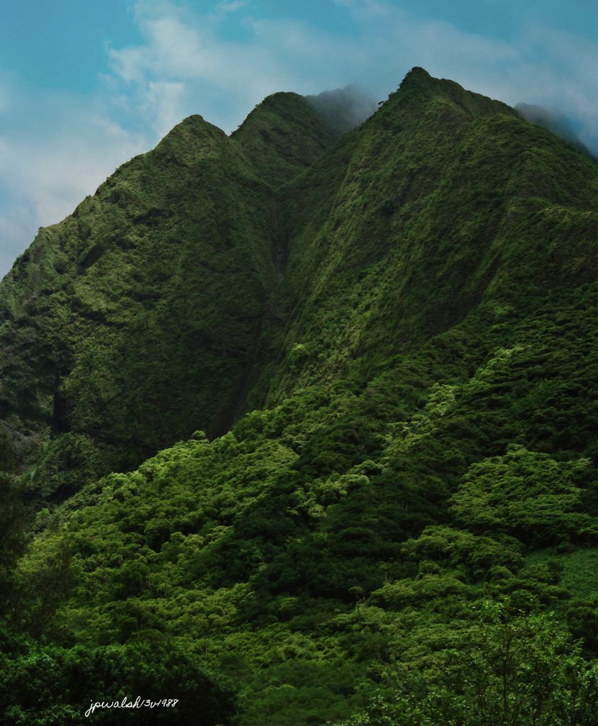
May 1988 — A sweeping view of the sheer amphitheater walls of the West Maui Mountains (Mauna Kahālāwai) from deep inside ʻĪao Valley State Monument, just west of Wailuku. The perspective looks straight up at the near‑vertical ridges surrounding the valley floor near the ʻĪao Needle, capturing the dramatic, water‑carved architecture of an ancient volcanic caldera.

The razor‑thin ridges are the exposed skeleton of the old West Maui volcano, shaped by more than a million years of intense erosion. Lush vegetation thrives in this ecosystem, fed by heavy rainfall that collects on the high peaks. Low‑hanging trade‑wind clouds spill over the crests, trapping moisture and generating the freshwater streams that sustain the island below.

Bright, sunlit slopes contrast sharply with dark ravines, creating a powerful, slightly ominous atmosphere that reflects the historic spirit of this sacred valley.
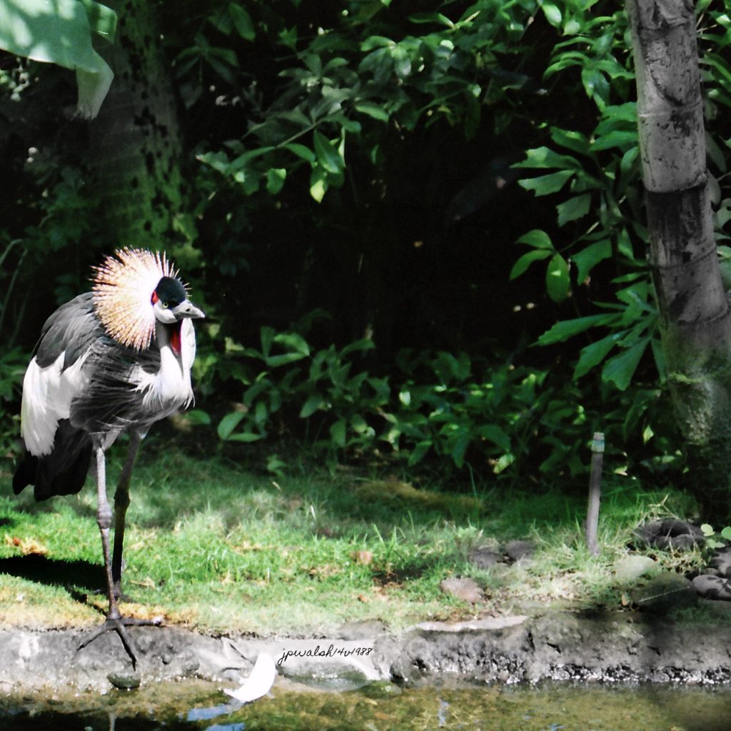
May 1988 — An endangered Black Crowned Crane (Balearica pavonina) resting beside a manicured freshwater pond at the Hyatt Regency Maui Resort and Spa. Native to the savannahs and wetlands of Sub‑Saharan Africa, the species is legally protected, yet its population has sharply declined over recent decades due to severe environmental and human pressures in its home range.
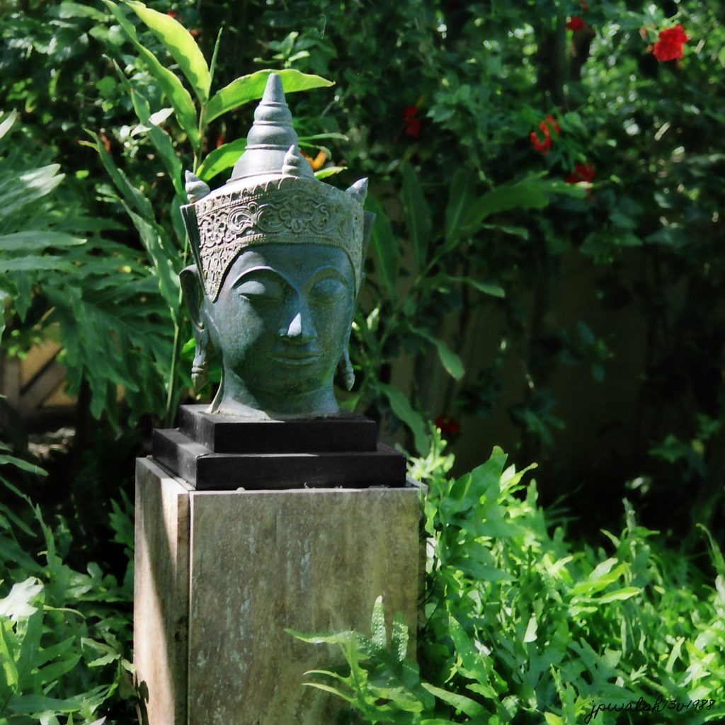
Cambodian Buddha, Maui, Hawaii, May 13, 1988.
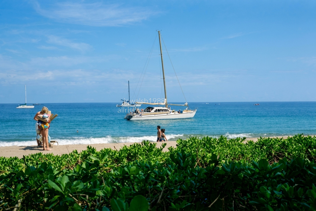
May 1988 — The relaxed, open‑air resort lifestyle that defined West Maui in the late 1980s. Kāʻanapali Beach, on Maui’s west coast, looks out toward the ʻAuʻau Channel, framed by shoreline vegetation along the resort path. Calm waters and anchored catamarans mark the coastal strip fronting major resorts such as the Whaler, the Westin, and the Hyatt Regency Maui. The large white catamaran centered offshore is a classic beach‑loading charter, waiting to pick up passengers directly from the sand — a signature sight at Kāʻanapali.

On the left, a woman in a colorful 1980s swimsuit carries towels and beach gear near a lounge chair. In the center‑right, a couple strolls along the wet sand at the gentle shorebreak. Passengers relax on the deck of the main sailboat, while a small tender crosses the horizon. The foreground is bordered by dense green Beach Naupaka (Scaevola taccada), the salt‑tolerant shrub used by Maui resorts to stabilize dunes and frame their beachfronts.

May 1988 — Evening, Maui, Hawaii. Taken from an upper‑level ocean‑view balcony at the Hyatt Regency Maui Resort and Spa, this photograph is part of a vintage film archive shot by photographer J.P. Walsh during a stay at the newly built Kāʻanapali resort strip in the late 1980s. The camera looks straight out across the ʻAuʻau Channel from the room’s balcony. The silhouettes in the lower third are the tops of mature palm trees and the lush tropical landscaping surrounding the Hyatt’s main oceanfront lagoon pools.

My Nature Photography: FLOWERS PARKS GARDENS.

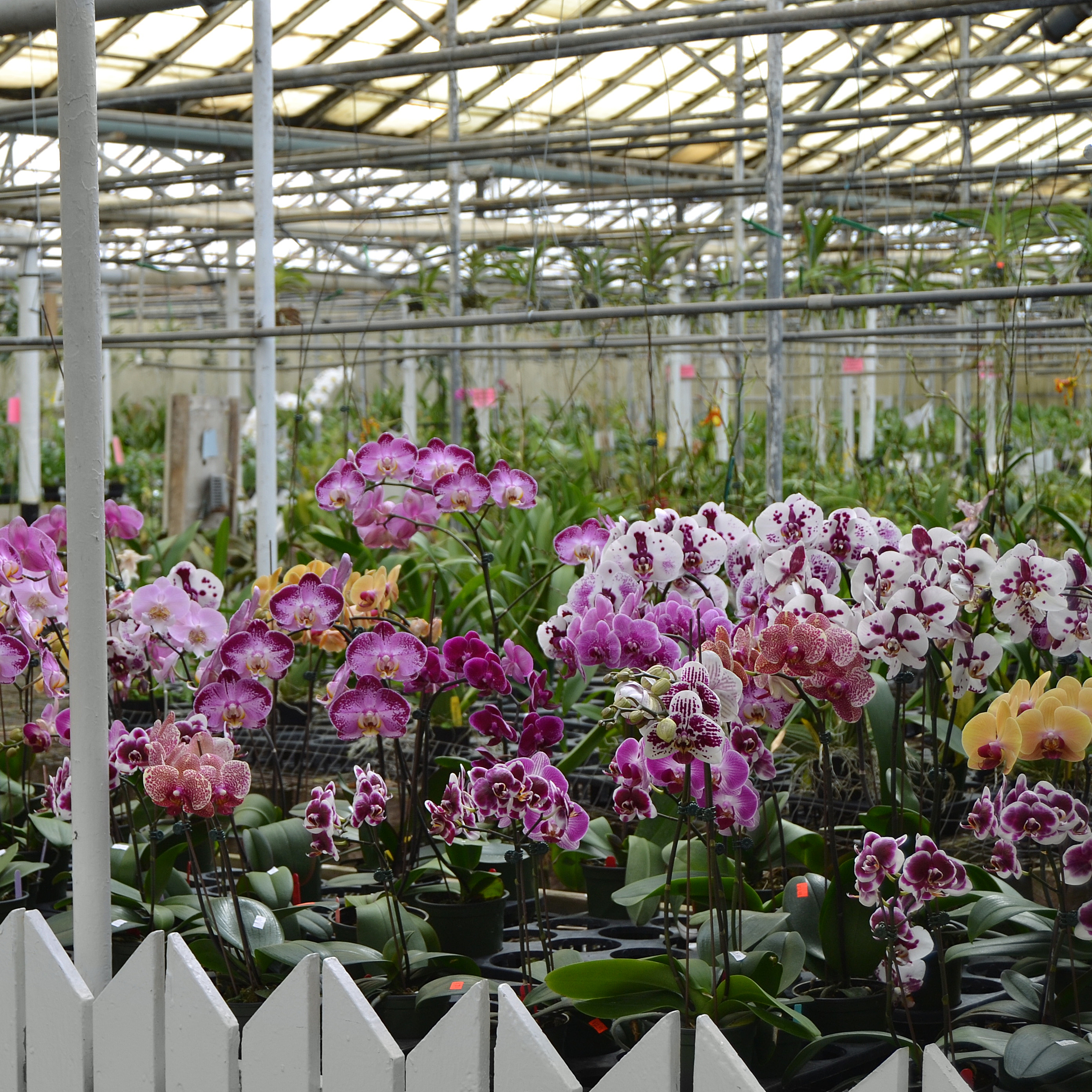
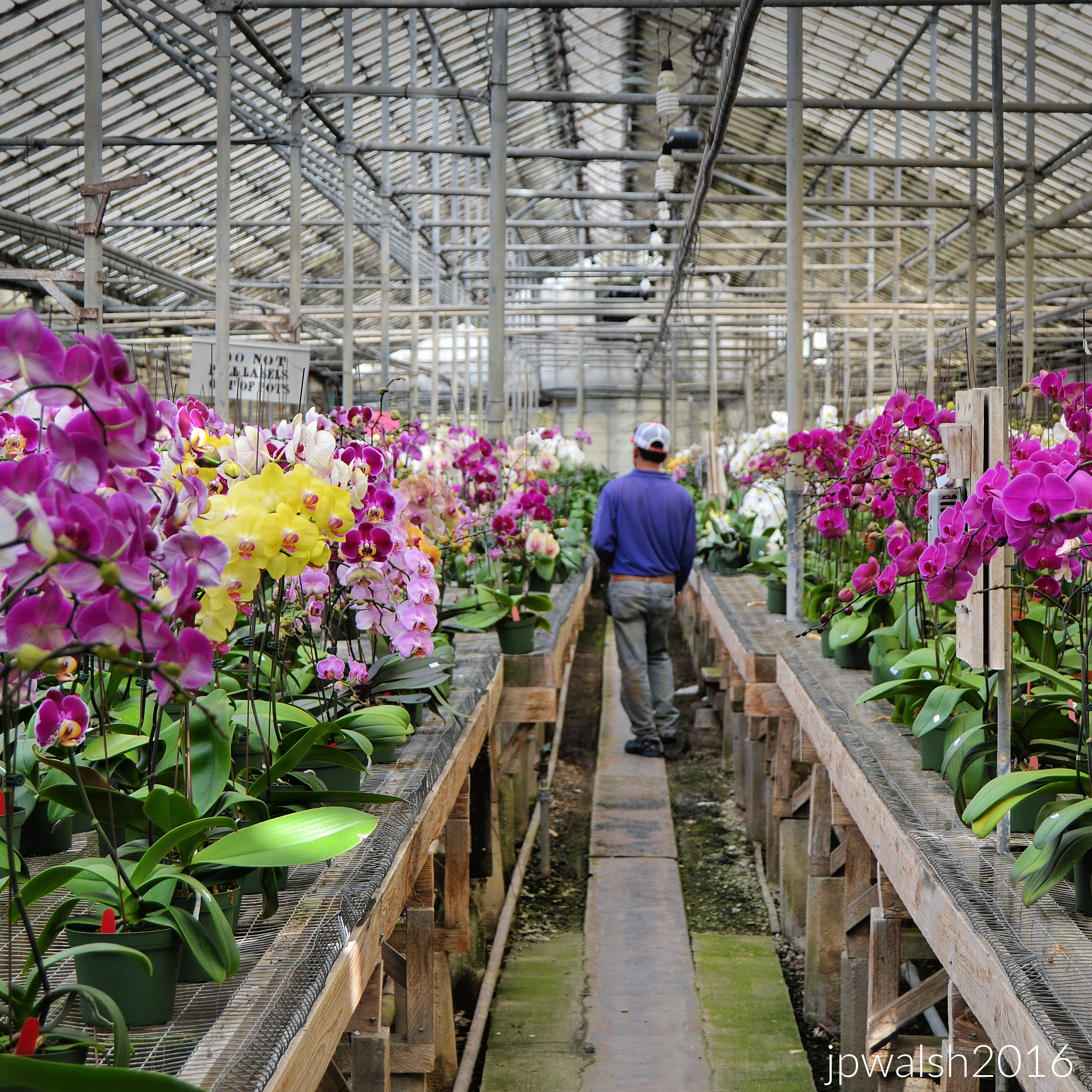
FEATURE image: May 2018. Orchids. All photographs and text ©John P. Walsh.

June 2017.

My entire life I have always enjoyed being around flowers and gardens.
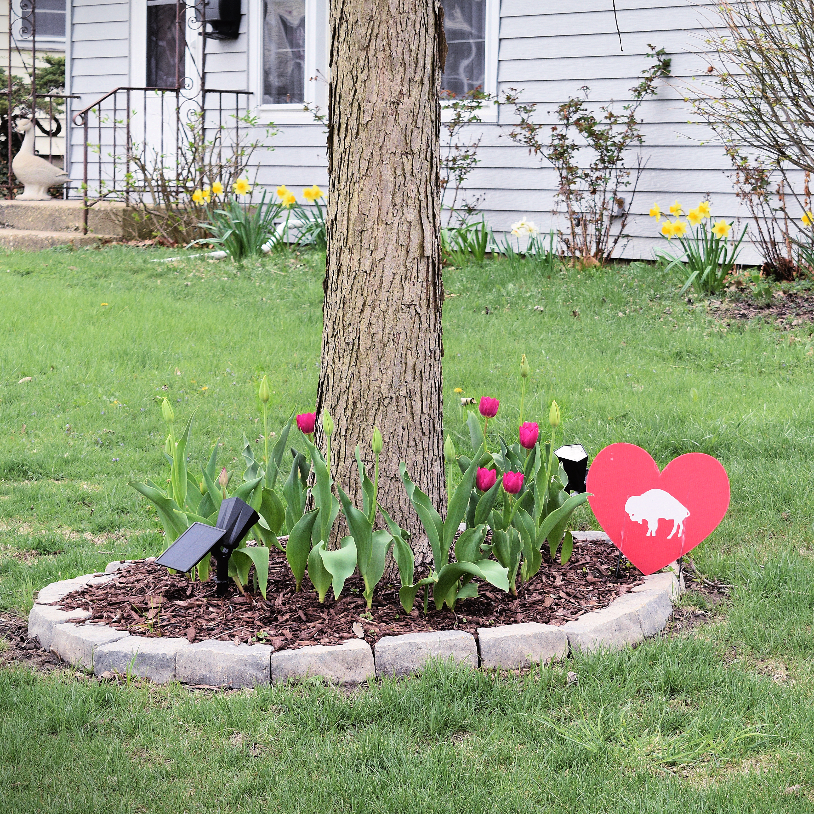
I started taking photographs of them in 2012. With so many other people everywhere, I have always enjoyed visiting and walking among the beautiful fragrances of earth’s bountiful and beautiful flora. Dangling, drooping, shooting straight up, bunches, single stem, of endlessly different shapes, sizes and colors—and places and settings—flowers and gardens embody life, creativity, and beauty. One of my earliest memories of gardens was on a childhood vacation to Jefferson’s Monticello and, in that summer’s heat, being surrounded with the scent of the boxwood shrubs. All these perennials and annuals are definitely worthwhile photographic subjects. To stroll (and bend and scrunch) among nature’s orchestra of leaves, branches, and blooms and photograph them is one of life’s pleasures.
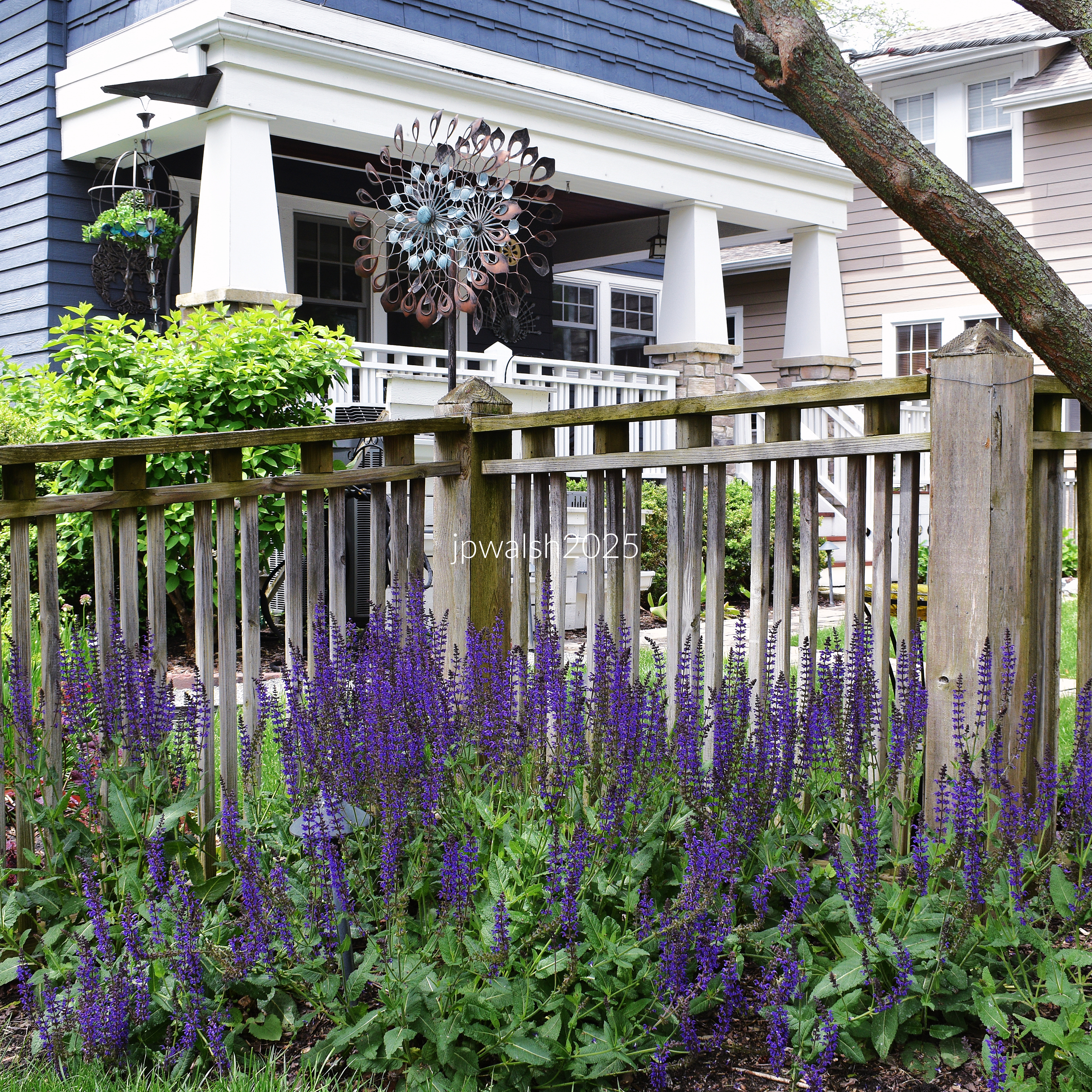
The world of flora contains some of the most distinctive creations on the planet.

Fresh blooms are engaging, shy, forthright and protective. In their season, they exist to proffer their fleeting beauty and fragrance for the spectacular end of reproducing themselves.

I have taken photographs of many other subjects but flowers I return to again and again. It’s because flowers don’t disappoint.

Grace Kelly wrote a book on flowers called My Book of Flowers. “I love walking in the woods, on the trails, along the beaches, ” she said. “I love being part of nature…” This is one of the great things about searching for and finding flora to photograph: whether in the wild, semi-wild, in a nursery, or on the front porch or in the garden, the wonder of their presence leads to an experience of nature in its most vital form.

Grace Kelly became interested in flowers and their arrangements only in the last years of her life. It had been suggested to the American princess in the late 1960’s that as part of the festivities for Monaco’s centennial she might host a flower arranging competition, which she did. Though princess Grace admitted she “was the most ignorant garden president going,” her knowledge of flowers and gardening grew and, if only because of their shared passion for these precious blooms, she met many new friends. I too have found that I have made friends from all over the world because of our mutual love for flowers and the garden. One cannot underestimate flower power!

Most of my photographs of flowers and gardens are shot in the Chicago area.

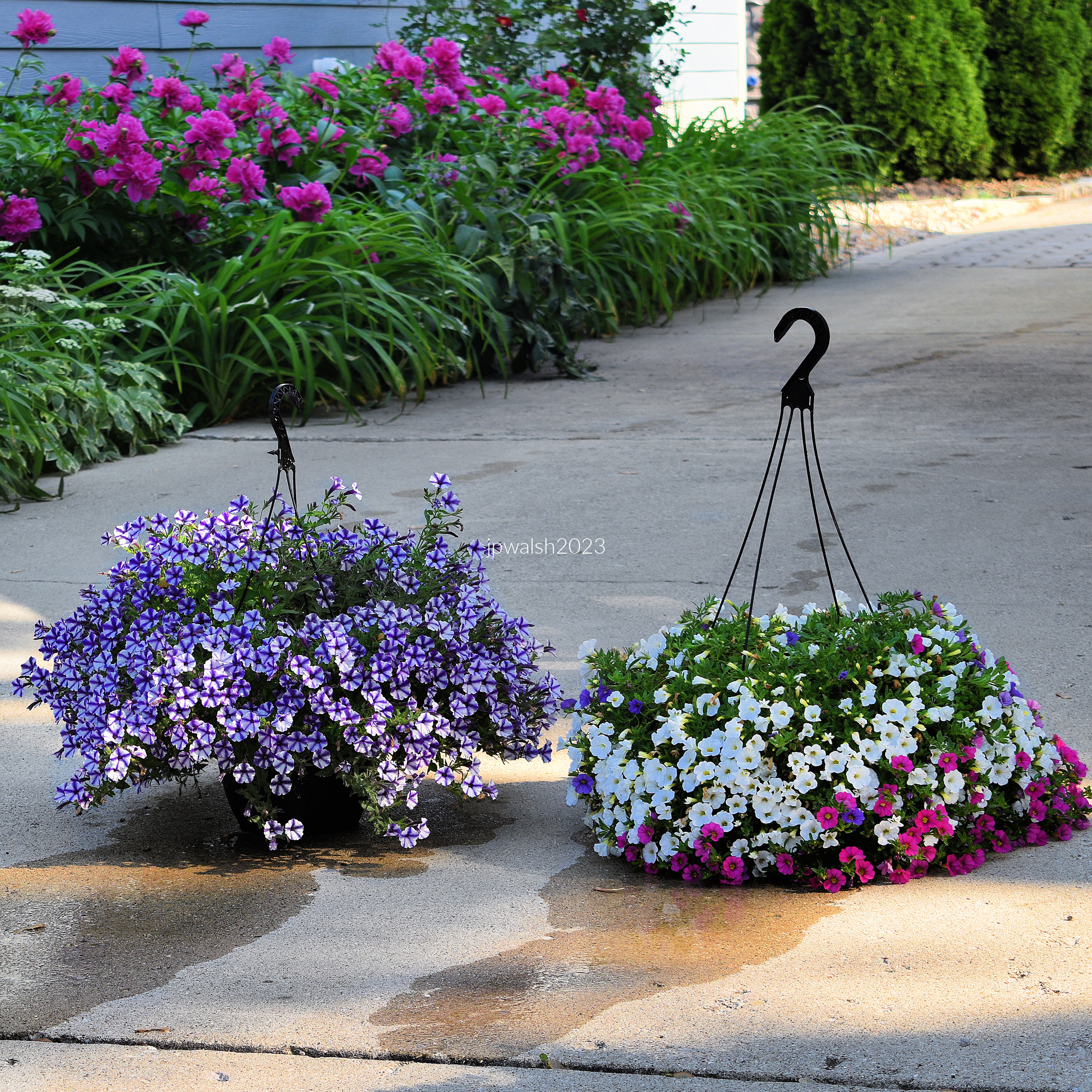
annuals jpwalsh
May 2018.
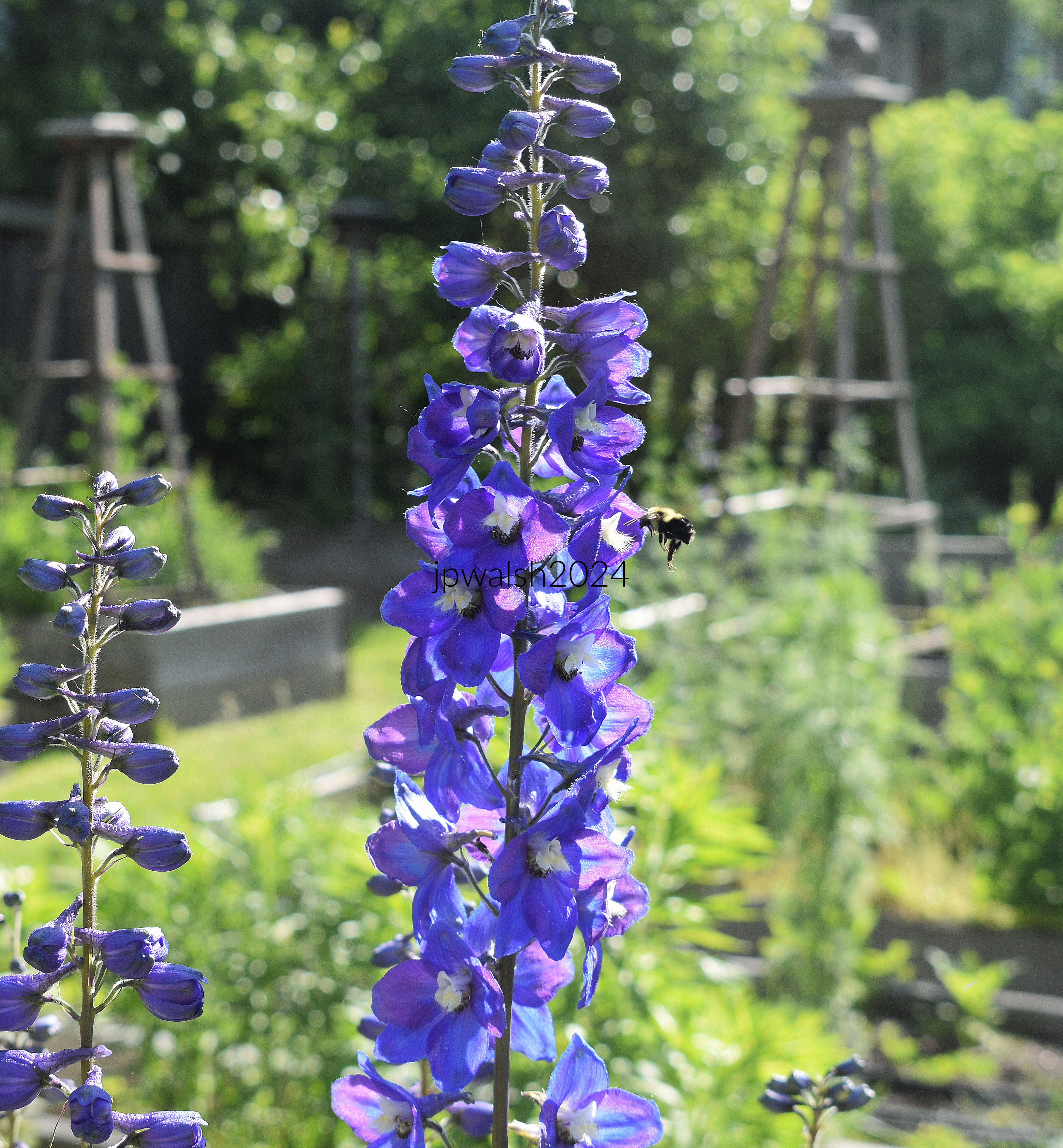
May 2024.
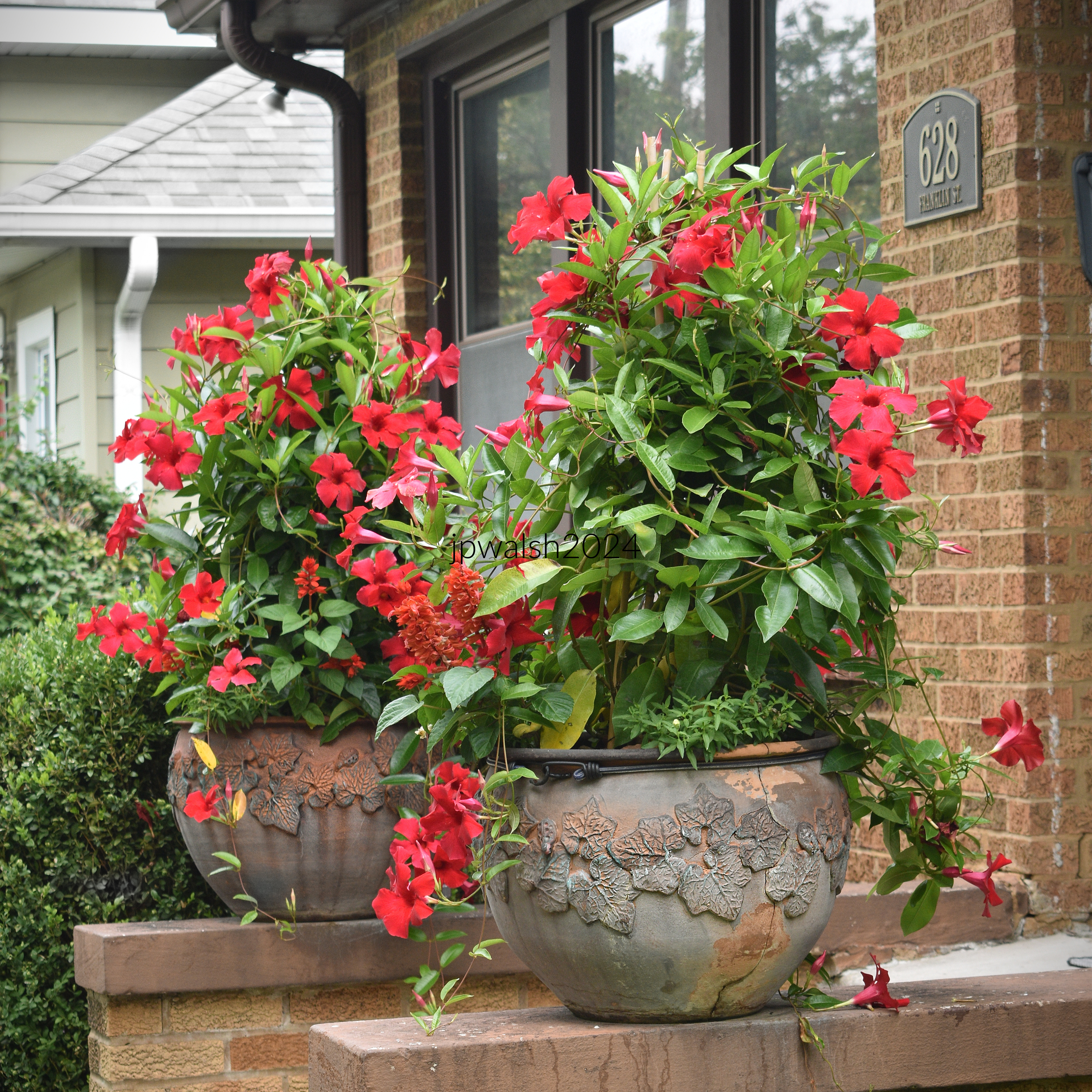
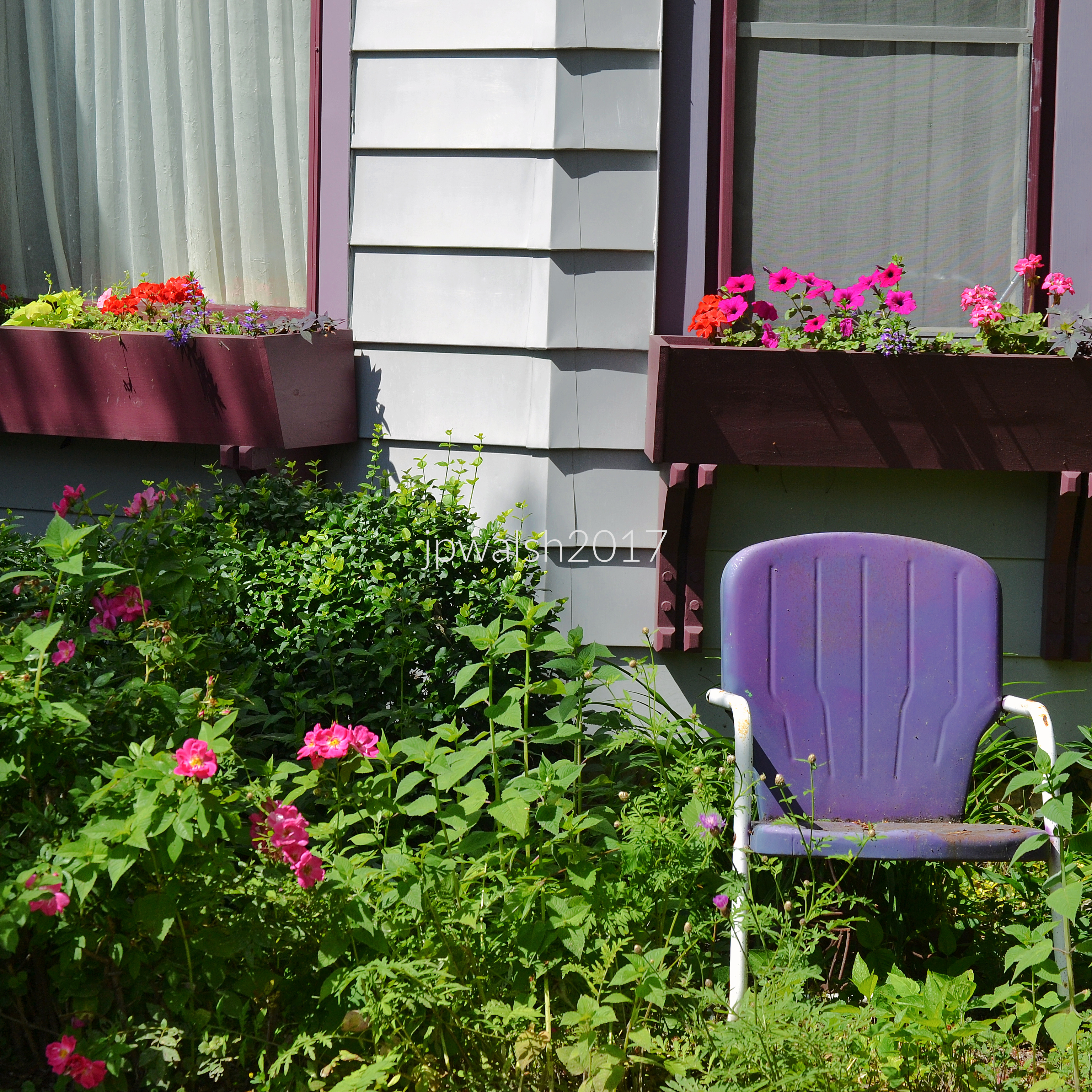
red chair and pots
May 2018.
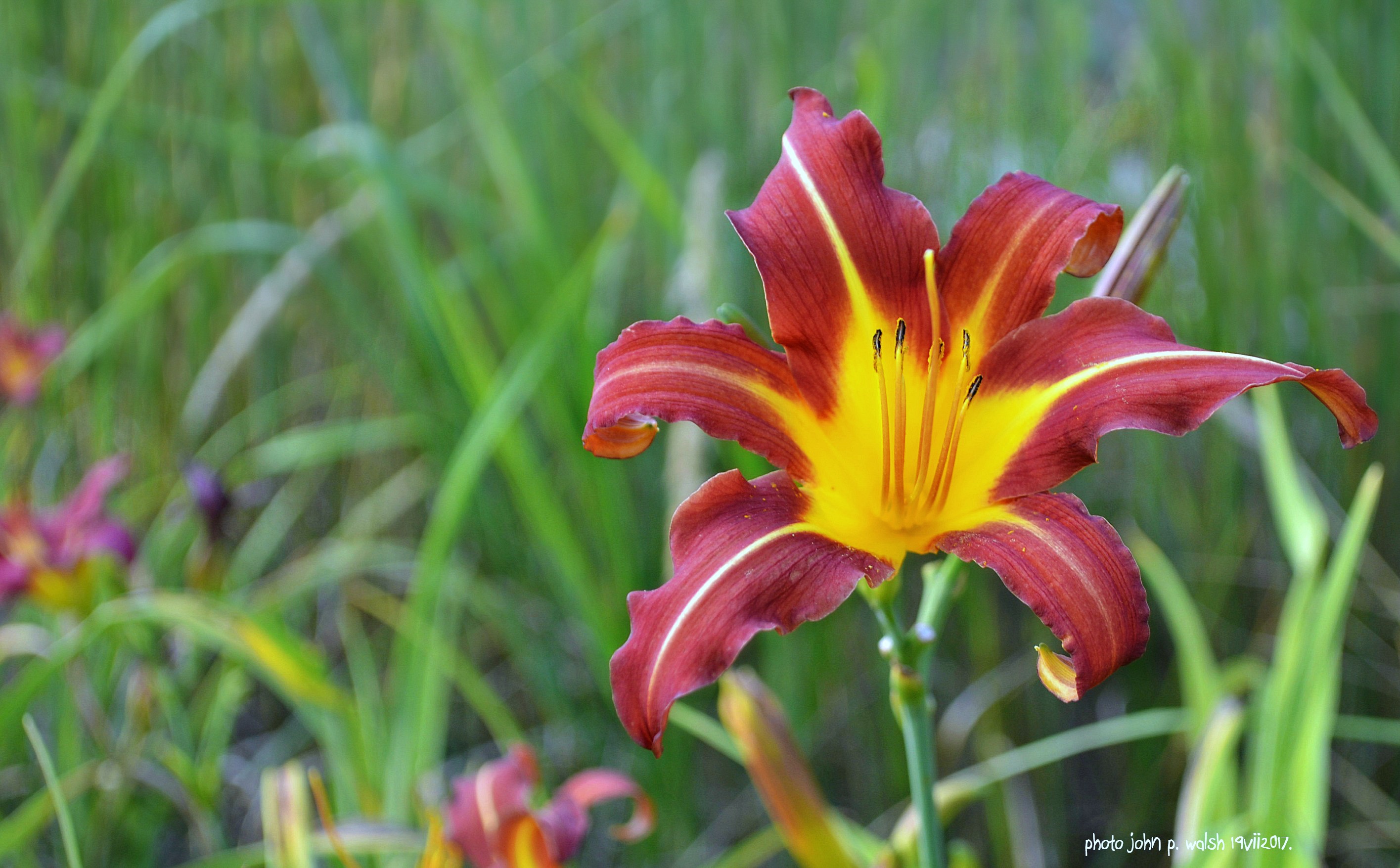
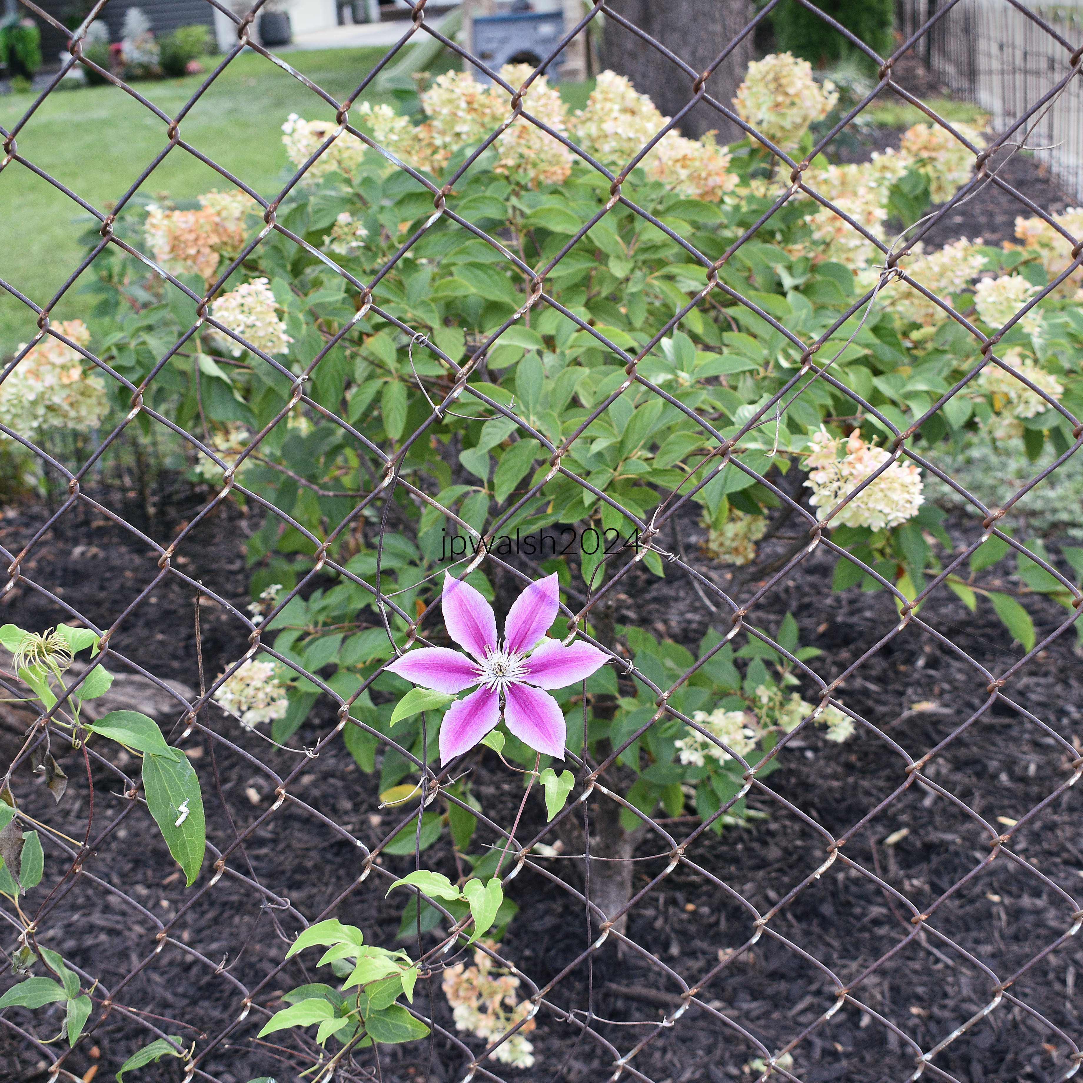
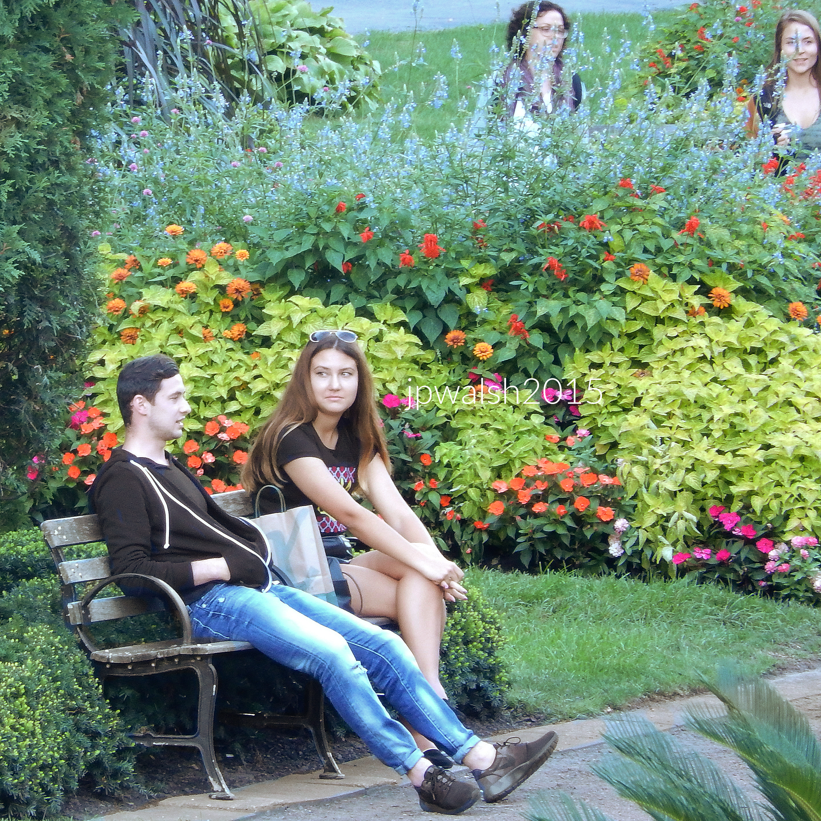
late summer flowers
September 2018.
desert setting
December 2017. Chicago, Garfield Park Conservatory.
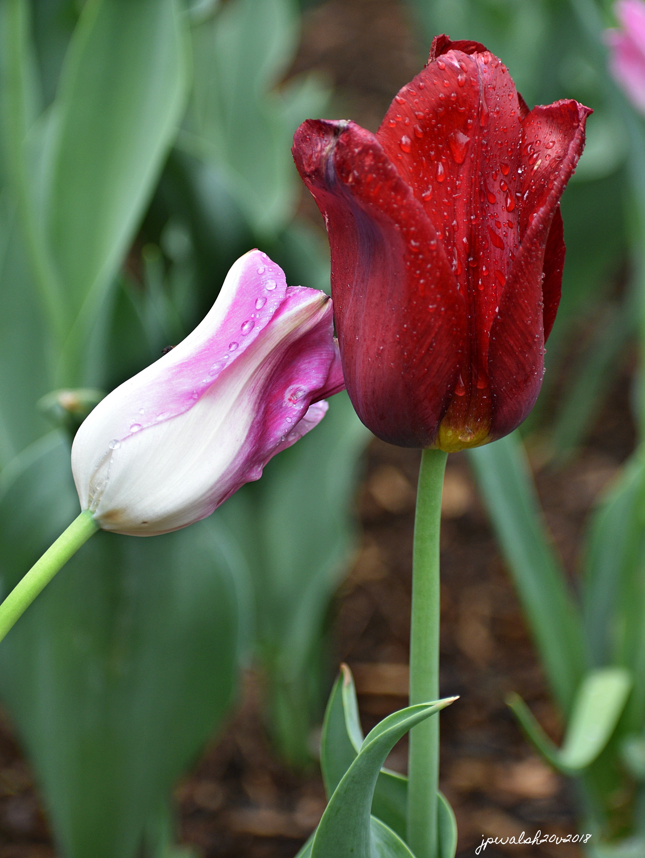
Tulips Jpwalsh
May 2018.
May 2028.
garden walk  jpw
May 2018.
7.19.17 saratogapinwheel
July 2017.
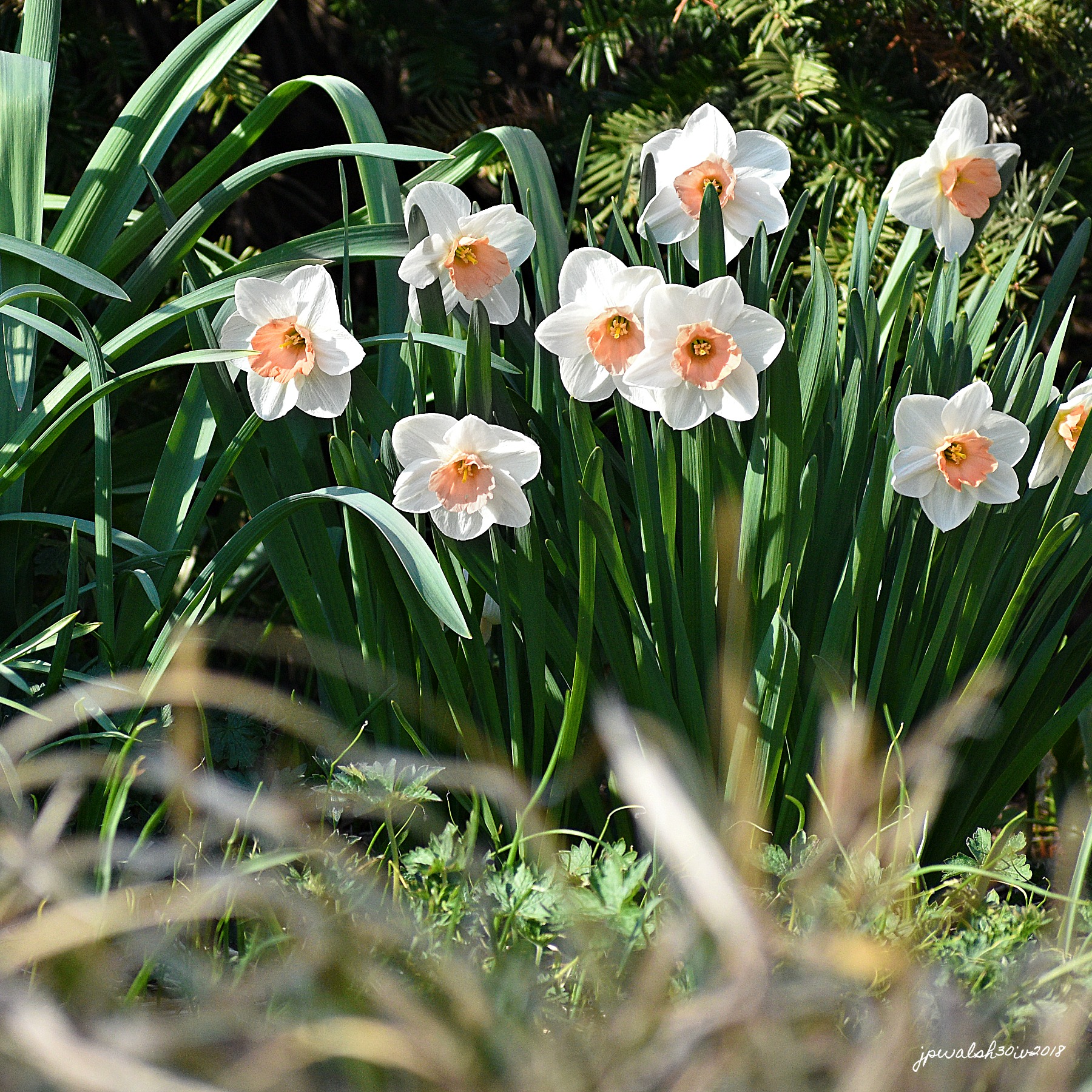
Daffodils Apr 30 2018 by John P. Walsh
April 2018.
May 2018.
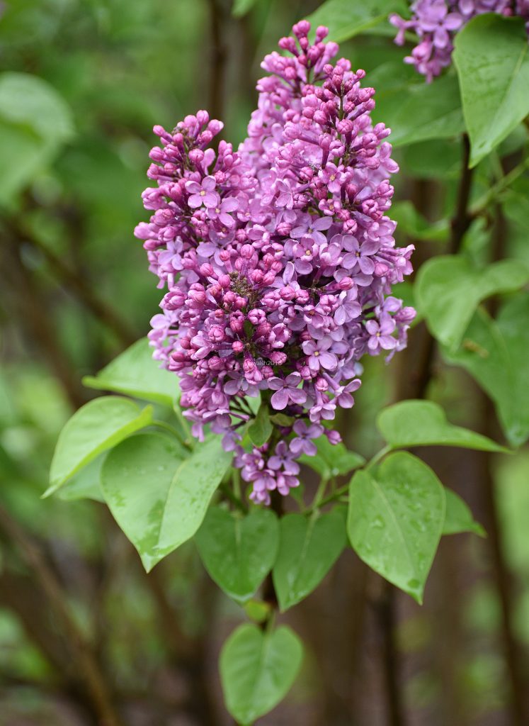
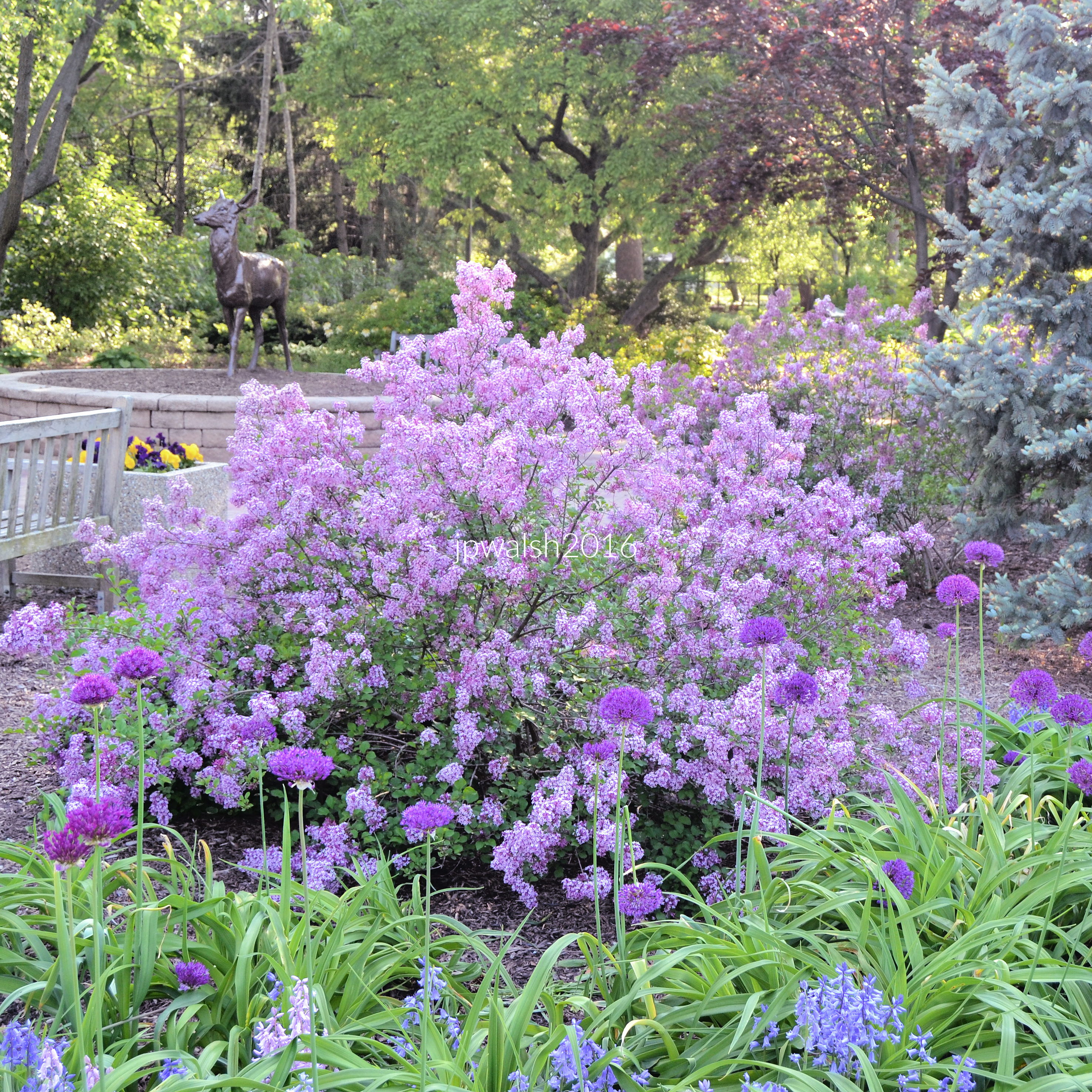
Bushy lilacs-photo John P. Walsh
June 2017. Pre- Civil War Lion House, North Prospect Avenue on North Franklin Place, Milwaukee, Wisconsin.
dianthus 5.17.16 final copy DSC_0026
May 2016. Dianthus.
3. may garden May 28 2016.
May 2016.
black magic petunia 5.17.16
May 2016. “Black Magic” petunia.
green garden 7.24.17
July 2013. Oak Park, Illinois.
RESIZE alcea 7.7.13
July 2013. Hollyhock.
May 2018. “Dream Touch” double late tulip.
May 2018. “Frederick Douglass” multi-petaled cultivar. Named for Frederick Douglass (1818-1895), American slave, abolitionist leader and author. Developed in 1972 by Richard Americo Fenicchia.
March 2018. Wheaton, IL. 99% 7.83 mb _5332 (1)
May 2019. Glen Ellyn, Illinois.
May 2020.
May 2018.
May 2018.
June 2020. Peony with cicada.
May 2018.
May 2018. Impatiens.
August 2014. Fox River, West Dundee, Illinois.
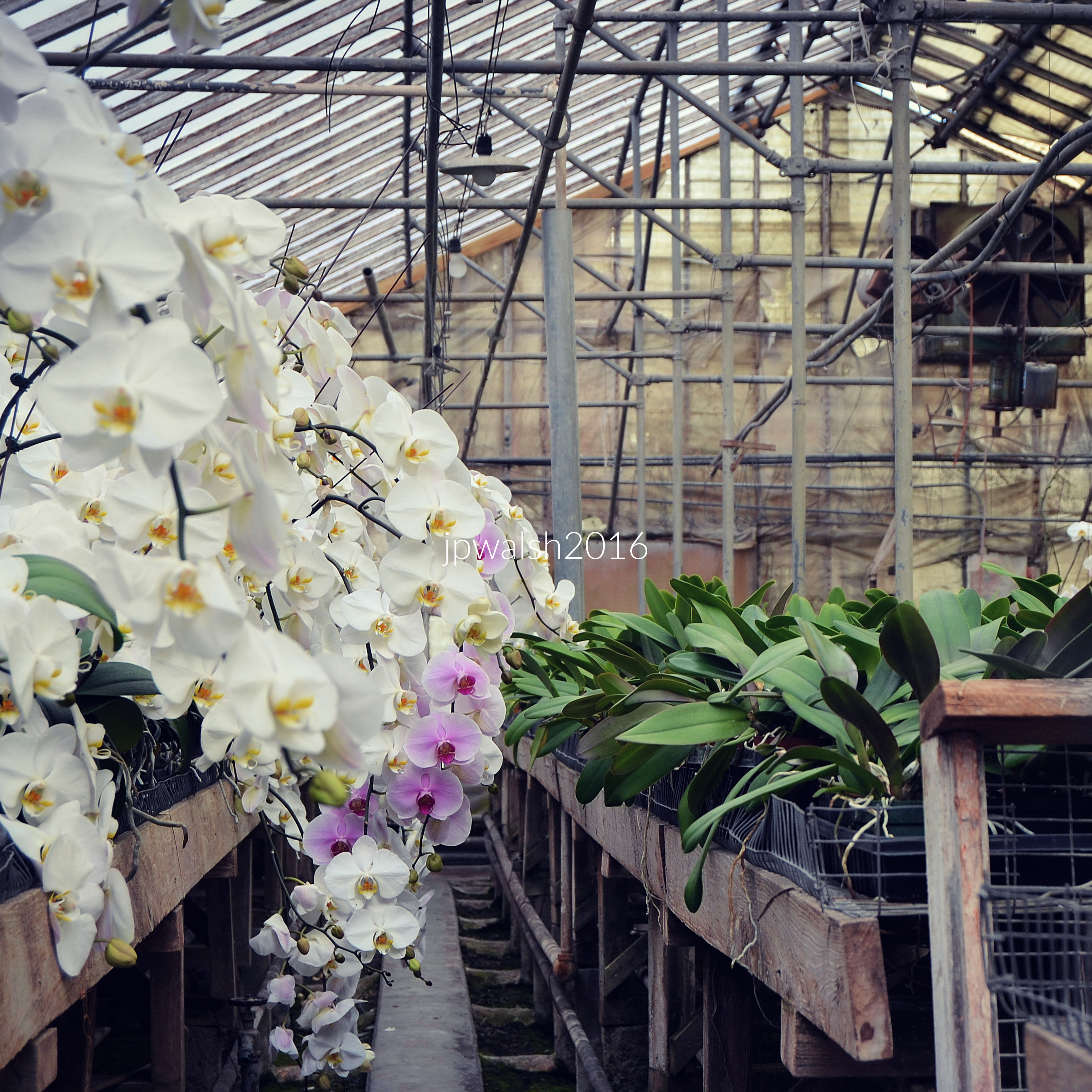
May 2018. Orchids.
July 2015. Chicago. Designed and built in 1917 by architect Frank Lloyd Wright,
July 2017. Anderson Japanese Gardens. Rockford, Illinois.
Chicago Old Town. hydrangeas
July 2013. Prairie Coreopsis (Coreopsis palmata). Woodridge, Ilinois.
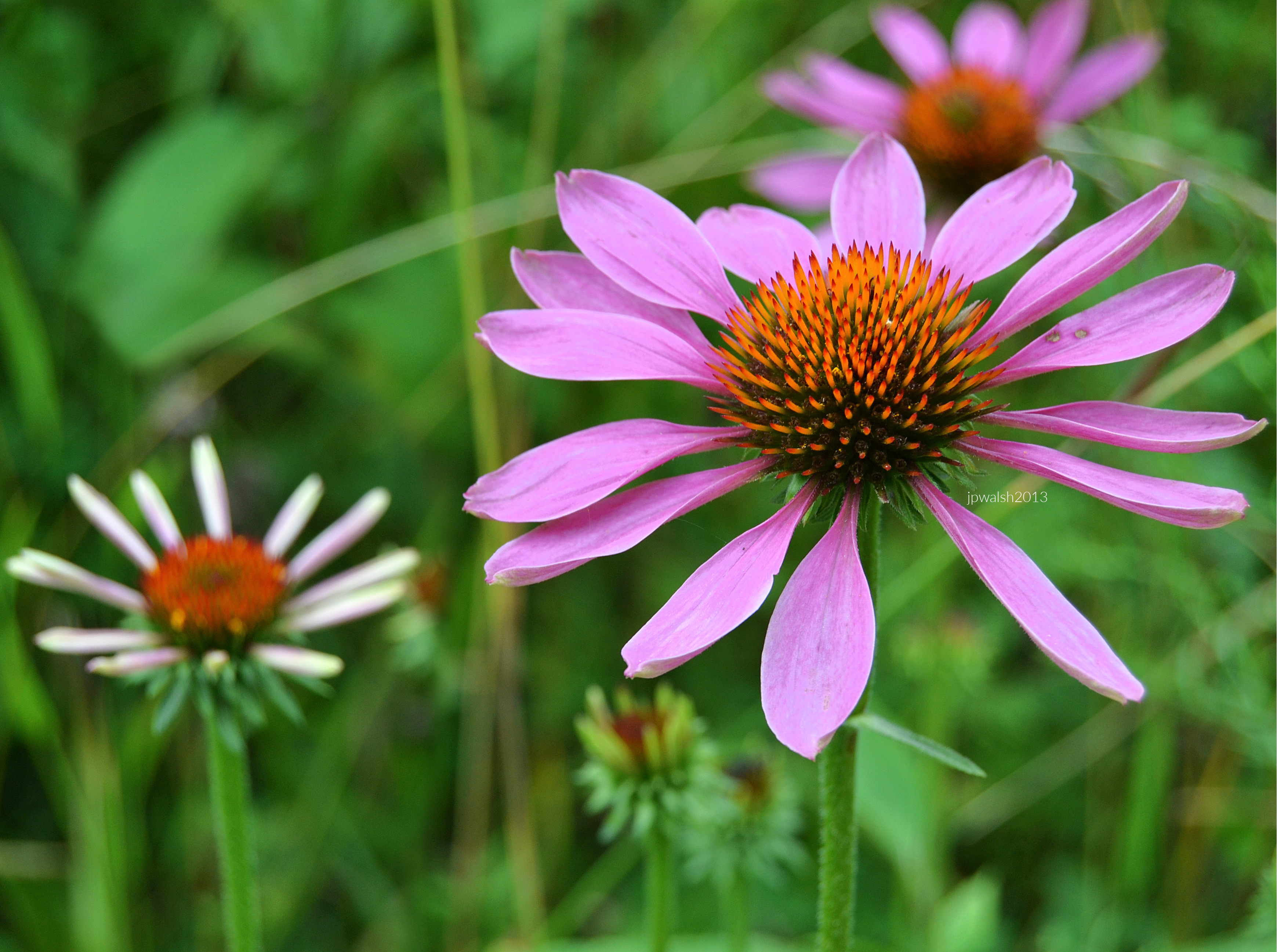
August 2013. Purple Cornflower (Echinacea purpurea). West Chicago Prairie.
August 2013. Orange sulphur butterfly & wild clover. Water Fall Glen, Lemont, Illinois.
September 2016. Ellwood House. Dekalb, IL.
August 2016. Richmond, Illinois.
August 2021. Lombard, Illinois.
August 2015.
June 2014. Naperville, Illinois.
May 2021. Chicago (State Street).
May 2017.
June 2022. 7.25mb 99%
June 2017. 7.04mb 95%
September 2017. 2.68 mb
April 2021 1mb
October 2016. 4.04 mb
September 2022. 6.60 mb 99% (50)
August 2017. 7.88mb 78%
October 2022. 7.98 mb 76%
October 2023. 7.82mb 79%
June 2022. Riverside, Illinois. 416 kb 35%
May 2023. 7.89mb 74%
May 2023. 7.90 mb 66%
May 2023. 7.83 mb 90%
May 2023. 4.43 mb
May 2023. 7.83 mb 89%
May 2023 4.02 mb. The U.S. Congress designated the Friday before Memorial Day as National Poppy Day. According to the American Legion founded by U.S. War Veterans in 1919 following World War I, the red poppy is a nationally recognized symbol of sacrifice worn by Americans since that time to honor those who served and died for our country in all wars. It reminds Americans of the sacrifices made by our veterans while protecting our freedoms. 
June 2023 7.70mb 88% (60)
June 2023. 7.85mb 70%
June 2023. 7.78 mb 88%
June 2023. 30%
July 2023. 7.78mb 76%
July 2023. 7.45 mb 99%
August 2023. 6.64mb
August 2023. 7.52mb 99%
June 2021. 7.82mb 63%
May 2023. 6.93 mb 99%
October 2023. 6.98mb (70)
November 2023. 5.92mb
August 2016. 6.62mb
August 2016. 7.85mb 89%
April 2024. 99% 7.29mb
April 2024. 64% 7.74mb
April 2024. 93% 7.78 mb
May 2024. 91% 7.91mb
May 2024. 98% 7.74 mb
July 2024. 99% 7.06 mb 0143 (1)
August 2024. 65% 7.69 mb 0929 (1)
September 2024. 7.28mb 1821 (1)
September 2024. 7.18 mb 1861 (1)
September 2024. 93% 7.81 mb_1879
September 2024. 7.23mb _1884 (1)
October 2022. 7.43mb_9353
September 2024. 95% 7.96 mb_2709
June 2024. 99% 7.30 mb 3442
September 2024. 5.41mb_2857 copy
May 2016. Chicago (Millennium Park). 7.45mb DSCN2453 (1)
August 2016. 5.41mb DSCN3803
August 2016. 6.45mb DSCN3784 (1)
March 2017. 6.74mb DSCN5474
June 2017. 4.64mb DSC_0350
April 2025. 7.84mb DSC_9352 (1)
April 2025. 99% 7.35 mb DSC_9322
May 2025. 87% 7.81mb DSC_1023
July 2025. 73% 7.88 mb DSC_3565 (1)
October 2025 99% 7.77mb DSC_7122
September 2015. Chicago. 5.99mb DSCN1212 (1)
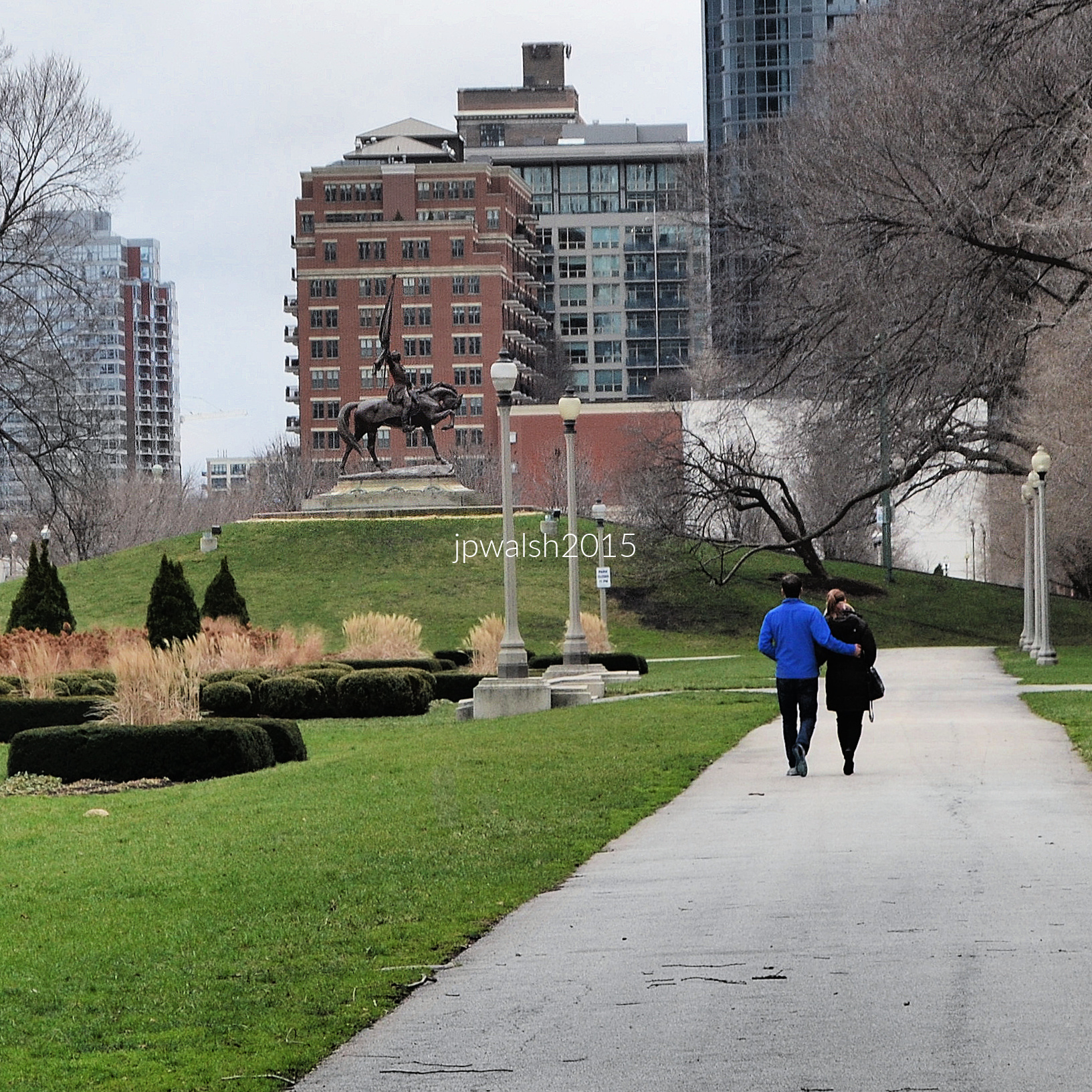
December 2015. Chicago. Gen. John Logan Memorial (1897), Grant Park. 1.17mb DSC_0590 (1)
May 2016. Lilacia Park designed by Jens Jensen. 3.95mb DSC_0140 (1)
May 2016. 2.69 mb DSC_0073 (1)
May 2016. 2.85mb DSC_0079 (1)
May 2016. 4.32mb DSC_0034 (1)
May 2016. 5.47mb DSC_0150 (1)
May 2016. 4.75 mb DSC_0065 (1)
May 2016. Wheaton, IL. 3.21mb DSC_0389 (1)
May 2016. Crest Hill, IL. 4.07mb DSC_0487 (1)
May 2016. Naperville. 2.94mb DSC_0596 (2)
May 2016. Wheaton (Adams Park). 3.70mb DSC_0617 (1)
June 2016. Naperville, IL. 4.62mb DSC_0669 (1)
July 2016. Downers Grove, IL. 6.04mb DSC_0494 (1)
July 2016. 5.89mb DSC_0687 (1)
September 2016. 4.56mb DSC_0448 (1)
September 2016. 4.90mb DSC_0690 (2)
Oct 2016. Chicago (Old Town). 4.42mb DSC_0932 (1)
July 2017. Dayton Bluffs Preserve, Ottawa, IL. 3.84mb DSC_0607 (1)
July 2017. Nicholas Conservatory & Gardens, Rockford, IL. 4.17mb tDSC_0789 (1)
July 2017. Rockford, IL. 4.28mb Rockford DSC_0795 (1)
July 2017. Japanese gardens, Rockford, IL. 6.75mb Rockford DSC_0731 (1)
July 2017. 6.58mb DSC_0669 (2)
June 2021. Wheaton, IL. 7.44mb DSC_7641
July 2017. 2.81mb DSC_0793 (1). “A quiet moment on a summer coneflower, the butterfly’s proboscis reaching into the heart of the bloom.”

History and reportage of the amazing natural event of May 18, 1980: the eruption of MOUNT ST. HELENS, Washington.

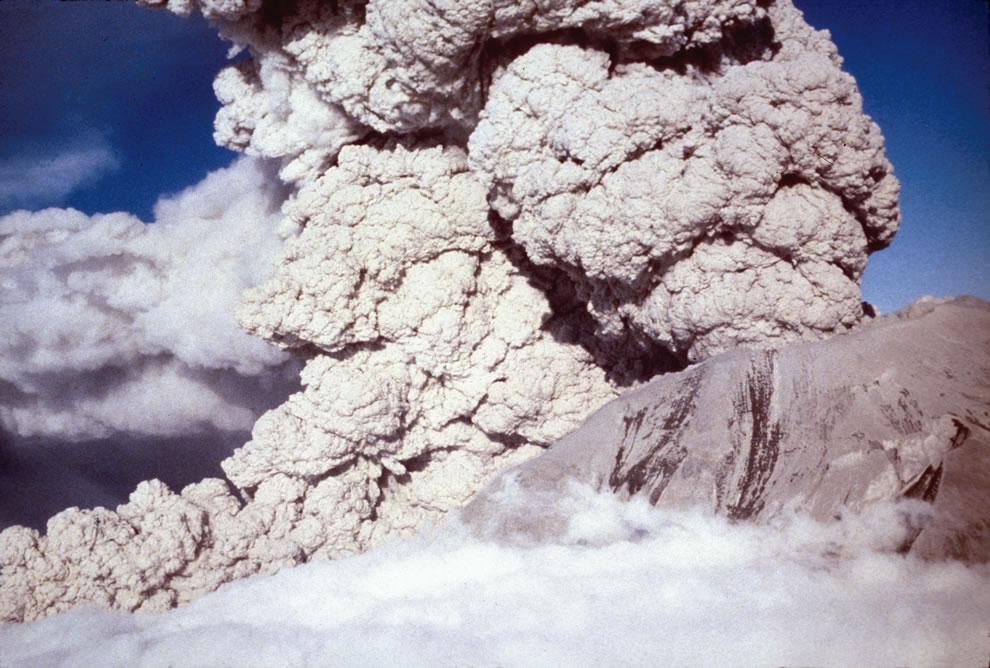
FEATURE image: Phreatic or steam-blast eruption from the summit crater of Mount St. Helens on April 6, 1980. USGS/Public domain.

By John P. Walsh, May 18, 2016.

“Nobody lies about her lodestone any more. She burned and destroyed the whole park! Killed people too – what a pity! Only scientists are out there now. What’s there to see, dear? Isn’t it all in ruins?”

This is what the lady innkeeper told me in Portland, Oregon, before I set out in the car one early morning in July 1991 to visit the crater.

“It’s a pity she blew. It was such a pretty mountain before. WAS, I say. The kids loved camping at its base. It was so easy for them to get in and out. Then she blew and changed everything.”

I waved my good-byes and started the two-hour drive.

1980-Mt-St-Helens-BEFORE-eruption USFS Photo #15 taken before 18 May 1980 by Jim Nieland,
As seen from Spirit Lake, Mount St. Helens in 1980 BEFORE the eruption on May 18, 1980. United States Forest Service (USFS) photo by Jim Nieland. USGS/Public domain.
7_-Mount-St_-Helens-Aftermath-w-Drawing
Earthquakes, avalanches and a ten-minute eruption on May 18, 1980 toppled nearly 4,000 feet from the mountain summit. Author’s collection. Fair use.
April-1980-a-bulge-develops-on-the-north-side-of-Mount-St_-Helens-as-magma-pushed-up-within-the-peak-pushed 450 feet bby may 18 Photo #20 by Peter Lipman
In April 1980 a bulge developed on the north side of Mt. St. Helens as magma pushed up inside it. View from the northeast. Photo by Peter Lipman. USGS/Public domain.
Phreatic or steam-blast eruption from the summit crater of Mount St. Helens on April 6, 1980. Aerial view to the southwest. The ash-laden cloud surrounds and obscures a finger-like ash column with an upper white cloud formed by atmospheric condensation of water vapor. USGS/Public domain.

At 8:32 a.m. on Sunday, May 18, 1980, an earthquake followed by a landslide and near simultaneous volcanic blast changed forever – and in less than 10 minutes – a Cascades landscape of 230 square miles. Months before the unexpected blast, volcano watchers had camped near the mountain, including scientists and photographers, who were interested to gauge its recent unusual seismic and geological activity and capture what the mountain may do. Local property owners pressured authorities to be let back into their homes during this uncertain and, as it turned out, critically dangerous waiting period. Especially good weather brought out an extra contingent of weekend campers, backpackers and curiosity seekers to the mountain, many from Portland only 70 miles away.

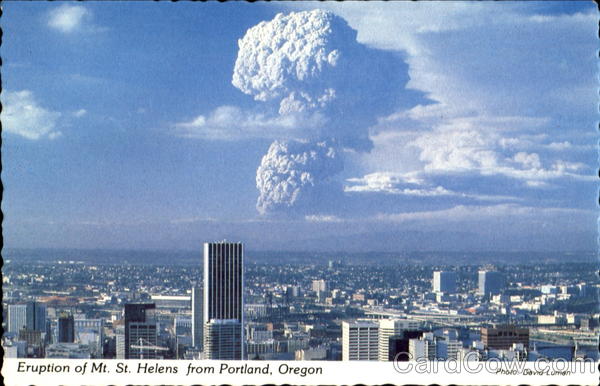
Eruption Of Mt. St. Helens From Portland
Eruption of Mt. St. Helens From Portland, ending 123 years of dormancy. This is the distance from which I traveled from the B&B to the National Volcanic Monument in July 1991 which is over 100 miles away. Fair Use.

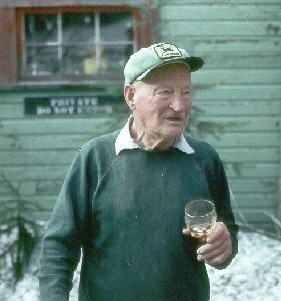
Everybody I talked to during my 1991 visit remembered 83-year-old Harry Randall Truman who lived by the mountain for over half his life and refused to leave in the days and weeks before the May 18, 1980 eruption. Not sure whether the mountain would blow or not, Truman, who served in the U.S. military in Europe in World War One, resigned himself to the mountain’s fiery whims. When the 1000-story high burbling volcano finally did blow, the avalanche and blast buried Mr.Truman, as it did Spirit Lake, in 350,000 acre-feet of fire and ash  debris. Mr. Truman’s body was never recovered nor did he represent the only loss of human life in the eruption. 

Harry Randall Truman (1896-1980), who lived by Mount St. Helens for 54 years, died in the blast when he refused to evacuate. Fair Use.
Harry Randall Truman lived less thana mile from the 1000-story Mount St. Helenswhen it erupted on May 18, 1980. Fair Use.
Reid Blackburn, 27, a photographer at The Columbian newspaper in Vancouver, Washington, was killed in the 1980 eruption of Mount St. Helens. Blackburn got caught in the blast at Coldwater Camp. While his car and body were recovered four days later, his camera only resurfaced after a week.
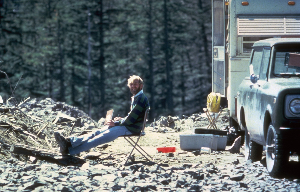
In this May 17, 1980 photo, 30-year old vulcanologist David Johnston is shown in the evening at his camp near what is now known as Johnston Ridge near Mount St. Helens.
The day before the blast – in this May 17, 1980 photo – 30-year-old volcanologist David Johnston is shown in the evening at his camp near what is now known as Johnston Ridge near Mount St. Helens. A principal scientist on the monitoring team, Johnston perished while manning an observation post 6 miles away on the morning of May 18, 1980. Johnston was the first to report the eruption, transmitting “Vancouver! Vancouver! This is it!” before he was swept away by the lateral blast. Johnston’s remains were never found, but state highway workers discovered remnants of his USGS trailer in 1993. Photo by Harry Glicken on May 17, 1980 at 19:00, 13 1/2 hours before the 1980 eruption. USGS/Public domain.
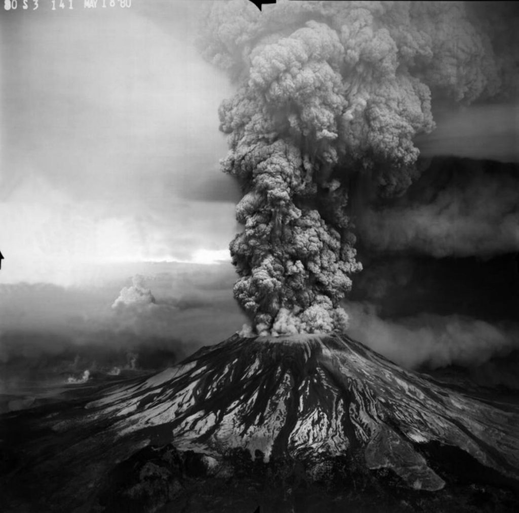
On Sunday, May 18, 1980 at 8:32 a.m., the bulging north flank of Mount St. Helens slid away in a massive landslide — the largest in recorded history. Seconds later, the uncorked volcano exploded and blasted rocks northward across forest ridges and valleys, destroying everything in its path within minutes. USGS/Public domain.
camper containing two victims of the Mount St. Helens eruption sits amidst the gray landscape about 8 miles from the mountain may 20 1980
This camper contains two victims of the Mount St. Helens eruption in a gray landscape about eight miles from the mountain, May 20, 1980. USGS/Public domain.
View downstream of the North Fork Toutle River valley choked by a debris avalanche deposit from the May 18, 1980 eruption of Mount St. Helens. USGS/Public domain.
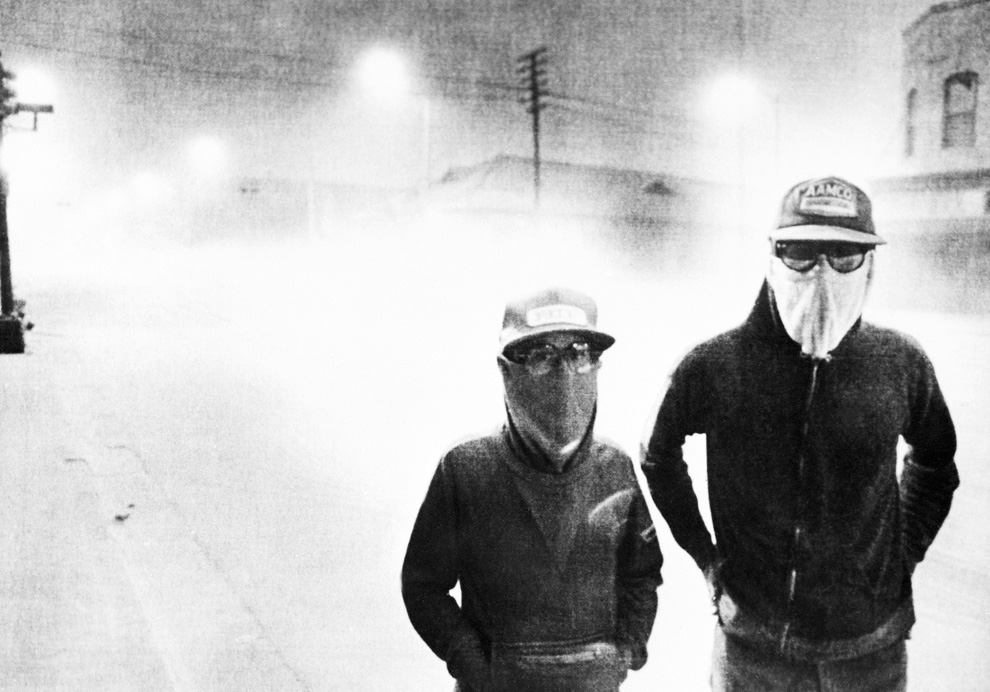
streets of Yakima, Washington may 18
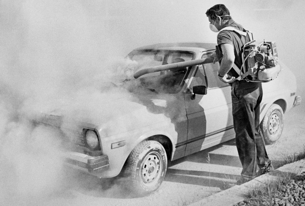
Streets of Yakima, Washington, May 18, 1980. Debris clouds moved east over the state of Washington and then the rest of the Continental United States and parts of Canada for weeks. Fair use.
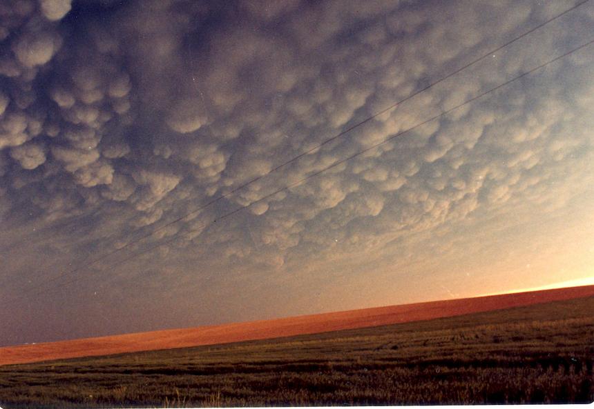
Taken from a rest area near Lewiston, Idaho, on May 18, 1980, Mammatus clouds caused by volcanic ash over the Palouse of southeastern Washington, north central Idaho and northeast Oregon. Photograph by Betty Ehr. Fair use.
Mount St. Helens’ eruption May 18, 1980. The image is in the public domain in the United States because it only contains materials that originally came from the United States Geological Survey (USGS). See – https://www.usgs.gov/volcanoes/mount-st.-helens
Sixth in a series of photographs by Gary Rosenquist. (see- https://pubs.usgs.gov/gip/msh/catastrophic.html – retrieved June 24, 2021.)
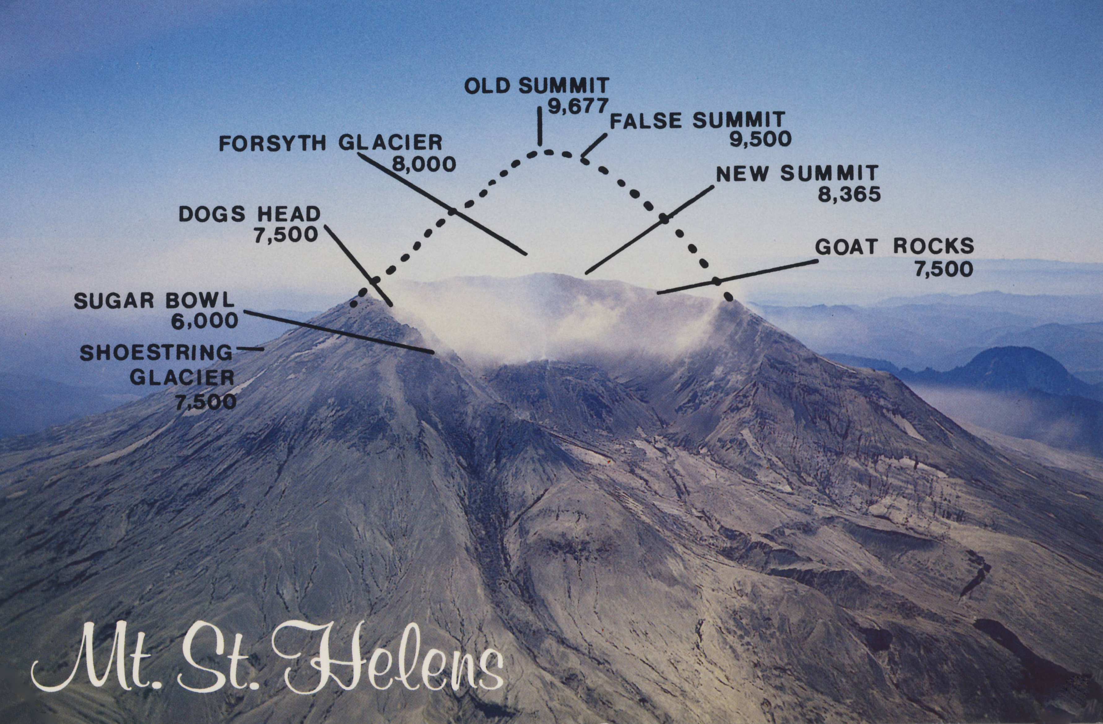
Author entering the “Restricted Zone” of Mount St. Helens National Volcanic Monument in July 1991. About eight miles away, the collapsed north face of the mountain looms in the distance. Only a few months before the authorities had re-opened Mount St. Helens for the first time since the blast. It was named a National Volcanic Monument and deemed safe again for visitors. Mount St. Helens was partially destroyed by a series of earthquakes followed by the largest debris avalanche in history and a blast and pyroclastic flow that flattened everything in its path over 230 square miles. Author’s collection.

Only a few months before my July 1991 visit the authorities had re-opened Mount St. Helens for the first time in more than a decade. It was named a National Volcanic Monument and deemed safe again for visitors. After Bear Meadow I followed the prolonged twisting road to past Ghost Lake, Meta Lake and Norway Pass until I reached Independence Pass. From its overlook I saw  for the first time the ashen slough that had been Spirit Lake. For years prior to May 1980 several camps inhabited the shore around the lake’s perimeter. There had also been various lodges around the oblong-shaped lake including the one Mr. Truman lived in. On May 18, 1980 Spirit Lake met the full impact of the volcano’s lateral blast. The sheer force of the blast lifted the lake out of its bed and propelled it about 85 stories into the air to splash onto adjacent mountain slopes. Despite the weeks of warnings about a potential eruption of Mount St. Helens, the sole film records of the actual event are in photographs.

The long and winding road into the Mount St. Helens National Volcanic Monument travels towards Spirit lake and the volcanic rim. Author’s photograph, July 1991.

At 8:32 a.m. on May 18, 1980 a 5.2-magnitude earthquake triggered the bulging north slope of Mount St. Helens to slice and fall away into the biggest debris avalanche in recorded history. This landslide was rapidly succeeded by the powerful lateral blast that sent scorching hot ash and rock hurtling out of the mountain at approximately 300 miles per hour, toppling and incinerating everything in its northward path. Fifteen miles away from the mountain temperatures reached Fahrenheit 572 degrees.

Spirit-Lake-Pumice-Plain-and-phreatic-explosions-soon-after-the-May-18-1980-eruption-of-Mount-St_-Helens
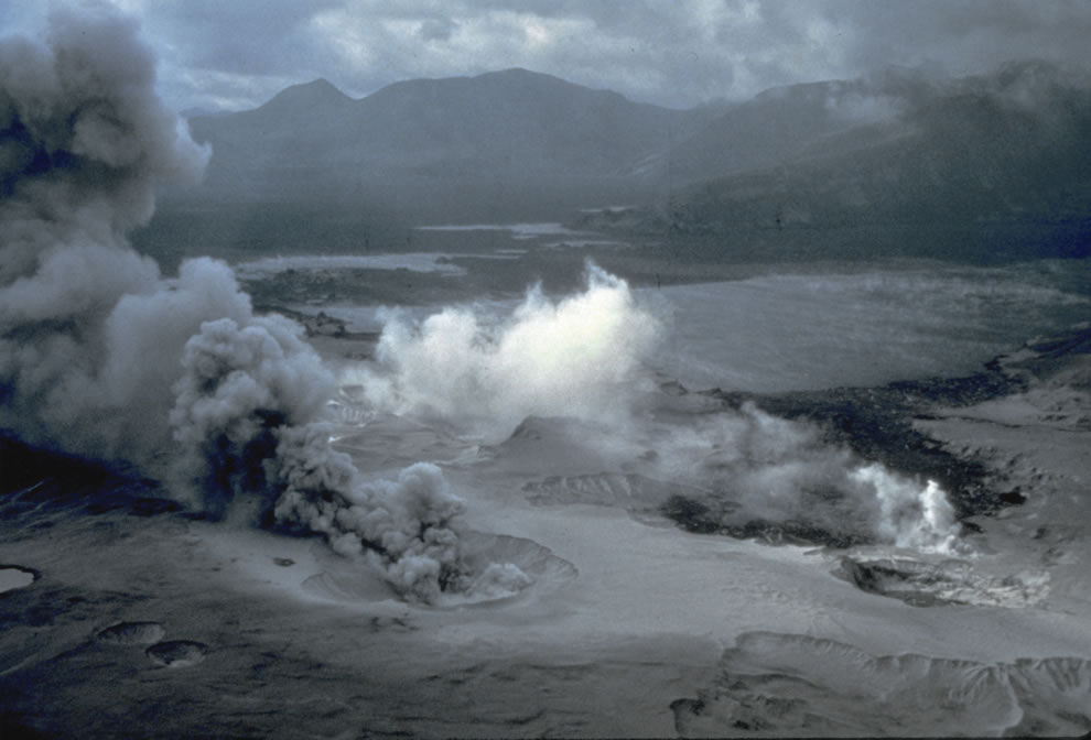
Spirit Lake a few days after the eruption on May 18, 1980. USGS/Public domain.

While in 2016 plant and animal life continue to recover and augment as it has for decades now,  my boots in 1991 crunched into a gray, dusty moon-like surface. From Spirit Lake to Windy Ridge I was confronted by trees flattened like toothpicks as far as the eye could see, and a cauldron emitting wispy white smoke. The base of the mountain is four miles wide. The journey had taken me from civilization and delightful wilderness into mile upon mile of  badlands. My bodily presence was miniature in an immense, silent, and deserted landscape, the scene only a decade earlier of the most powerful natural event in the Continental United States in over one thousand years. While I heard some people talk about this volcanic eruption as comparable in its destructive power to that of a detonated atom bomb, I know that sort of comparison is ludicrous. For all its destructive force, this is not a disaster as it contains, if one requires patience to believe it,  a natural benignity – or what scientists  call a natural disturbance on a grand scale which allows mankind to study the natural cycle of death and life in a landscape. An atom bomb provides none of that -it only bestows extinction and contamination.

“The standing dead” by Rudimentary is licensed under CC BY-NC-ND 2.0 
msn 3 001 FIXED
A gray, dusty moon-like surface with trees flattened like toothpicks as far as the eye could see. At Mount St. Helens National Volcanic Monument, Author’s photograph, July 1991.

Ash and gas, accompanied by lightning, ascended 15 miles into the air at the speed of a mile a minute. In a blast that killed 57 people – many of whom were there to study and record its possible eventuality – it also decimated approximately 7,000 large animals and 12 million salmon. No trees of dense forest were left standing within 6 miles of the summit. Rescue operations continued for days with varied success.

Eruption of Mt St Helens May 18, 1980, Gifford Pinchot National Forest” by Forest Service Pacific Northwest Region is marked with CC PDM 1.0.
Army National Guard helicopter pilot Harold Kolb rescues two men and their sons
Army National Guard helicopter pilot Harold Kolb rescues two men and their sons from the eruption of May 18, 1980. USGS/Public domain.
horse rescuers gave up their efforts as they fled for their lives as flood waters from the Toutle Rive
Army National Guard helicopter pilot Harold Kolb rescues two men and their sons from the eruption of May 18, 1980. USGS/Public domain.
mudflow deposit covers Washington State Highway 504 near the town of Toutle, northwest of Mount St. Helens, to a depth of 2m (6 ft). USGSR.L. Schuster) #
Mudflow deposits cover State Highway 504 near of Toutle, to a depth of over six feet. Photo by USGS R.L. Schuster/Public Domain.
This aerial view shown May 23, 1980 from a search and rescue helicopter
This aerial view shown May 23, 1980 from a search and rescue helicopter. USGS/Public domain.
30210599_008_large
USGS/Public domain.
SGS Photograph taken on May 18, 1980, by Austin Post/Public Domain.
Tim_Florin_washed_road_t860
Encountering a washed-out road to the Mount St. Helens Visitor Center in late summer 1980.
in Moscow, Idaho more than 350 miles away (AP Photo Moscow-Pullman Daily News
Debris ash in Moscow, Idaho, over 350 miles away from the blast on May 18, 1980.
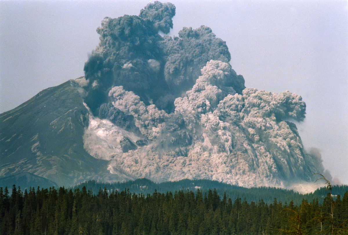
After the May 18, 1980 eruption, five more explosive eruptions took place at Mount St. Helens in 1980 including this spectacular one of July 22, 1980. Photo by Mike Doukas.
July-1980-Aerial-view-pryoclastic-flow-emerging-from-Mount-St_-Helens-craterUSGS Photo #22 taken at 701 p.m., on July 22, 1980, by Harry Glicken
July 1980 aerial view of pyroclastic flow from Mt. St. Helens. USGS Photo July 22, 1980, by Harry Glicken. USGS/Public domain.
Pyroclastic flow during August 7, 1980, Mount St. Helens eruption. The view is from Johnston Ridge, located 8 km (5 mi) north of Mount St. Helens. Photo: Peter Lipman. Public Domain.
a helicopter stirs up ash while trying to land in the devastated area on August 22nd, 1980. USGSLyn Topinka
A helicopter stirs up ash while trying to land in the devastated area on August 22, 1980. Photo by Lyn Topinka United States Geological Service. USGS/Public domain.
Fireweed with Spirit Lake n September 4, 1984
September 1984: Fireweed on the slopes of Spirit Lake four years after the eruption. Public Domain.
MOUNT ST HELENS
An eruption from Mount St. Helens on March 8, 2005. In 2016 the volcano is showing increased signs of significant seismic activity. AP Photo/USGS Matt Logan. USGS/Public domain.
65472-050-83D9BBC4
In 2016 in nature it is survival of the fittest – while woody plants are beginning to appear with the promise of a forest, the boll weevil is eating the wood. Photo credit: Michael Hynes.
lightning-over-mount-st-helens1
Mount st Helens May 18, 1980
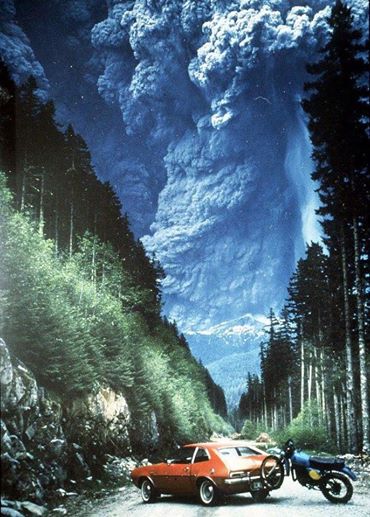
This photo of an erupting Mount St. Helens has been published and viewed widely on television over the years since the eruption. Photo credit: Richard “Dick” Lasher.
Albert Bierstadt (1830-1902), Mount St. Helens, Columbia River, Oregon, oil on canvas mounted on panel, 18 x 32 1/4 inches (45.72 x 81.92 cm), Public collection.
Mount Saint Helens 1980 with music by Alan Hovhaness.

Scenes of the eruption on May 18, 1980, and its aftermath set to music from “Mount St Helens,” a symphony in three movements by Alan Hovhaness (1911-2001). Hovhaness, who lived in Seattle, WA, at the time, completed the commissioned symphony in January 1982. When it premiered in March 1982, the composer wrote: “When Mount St. Helens erupted on the morning of May 18, 1980, the sonic boom struck our south windows. Ashes did not come here at that time but covered land to the east all across the State of Washington into Montana. Ashes continued to travel all around the world, landing lightly on our house a week later, after their journey all around our planet.”

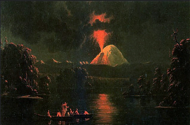
The volcano was particularly restless in the mid19th century, when it was notably active off and on for a 26-year span from 1831 to 1857. Canadian artist Paul Kane (1810–1871) painted Mount St Helens Erupting At Night in 1847 (Royal Ontario Museum, Toronto). Though considered once dormant, the volcano has been continually active in degrees over the centuries as this nineteenth century painting attests, and remains so today after the major 1980 blast. Public Domain.

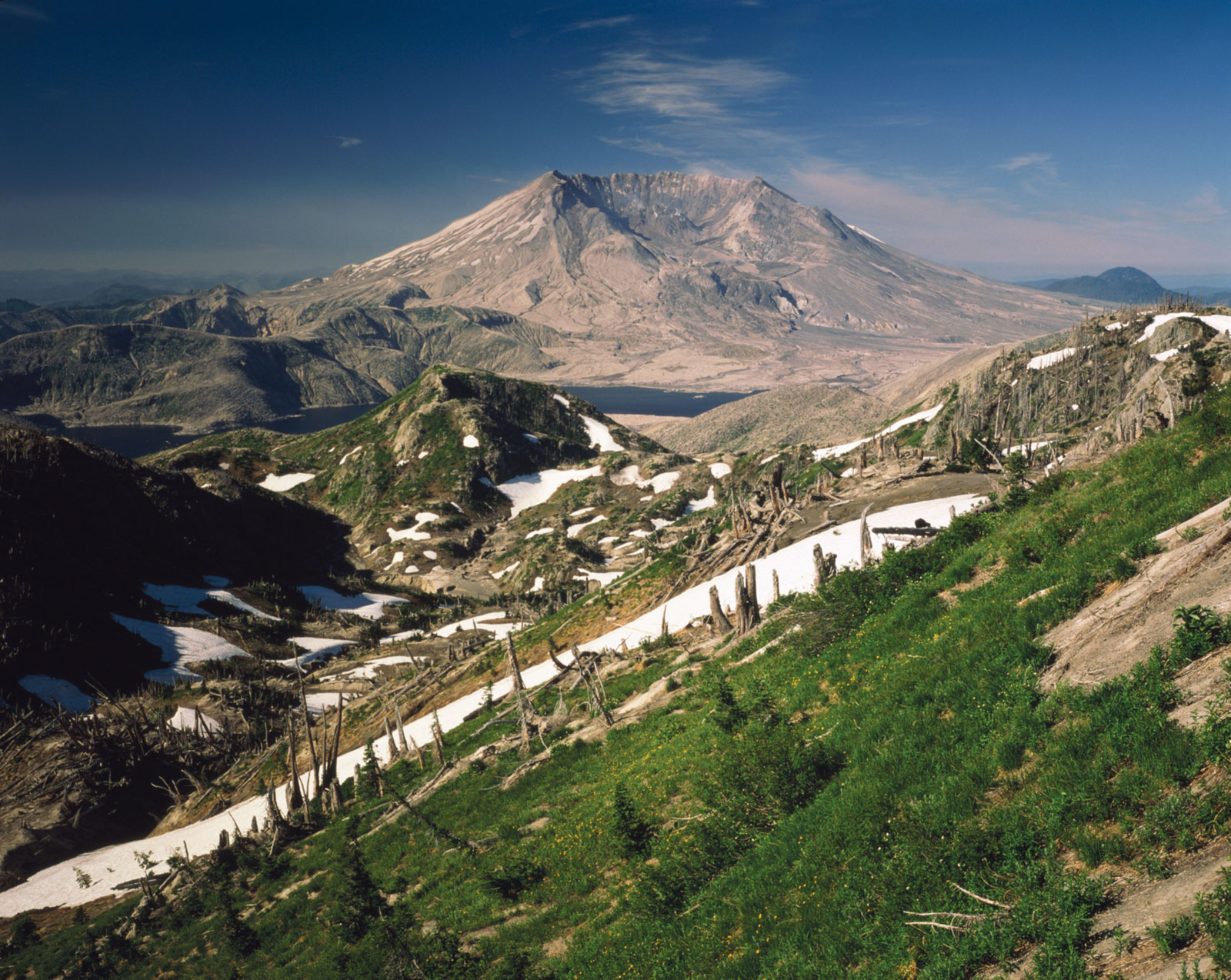
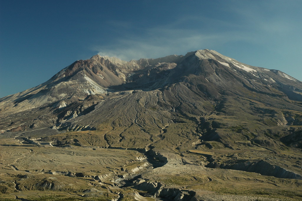
Mount Saint Helens today. The powerful lateral blast in May 1980 sent scorching hot ash and rock hurtling out of the mountain at approximately 300 miles per hour and resulted in toppling about 40% of the mountain’s height.Mount Saint Helens” by jimculp@live.com is licensed under CC BY-NC-ND 2.0.