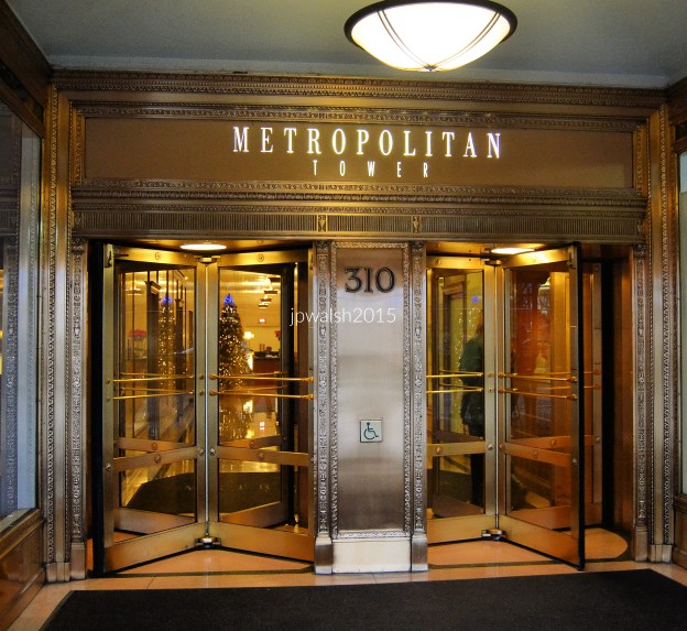
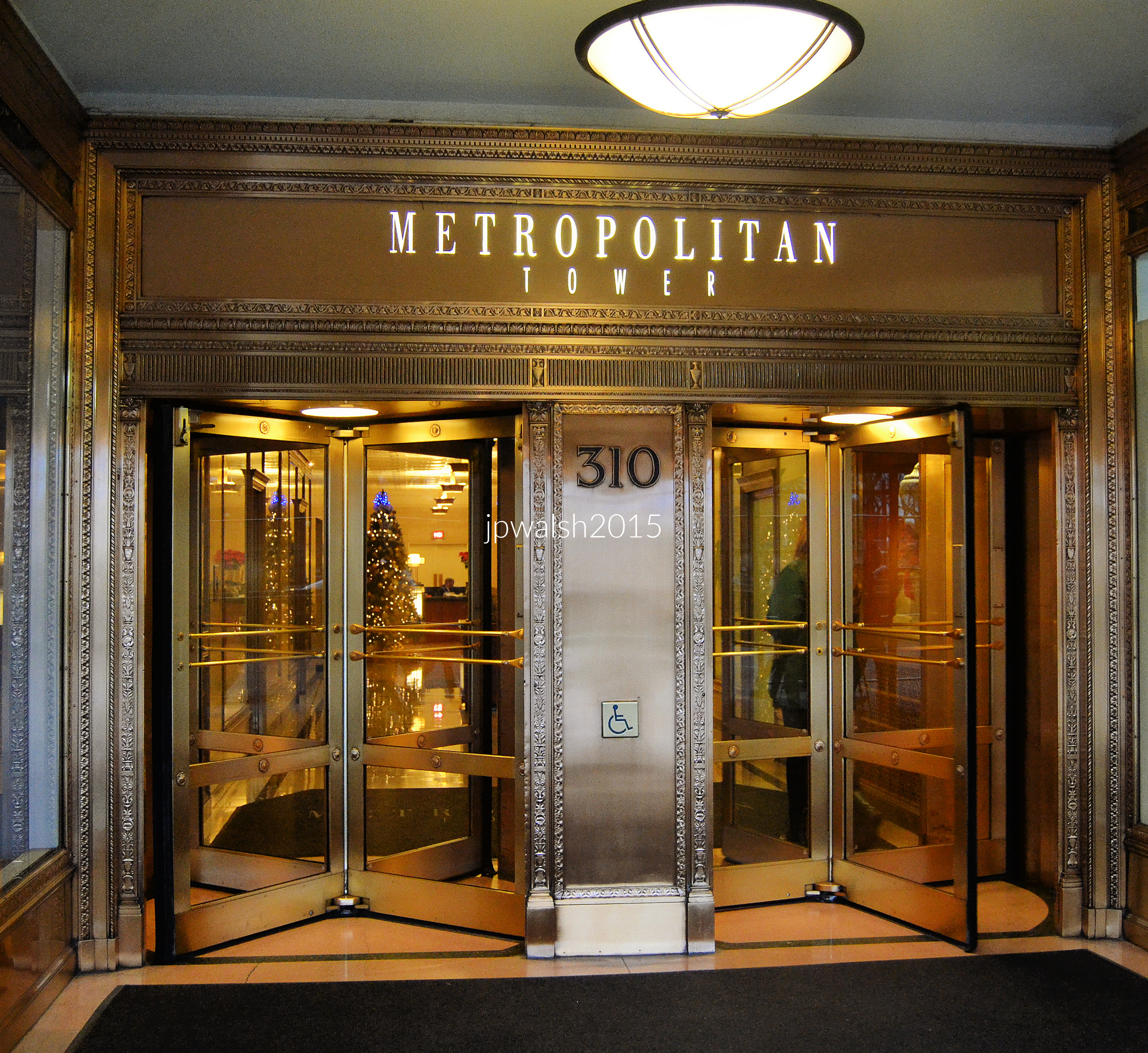
Feature Image: Main Entrance, Metropolitan Tower (1924), 310 South Michigan Avenue, Chicago, was designed by Graham, Anderson, Probst & White. December 2015. 4.89 mb DSC_0963 (1). Author’s photograph.
Metropolitan Tower’s main entrance is more than an architectural detail: it is a surviving gateway to one of Chicago’s most significant early skyscrapers, a building that embodied the ambitions, craftsmanship, and corporate prestige of the 1920s while reflecting the evolution of Michigan Avenue and modern Chicago.
Located at 310 South Michigan Avenue on the southwest corner of Jackson Boulevard, Metropolitan Tower originally served as corporate headquarters for S.W. Straus and Co., a banking and investment firm. The building was erected in 1924 by Graham, Anderson, Probst & White in their signature classical style. The architectural firm was one of the largest in the first half of the twentieth century and went on to build Chicago’s Civic Opera Building in 1929. Founded in 1912, the firm was the successor to D. H. Burnham & Co. by way of partner, Ernest R. Graham (1868-1936), and Burnham’s sons, Hubert and Daniel Jr. Five years later the Burnhams left to form their own firm (Burnham Brothers) and Graham partnered with others of the firm’s members: William Peirce Anderson (1870-1924), Edward Mathias Probst (1870-1942), and Howard Judson White (1870-1936). No expense was spared for the Straus Building’s interior, though of the original lobby’s opulence all that remains are the elaborate bronze elevator doors. The entrance’s coffered bronze doors by Italian sculptor Leo Lentelli (1879-1961) were destroyed. see – Saliga, Pauline A., editor, The Sky’s The Limit A Century of Chicago Skyscrapers, Rizzoli New York, 1990, p. 117.
The Metropolitan Tower was built in 1924 as the headquarters of S.W. Straus & Co. and designed by Graham, Anderson, Probst & White, successors to the Burnham architectural tradition.
Ernest R. Graham (1868-1936).
William Peirce Anderson (1870-1924).
Edward Mathias Probst (1870-1942).
Howard Judson White (1870-1936).
The elaborate entrance and lobby originally featured exceptional decorative work, including bronze doors created by sculptor Leo Lentelli, although many original elements have been lost.
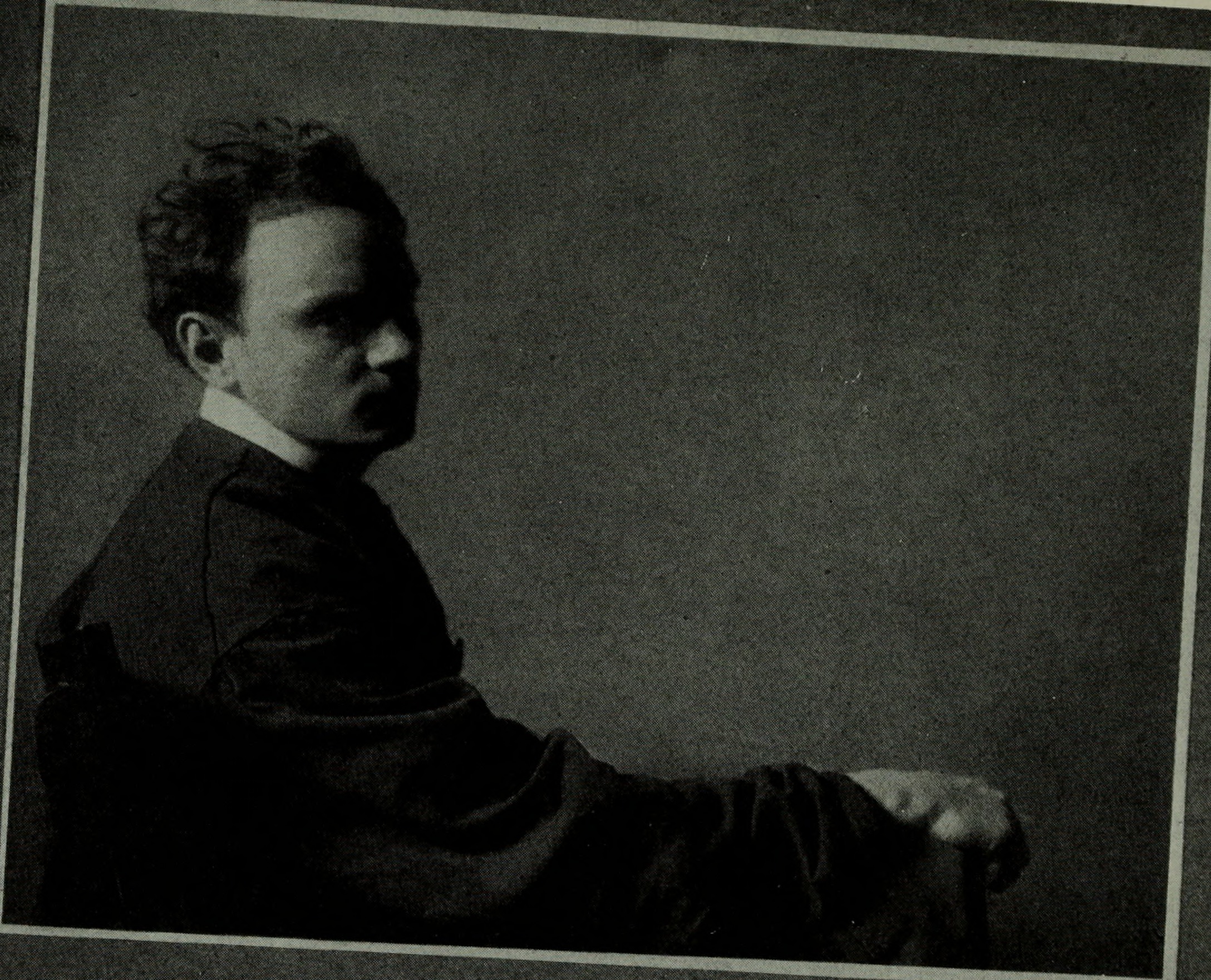
Leo Lentelli (1879-1961). The Italian sculptor created the original main entrance doors for Metropolitan Tower that were later destroyed. Public Domain.
The 30-floor classical-style Straus Building was renamed over the years for other of its famous inhabitants including Continental National Insurance Co. and Britannica Center for Encyclopedia Britannica. Metropolitan Tower was the first building in Chicago that took advantage of the new 1923 zoning ordinance for skyscrapers that allowed buildings taller than 260 feet (30 or more floors) with the necessary setbacks. Metropolitan Tower’s required setbacks begin at the 21st floor on which sits a nine-story tower until there is a second setback and then the final two stories. Crowned by a stepped pyramid and possessed of a powerful beacon that opened in 1924, the building is Chicago’s first Michigan Avenue skyscraper.
Metropolitan Tower was the first skyscraper on Michigan Avenue and one of the earliest buildings to take advantage of Chicago’s new 1923 zoning regulations permitting greater height through setbacks. Its distinctive stepped crown, beacon, and symbolic ornamentation made it a recognizable feature of the Chicago skyline.
Unused for years, the building’s 1,500-pound carillon bells were restored in 1979 for Pope John Paul II’s visit to Chicago. Just steps from Metropolitan Tower, the papal visit included an outdoor mass in Grant Park on October 5, 1979, which attracted over one million attendees, the largest gathering ever in Grant Park history up to that time. see – CBS Chicago Vault: Pope John Paul II enthralls Chicagoans on 1979 visit – CBS Chicago – retrieved March 18, 2026.
At one time, the thirtieth floor was the Straus Tower Observatory, which was open to the public for viewing the city in all four directions. see – Home | Metropolitan Tower – retrieved February 24, 2026. Home to the Continental National Insurance Company soon after it was built, this iconic skyscraper is located within Chicago’s Landmark Historic Michigan Boulevard District. The glass “beehive” supported by four bison figures at the top of the building held the blue light of a four-direction beacon. The ensemble, symbolizing industry, strength, and thrift, saw its beacon, signifying global reach, permanently shut down in 1934 following the financial failure of the S.W. Straus and Company during the Great Depression. The building was converted to residential condominiums in 2007. see – Metropolitan Tower | Powered by Baird & Warner– retrieved February 24, 2026; AIA Guide to Chicago, 2nd Edition, Alice Sinkevitch, Harcourt, Inc., Orlando, 2004, page 42.
The building was constructed in a classical style and represented the high quality and prestige associated with major Chicago commercial architecture of the 1920s. Over time, the building adapted to changing uses and occupants, including Encyclopedia Britannica and residential condominiums, demonstrating its continued relevance and preservation.
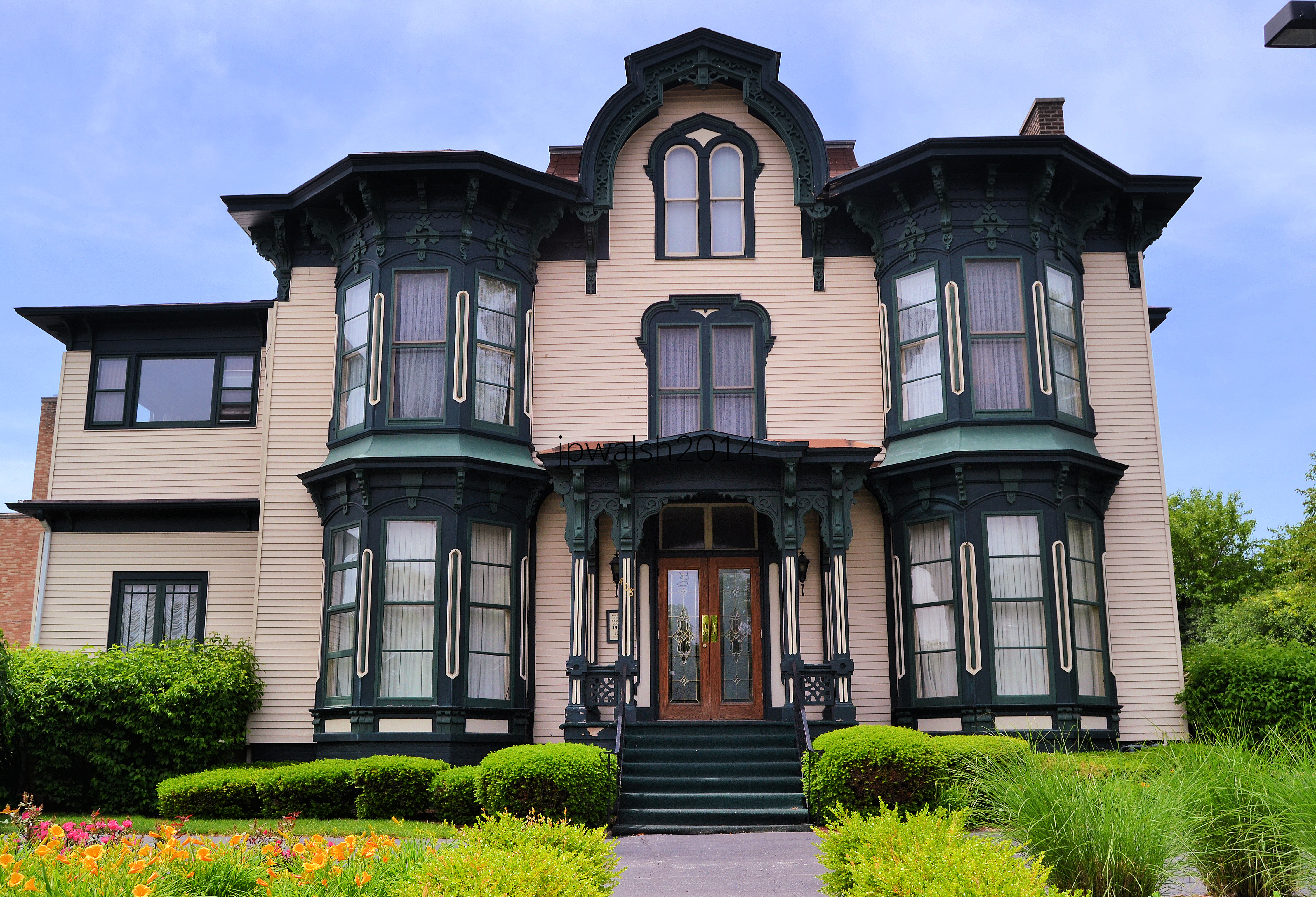
FEATURE image: 946 N. Sheridan Road, Waukegan, Illinois 1876.
Waukegan’s surviving architecture serves as a visual record of the city’s transformation from frontier trading post to prosperous Great Lakes industrial center, preserving nearly a century of changing architectural tastes and civic ambitions.
Text & photographs by author.
INTRODUCTION
Waukegan, Illinois, is an historic community on Lake Michigan about 40 miles north of downtown Chicago. It is one of the oldest settlements in Illinois. The site of the city was visited by French explorers Louis Jolliet (1645-1700) and Père Jacques Marquette, S.J. (1637-1675) in 1673 where Waukegan began as a French trading post and Potawatomie village.
Inside the Kiva (c.1905-1912), oil on canvas. 20 in. x 30.25 in., Kate Cory (1861-1958), Waukegan Historical Society. Waukegan photographer, sculptor, painter and muralist Kate Cory moved to Newark, New Jersey, with her family as a child. Between 1905 and 1912 she lived among the Hopi of the Oraibi Mesa in Arizona where this painting was made. Public Domain.
Waukegan’s origins as “Little Fort.”
“Little Fort” was the first name for the environs of Waukegan. It started around 1700 as a log building overlooking the Waukegan River on its southwestern shore as it drained into Lake Michigan. This point marked the portage from the Lake to the Des Plaines River as it traveled west. The state of Illinois was established in 1818. Over the next quarter century, the Illinois volunteer army fought local native American tribes and forced them to sign treaties and migrate west of the Mississippi. The Potawatomie left Waukegan by 1829 as they ceded their land in this area and throughout northeastern Illinois to the U.S. Government. The 1830s brought vast changes to the area with opportunities for development. In addition to the land transfer, the building of the Erie Canal in 1830 brought boatloads of settlers from New England and New York State into the Illinois and the Midwest region.
Along with other communities which developed on Chicago portage routes, the history of Waukegan’s founding and development shares a similar time frame as well as personalities and activities. In 1835 Thomas Jenkins was the first settler at “Little Fort.” Jenkins was followed in quick succession by other enterprising and hard-working New Englanders who settled much of northern Illinois in the 1830s which was the edge of the Western wilderness. Like Marquette and Jolliet in the 17th century, these newcomers recognized the potential monumental impact that access to Lake Michigan had for transport of goods in and out of the region and what that commercial activity and subsequent settlement would have on the surrounding real estate. As more people arrived, the creation of a village emerged. The area was platted and streets designated, and in a contested election in 1841, “Little Fort,” became the governmental center for a recently formed Lake County.
Little Fort Becomes Waukegan
Between 1844 and 1846 the town’s population multiplied from 150 to 750 persons. In 1849 the community changed its name from “Little Fort” to Waukegan. By 1859, when the town was incorporated as a city, Waukegan boasted a population of 2,500 people. Chicago, by comparison, had a population of 112,172 denizens in the 1860 census. Waukegan is an English alliteration that closely approximated the word for “fort” or “trading post” in the Algonquin language. In the 2020 census Waukegan reported a population of 89,321 people.
Growing population in the port city. Coming of the railroad
Waukegan had a natural deep harbor and was a port city. This feature attracted merchants and farmers who could readily ship their goods, produce, and grain from Lake and McHenry County businesses and farms to Chicago –- and, from that point, to the Midwest and the world. Waukegan soon became one of the busiest ports on the lake. When the railroad came to Waukegan in 1855 (today’s Chicago and North Western Railway), it stimulated interest in Waukegan as a manufacturing town that included ship and wagon building, flour milling, sheep raising, pork packing, beer brewing and dairy farming (Hawthorne-Melody Farms). The railroads made it feasible for the establishment of larger industries which appeared in Waukegan at the end of the 19th century such as U.S. Sugar Refinery, Washburn and Moen Wire Mill (U.S. Steel Corporation), U.S. Starch Works, and Thomas Brass and Iron Works, among others. This mercantile and agricultural activity generated sufficient wealth for its citizens to build big houses along Waukegan’s main streets. These residences expressed the current tastes in residential styles from Greek revival and Italianate styles to the Victorian and Prairie School.
1890-1930: Population boom fueled by immigration
Between 1890 and 1930 Waukegan experienced a population boom fueled by European immigrants and, in the 1920’s, Black Americans during the Great Migration. Waukegan thrived though by the end of the 20th century, the city suffered from an exodus of its population to farther west suburbs. This was accompanied by a shuttering of industries as management sought cheaper labor in other countries. At the same time, Waukegan was welcoming a new influx of immigrants from Latin America.
Famous residents
A few of Waukegan’s most famous residents in history include comedian Jack Benny (1894-1974), science fiction writer Ray Bradbury (1920-2012), World War II combat photographer under Colonel Darryl F. Zanuck (Twentieth Century Fox) Albert Klein, the aforementioned fine artist Kate Cory and NFL quarterback for the Cleveland Browns Otto Graham (1921-2003).
When he became famous, Jack Benny never forgot his hometown of Waukegan.
Science Fiction writer Ray Bradbury said he had a sign over his typewriter for 25 years as advice to himself and other writers: “DON’T THINK.”
When Otto Graham played for the Cleveland Browns the team played in 10 consecutive title games, 4 all-American Conference and 3 NFL championships. In Waukegan, Otto Graham’s father was a music teacher who taught Jack Benny to play the violin.
THE HOUSES:
408 N. Sheridan Road, 1875. Built in the Italianate style in 1875. The set of four symmetrical bay windows on the first and second floors have 12 tall thin windows. The moldings have scroll cut, incised, and cut out brackets with heavy decorative surrounds with keystones. In the center above the canopied main entrance are a second floor and gable windows with heavy shoulders for its surrounds. Above the gable window is punched out, playfully decorative bargeboard. The two story porch to the south (left) while integrated to the Italianate building is a later turn-of-the-century addition.
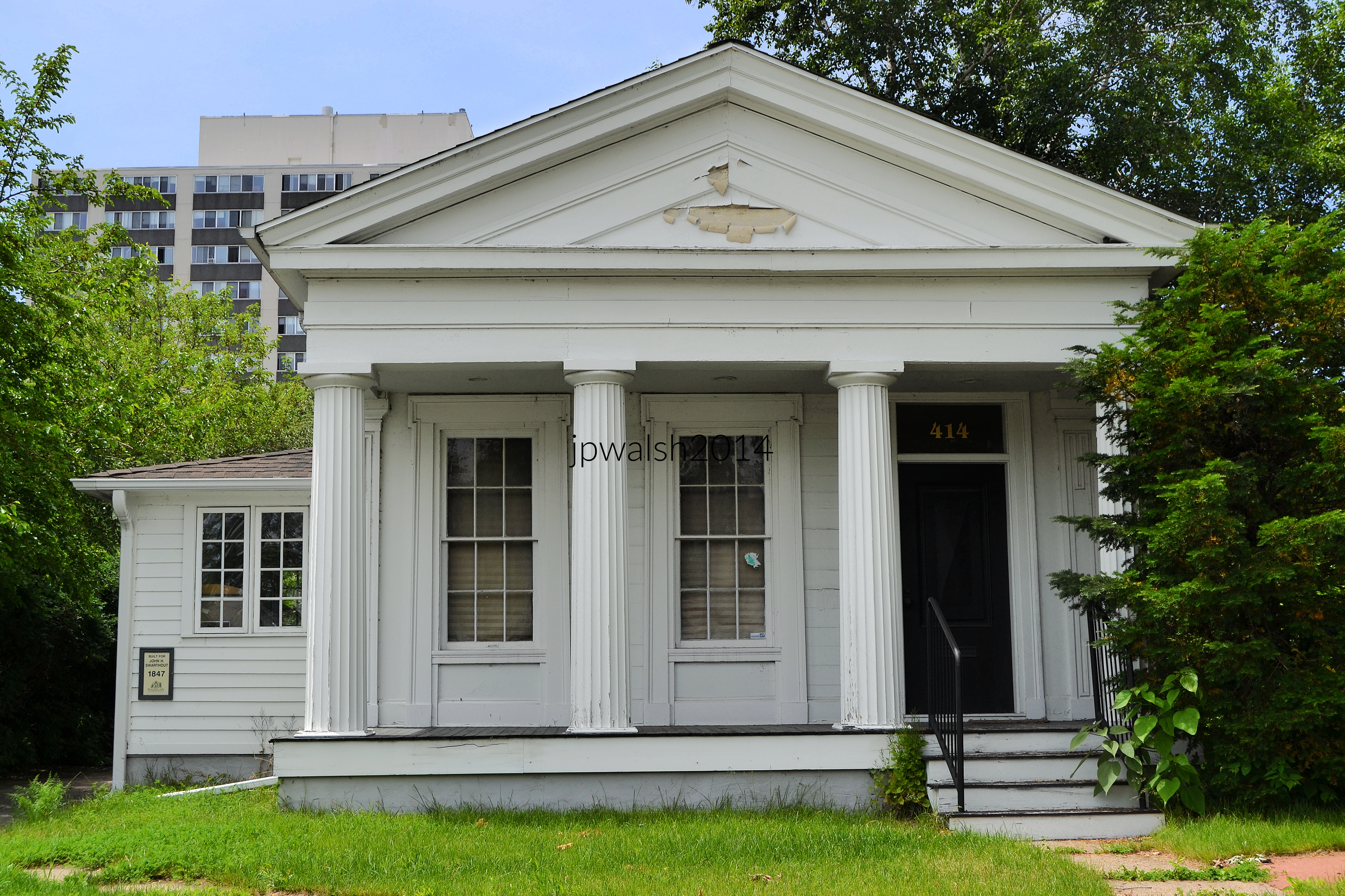
414 N. Sheridan Road, 1847. The strict Greek Revival-style modest building dates from 1847. Built by John H. Swartout, the frame house has a portico with a perfect classical pediment with Doric columns holding up a blank entablature. The façade hosts three identical openings – two being windows with shouldered moldings and a door with a transom. It is a simple and relatively small building that was in need of repair in 2014 when this photograph was taken by the author.
438 N. Sheridan Road, 1840s. The house was built up around a small 1840s Greek revival Style house. The Italian Villa style with its tall central tower, porch and columns, double brackets under the eaves and pediments above the windows, dates from the middle 1850s. the central door starts with the rope molding around the double doors and ascends to double arched windows on the second and third floors.
438 N. Sheridan Road, 1840s. Same house as above, southern exposure. The tower’s windows are replicated on each side at the same level as the front view.
505 N. Sheridan Road, 1850s. A central tower with a double window and a peaked arched pediment and a steep pitched roof marks this house from the 1850s as Greek Revival style. The door has heavy shoulders for its surrounds.
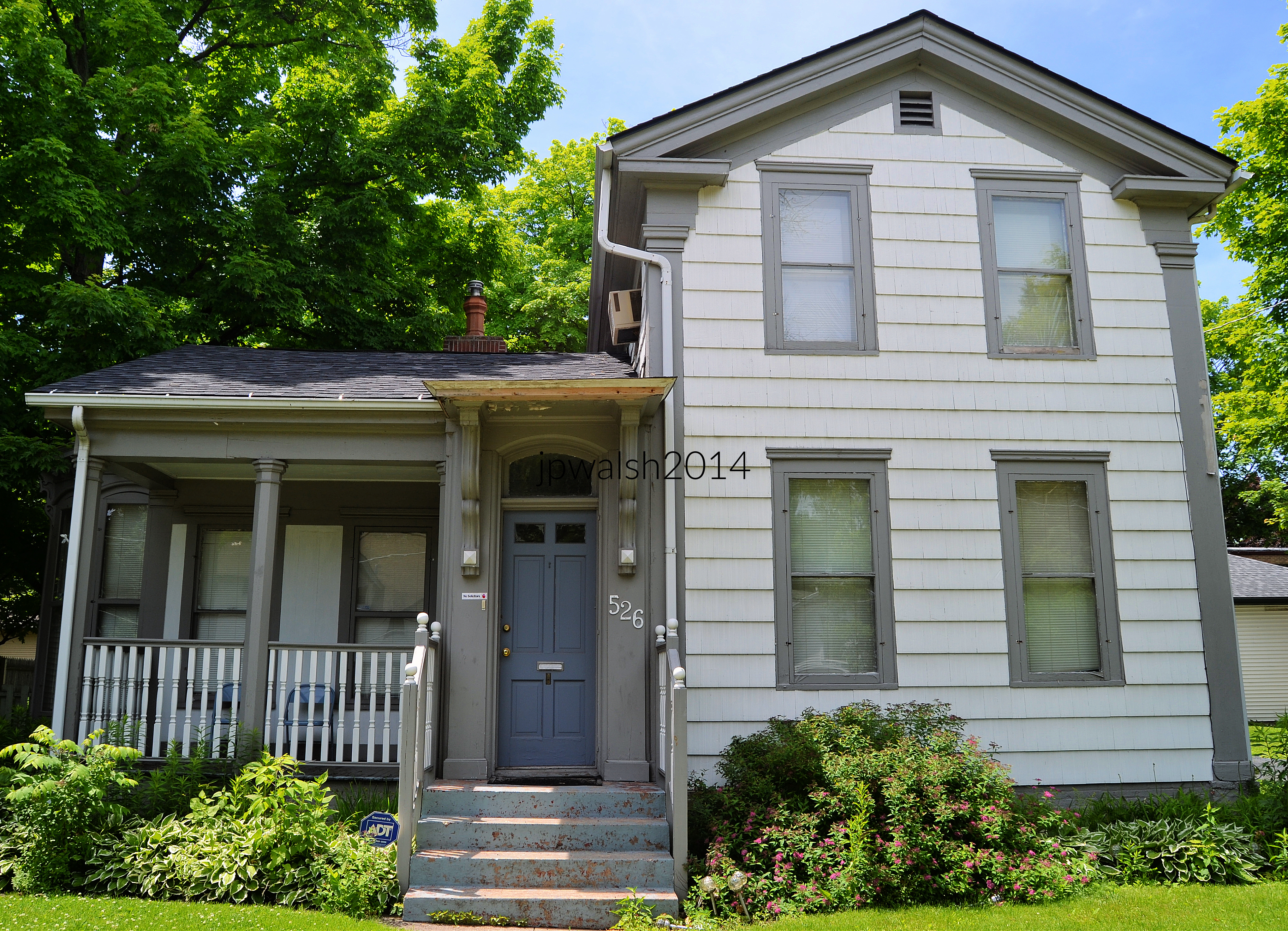
526 N. Sheridan, late 1840s. A Greek revival style house prevalent in the state of Ohio. The Greek Revival gable has short returns with the second-floor windows extending into the gable area. This is a construction short cut for these upper story rooms. The porch with its octagonal columns and front door entry with its heavily bracketed canopy are later additions although no later than the mid1870s.
619 N. Sheridan Road, 1840s. The present house was built around an earlier house erected in the 1840s. It is in the Victorian Gothic style. There are steep gables for the central tower and dormers. The central doors and windows have simple and neat surrounds.
Detail of same house above, 619 N. Sheridan Road, 1840s.
Waukegan’s historic houses and neighborhoods reveal the story of a city shaped by lake commerce, railroads, industry, immigration, and economic growth, with its architecture preserving the ambitions and cultural aspirations of successive generations from the 1840s through the early twentieth century.
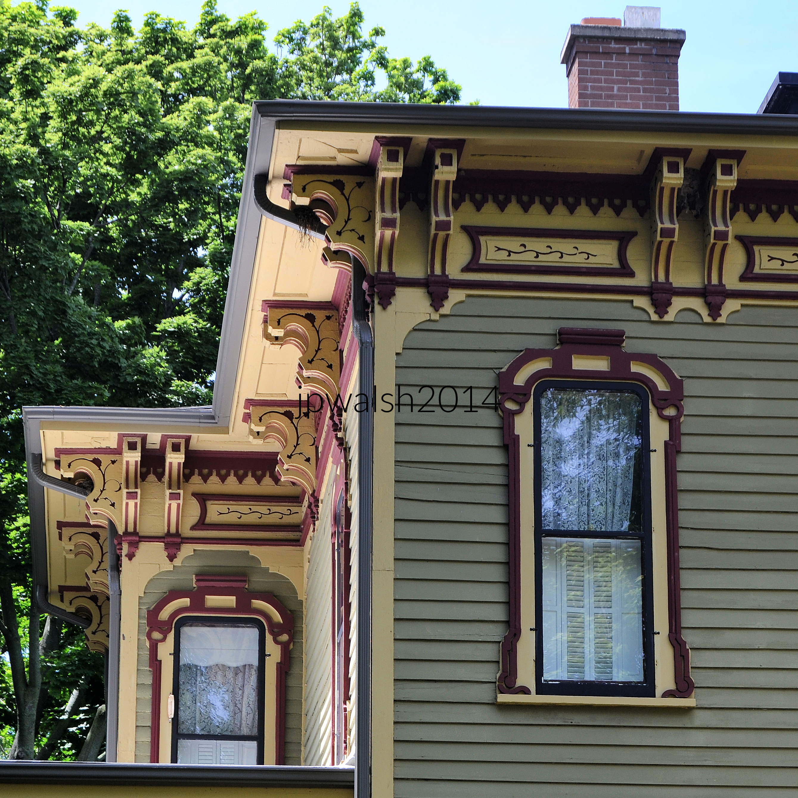
710 N. Sheridan Road, 1872. A restored Second Empire and Italianate Victorian mansion. The frame house features a double door entrance with glass panes and a veranda-like columnar front porch. A square-shaped second-floor porch is above the front entrance in the central section of the house and below its double bracketed cornice and Mansard roof.
Detail of double bracketed cornice of restored 1872 Second Empire and Italianate Victorian mansion at 710 N. Sheridan Road in Waukegan, Illinois.
Waukegan preserves a remarkable range of architectural styles including Greek Revival, Italianate, Italian Villa, Victorian Gothic, Second Empire, and Tudor Revival.
837 N. Sheridan Road, 1858. The front porch and polygonal bay window were added to this late-1850s Italianate brick house more than 60 years later, around 1910.
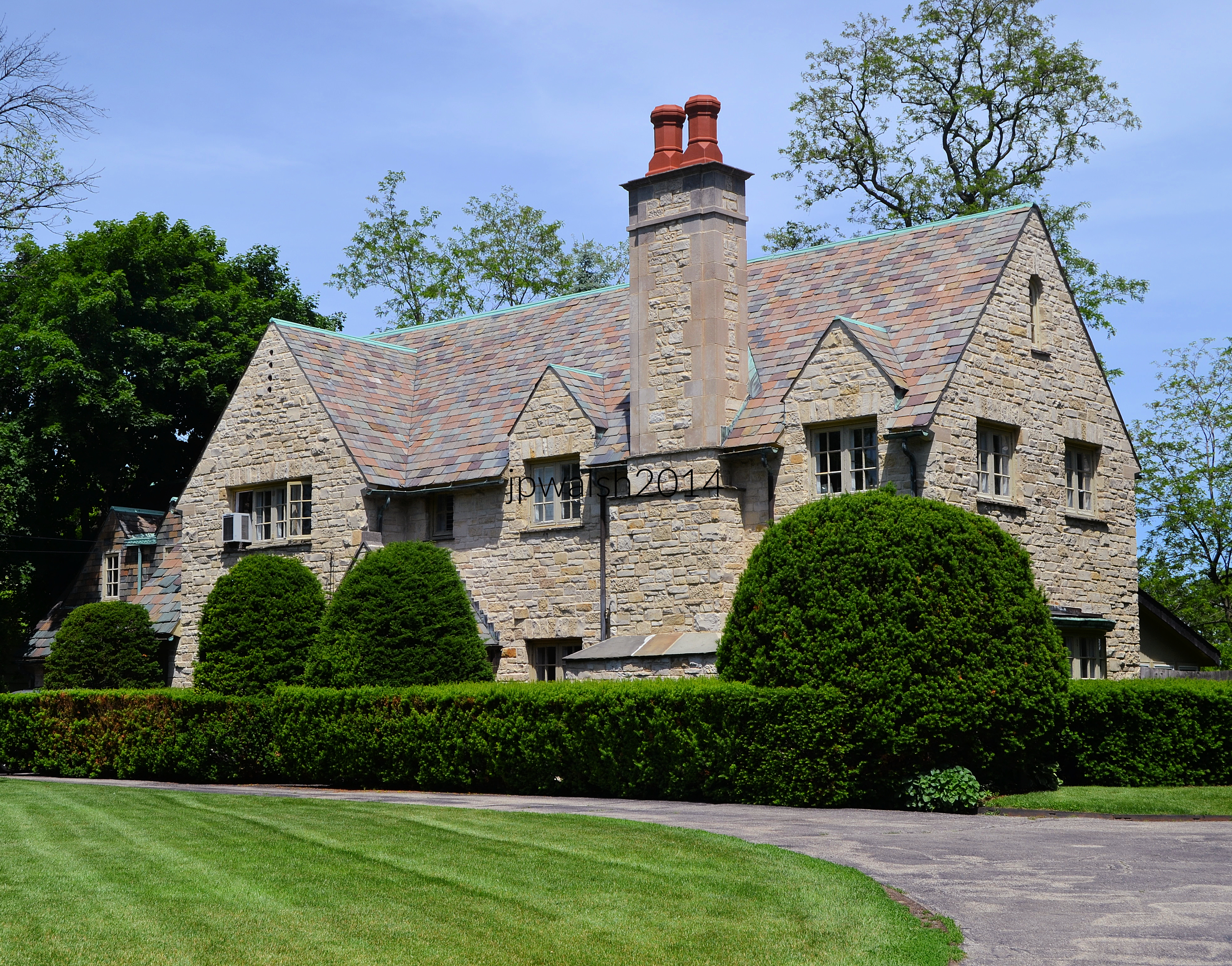
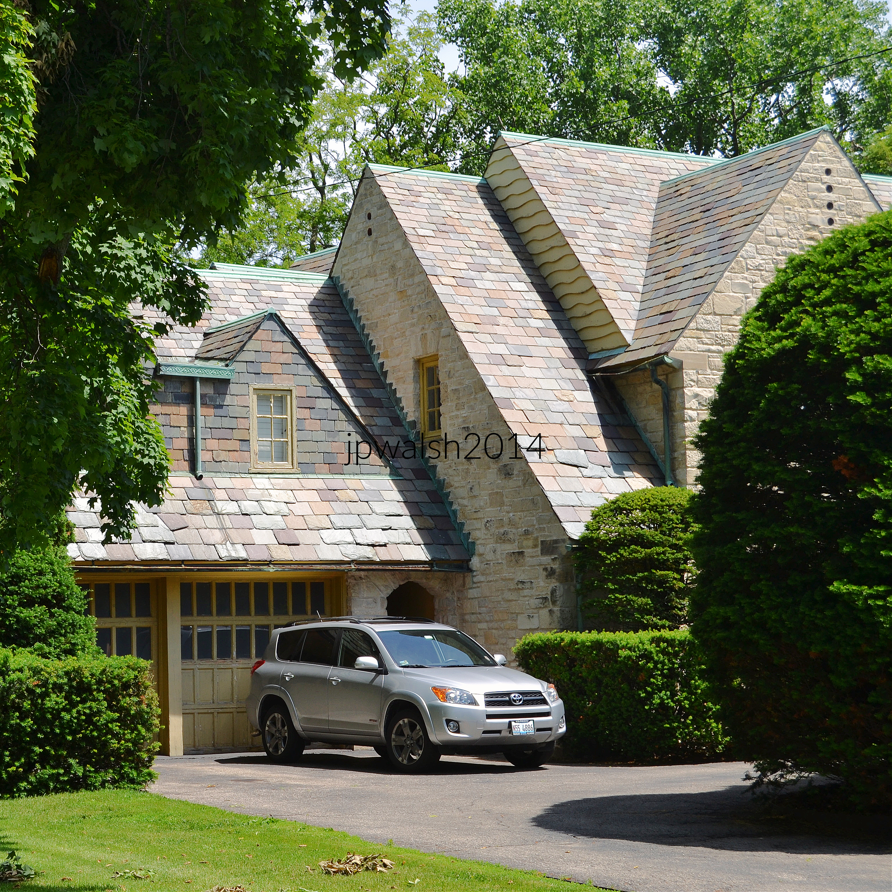
907 N. Sheridan Road, early 1930s. Made of Lannon stone from Wisconsin, the buff-colored, blocky, sedimentary dolomite rock house is designed in the English Tudor style. It has a slate roof. The tall wide chimney is integrated into the façade of the solid stone wall building flanked by casement windows in gabled wall dormers.
Another view of same house above, 907 N. Sheridan Road, early 1930s. The well-designed monolithic stone and slate fortress was erected during the Great Depression.
Individual houses illustrate changing architectural fashions across nearly a century of development. Waukegan’s built environment reflects both nineteenth-century optimism and twentieth-century prosperity before later industrial decline and demographic change.
946 N. Sheridan Road, 1876. An Italianate house has a central tower with notable openings – a ground floor heavy doorway; above that, a pair of windows under a semi-circular pediment; and finally, at the top, a triplet of windows under a triangle pediment. The second floor carries the semi-circular pediment design across three more of its windows and there are double brackets under the eaves. The porch is likely an early 20th century addition.
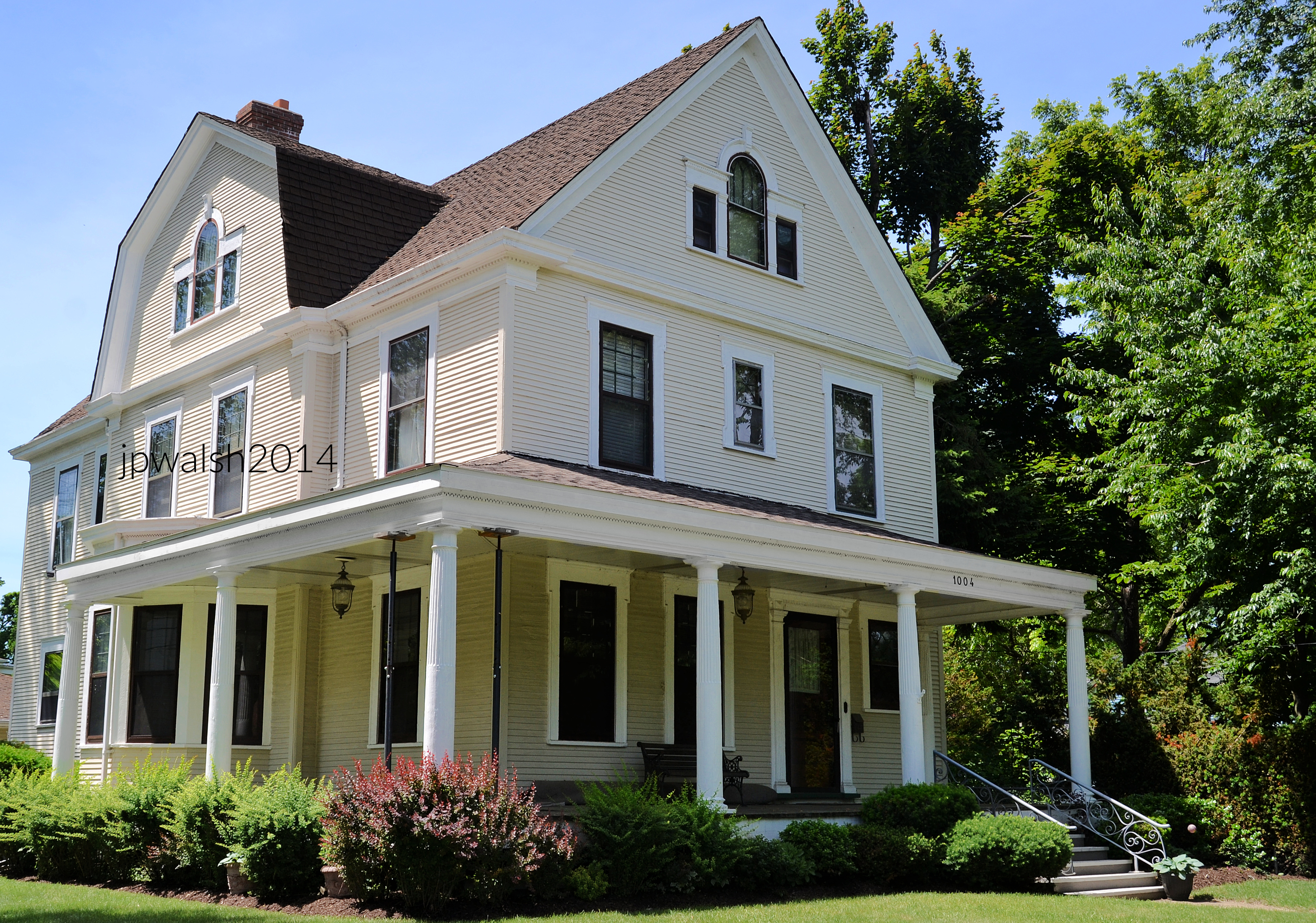
1004 N. Sheridan Road, late 1890s.
Sources:
Bach, Ira J. 1981. A Guide to Chicago’s Historic Suburbs on Wheels and on Foot. Chicago: Swallow Press/Ohio University Press, pp. 97-111.
FEATURE Image: 124 Scottswood Road, Riverside, Illinois, 1871, by William LeBaron Jenney (1832-1907). A full description of this house is in the post. June 2022. Author’s photograph.
Riverside, Illinois, is not simply an early suburb of Chicago but one of America’s most significant planned communities, where the visionary landscape design of Frederick Law Olmsted and Calvert Vaux created a setting that attracted generations of distinguished architects, producing an extraordinary architectural legacy that spans Gothic Revival, High Victorian Gothic, Queen Anne, Richardsonian Romanesque, Prairie School, and other styles.
John P. Walsh, 2022-23. All rights reserved. All text and photos are the property of the author, except for materials explicitly credited as public domain or licensed content.
INTRODUCTION.
The location of today’s Riverside, Illinois, has been an active and important historical area since before the 17th century. It was part of an active trading route and the center for Native American Indian settlements – The Green Bay, Barry Point, Portage Trails, and numerous smaller Indian trails, all passed through the area. It was only a couple of miles from the so-called Chicago Portage which connected Lake Michigan to the Mississippi River centuries prior to the building of the I&M Canal before 1850. French explorers Jacques Marquette and Louis Jolliet passed by Riverside in 1673 when they were shown the portage by Native Americans. The Chicago Portage is a National Historic Site because it opened the western continent to trade and settlement as well as became the key to the founding and development of Chicago, just 11 miles away.
Riverside was originally inhabited by the Illinois and Miami Indians. In the late 18th and early 19th centuries the Potawatomi became the dominant tribe together with the Chippewa and Ottawa and formed an alliance called the “Council of Three Fires.” These tribes lived on wild game and roots, but later adapted to farming, with fields of corn, beans, and squash.
During these many centuries, Indian burial grounds and encampments were located in Riverside on grounds besides the Des Plaines River and towards the east to today’s Fairbank Road.
The state of Illinois was founded in 1818. For the next 24 years, the Illinois volunteer army fought local native American tribes and forced them to sign treaties and migrate west of the Mississippi.
After the Indians were first forced off their land by treaty in the early 1800’s, brothers David and Barney Lawton (or Laughton) came to the area from Michigan and established an outpost in Riverside in 1827 or 1828. Into the 1840s Illinois was the edge of the wilderness. These fur traders chose the area for similar reasons that the Native Americans had – its proximity to the Chicago Portage and the convergence of established trails whose traffic made it conducive to a thriving trading business.
Riverside grew from an important Native American and transportation corridor into one of America’s earliest planned suburban communities.
The Scout Cabin on the Des Plaines River in Riverside, Illinois, is situated in an historic area of Native American and pioneer settlements. February 2023. Author’s photograph.
In July 1832 the U.S. Government sent General Winfield Scott (1786-1866) to help with the Black Hawk War that started in April of that year and ended in August. That short war also involved a young 23-year-old captain from New Salem, Illinois, named Abraham Lincoln. Upon leaving Chicago, Scott and his army camped in Riverside along the Des Plaines River for several days and then marched further west. Scottswood Road, one of Riverside’s primary residential arteries, is named after the general.
In 1831, the first white permanent settlers came to Lawtons’ Tavern in Aux Plaines (the name for Riverside then) and settled in the first houses west of Chicago. Once Gen. Scott’s military campaign was over, he returned to Chicago and dispersed the volunteers. Federal law required the state to have a standing army, so the state legislature passed a law requiring counties to form militia. In 1834, Cook County formed the first militia when Stephen Forbes, Cook County’s first sheriff, called up volunteers to Laughton Tavern. Over 1000 enterprising men assembled in Riverside and elected Jean Baptiste Beaubien (1787-1864) the first colonel of the Cook County Militia.
The first stage of modern transit development was the Southwest Plank Road (later Route 66) completed from Chicago to Riverside in 1849. The road, called Ogden Avenue today, was eventually extended to Naperville, Illinois. It was operated as a toll road whose proceeds went to the private concerns that built it. Toll amounts depended on whether the traveler was a four-horse vehicle or a single horse and rider. Since its installation, the plank road has been a successful endeavor as it was the only road through areas that were often inaccessible.
Commercial enterprises in this period included additional taverns that offered lodging and board for travelers and their horses. There was also a brewery and distillery.
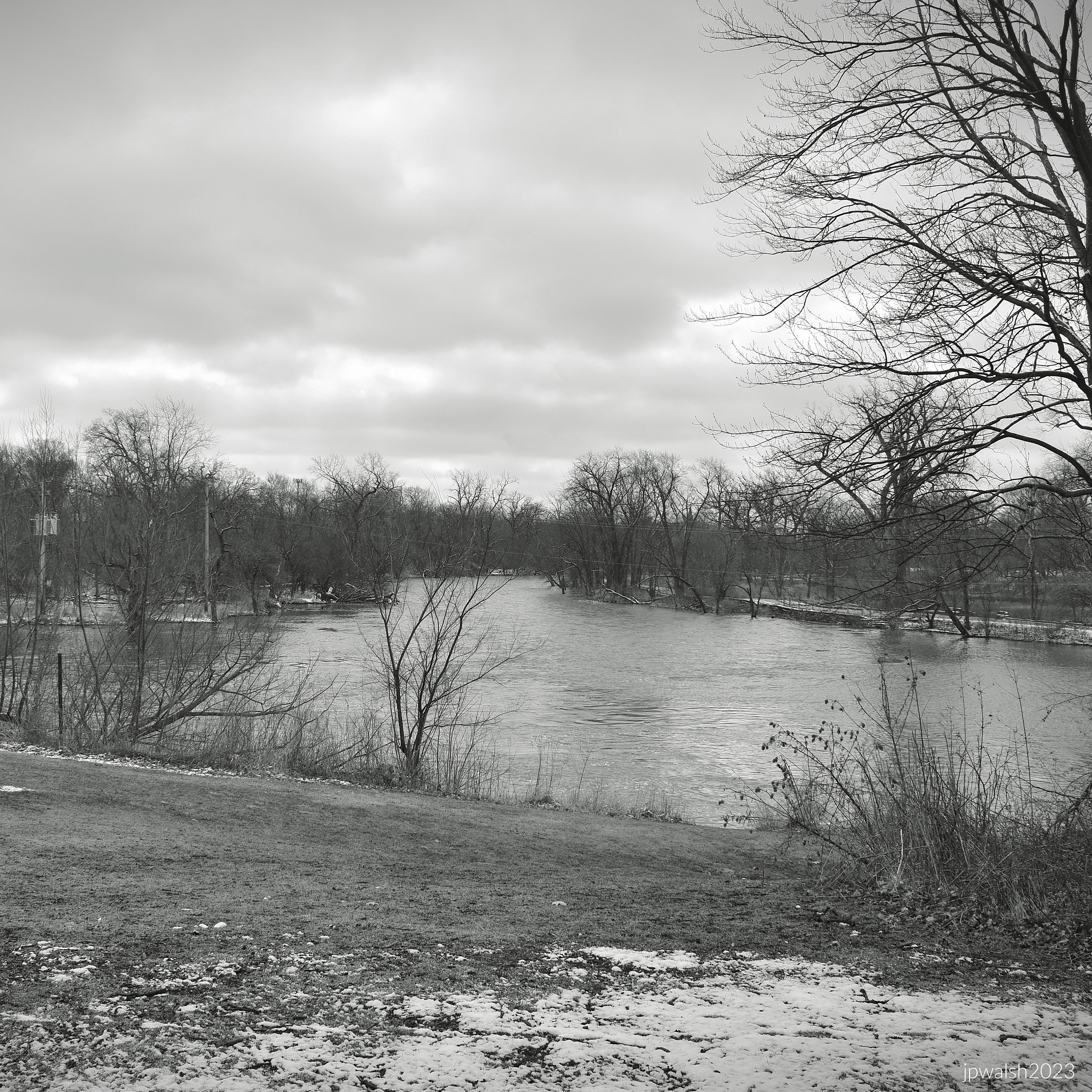
A bend of the Des Plaines River in Riverside, Illinois. February 2023. Author’s photograph.
Riverside was mostly wooded tracts and farmland until the Civil War when the Chicago, Burlington & Quincy Railroad built a rail line through the area in 1863. With the rail a group of businessmen in 1869 formed the Riverside Improvement Company and set out to develop “a perfect village in a perfect setting.”
These Riverside businessmen hired landscape architects Frederick Law Olmsted (1822-1903) and Calvert Vaux (1824-1895), who had previously designed Manhattan’s Central Park, to design one of America’s first planned suburban communities. Their innovative plan set a template for suburban community planning such as curvilinear streets and modern amenities. Their vision was to design a mostly rural community with the conveniences of urban life such as utilities and broad streets. Whereas these curvilinear streets were utilized to fit an expansive community into limited open space it was also inspired by the community’s relationship to its natural environment, particularly the curves of the abutting Des Plaines River.
In addition to its legendary landscape architects (like Frederick Law Olmsted and Calvert Vaux) and world-renowned residential architects (such as Frank Lloyd Wright), the development of Riverside, Illinois relied heavily on civil engineers, sanitation and drainage planners, and bridge/infrastructure architects.
Portrait of Frederick Law Olmsted (1822-1903). Public Domain.
Calvert Vaux (1824-1895). Public Domain.
The 1869 plan by Olmsted and Vaux established curving streets, parks, and a design philosophy that integrated architecture with the natural landscape of the Des Plaines River.
The design of Riverside included important public spaces including a central square and park system that contained several large parks and scores of small triangular parks scattered through the village.
General Plan of Riverside · Olmsted, Vaux & Co. Landscape Architects 1869. Public Domain.
By 1871, Riverside had several larger homes, the water tower, and one of the country’s first multi-shop arcade buildings. There was a church, train depot, and grand hotel. Following the Chicago Fire in October 1871 there was a time of regional financial panic accompanied by frenzied renewed building. In the wake of Riverside Improvement Company going out of business, local Riverside residents came together to see Olmsted and Vaux’s design plan completed and built upon.
The Wesencraft residence is Riverside’s oldest home. It is located at 78 Pine Avenue on the north side of the railroad tracks. Public Domain.
Riverside grew slowly in its first decades but by the 1920s and 1930s had doubled and tripled its population of mostly middle class and upper middle Chicago commuters. This bedroom community grew steadily until its peak in 1970 (10,357 residents). Since then, Riverside’s population has dropped slightly and leveled off to a lower growth number so that by 2020 there were nearly 9,300 residents. (See – https://www.census.gov/programs-surveys/decennial-census.html – retrieved 3.3.23)
Since its incorporation as a village in 1875, Riverside also attracted increasing numbers of eminent architects to contribute to the diversity of Riverside’s historic architecture. These include Frank Lloyd Wright (1867-1959), William Le Baron Jenney (1832-1907), Charles Frederick Whittlesey (1867-1941), Joseph Lyman Silsbee (1848-1913), R. Harold Zook (1889-1949), Frederick Clarke Withers (1828-1901), Howard Van Doren Shaw (1869-1926), and William Eugene Drummond (1876-1948). Much of their work remains today evident in scores of historic landmark structures in Riverside.
Riverside became a showcase for the work of major architects including Frank Lloyd Wright, William Le Baron Jenney, Frederick C. Withers, Howard Van Doren Shaw, R. Harold Zook, Joseph Lyman Silsbee, and William Drummond.
Frank Lloyd Wright in 1903, likely a self-portrait. Public Domain.
William Le Baron Jenney (1832-1907). Public Domain.
Charles Frederick Whittlesey (1867-1941). Public Domain.
Frederick Clarke Withers (1828-1901). Public Domain.
William Eugene Drummond (1876-1948). Public Domain.
Howard Van Doren Shaw (1869-1926). Public Domain.
Public buildings such as the Water Tower, Arcade Building, train depot, Town Hall, and churches are as significant as the residential architecture.
OLD WATER TOWER, 1869, 10 Pine Avenue. Designed and built by William Le Baron Jenney of Jenney, Schermerhor & Bogart, Architects and Engineers.
The original Water Tower had a Gothic Revival wooden tank. The tower is accompanied by two round stone well houses built in 1898 and designed by George William Ashby. When the original tank was destroyed by fire in 1913, a steel tank was installed and the tower was raised 20 feet. It was topped by a canopy designed by William Mann.
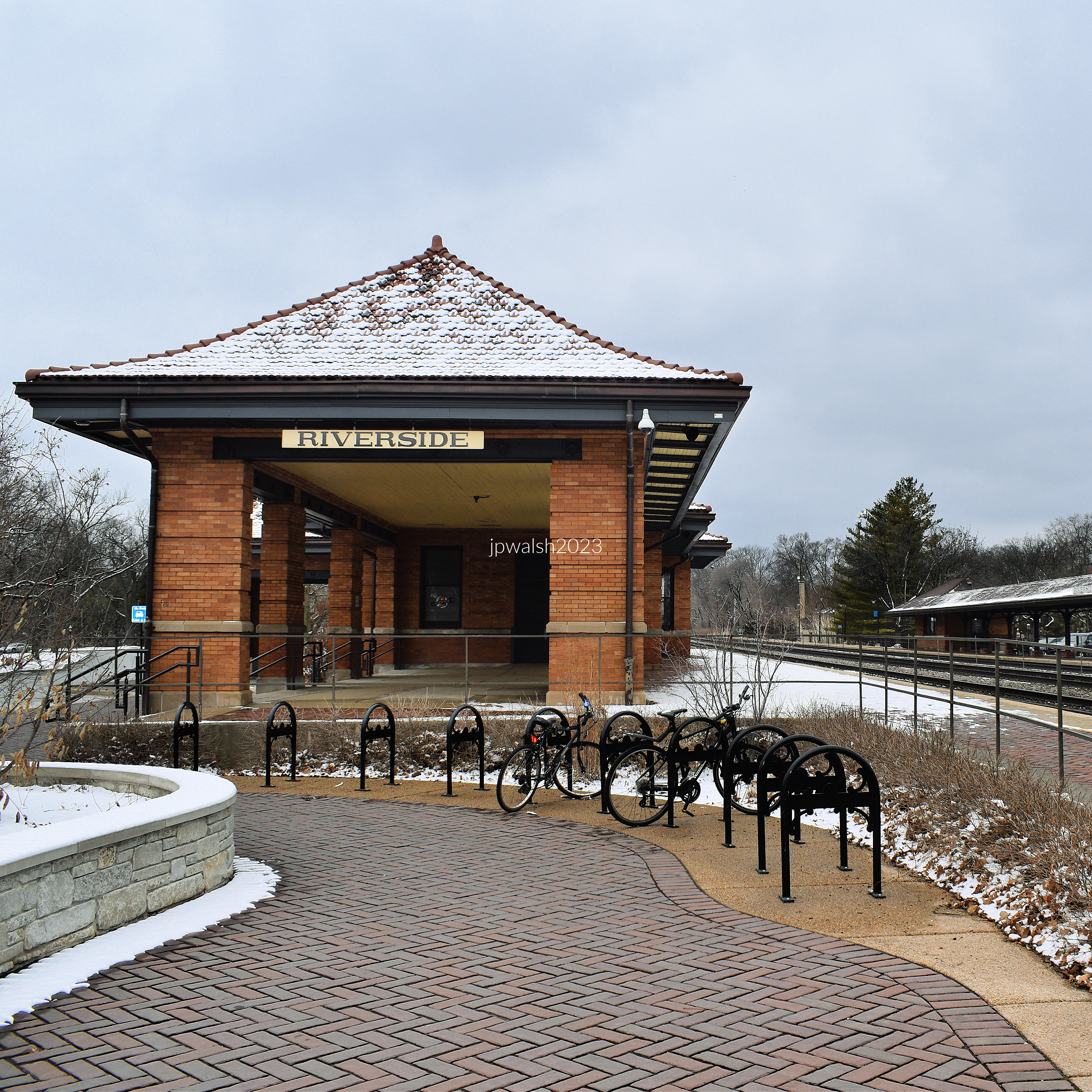
Riverside Railroad Depot, c. 1901, 90 Bloomingbank Road and 15 Pine Avenue. Designed and built by the Chicago, Burlington and Quincy Railroad.
A railroad through Riverside came in 1863, 6 years before the Olmsted/Vaux plan and 12 years before the village’s incorporation. William Le Baron Jenney designed the first depot in 1871. This main depot with open covered extensions on the south side of the tracks was connected by a tunnel to the north platform.
The view above shows the expansive tile roof-covered main entrance. The two large columns with variegated brick gives columns design and texture. There are many windows to allow natural light from its south exposure and a view of the tracks to the north.
Looking east, the orange-brick-colored main depot has open covered extensions for commuters to be protected from the elements during their wait outdoors for a train connection.
Looking west, a view of the train depot with one of its open covered extensions and peaked snow-covered tile roof. The northern platform is visible across the railroad tracks on the right. Author’s photograph taken in February 2023.
The same view as above over 100 years ago. Riverside Train Depot, 1919. Public Domain.
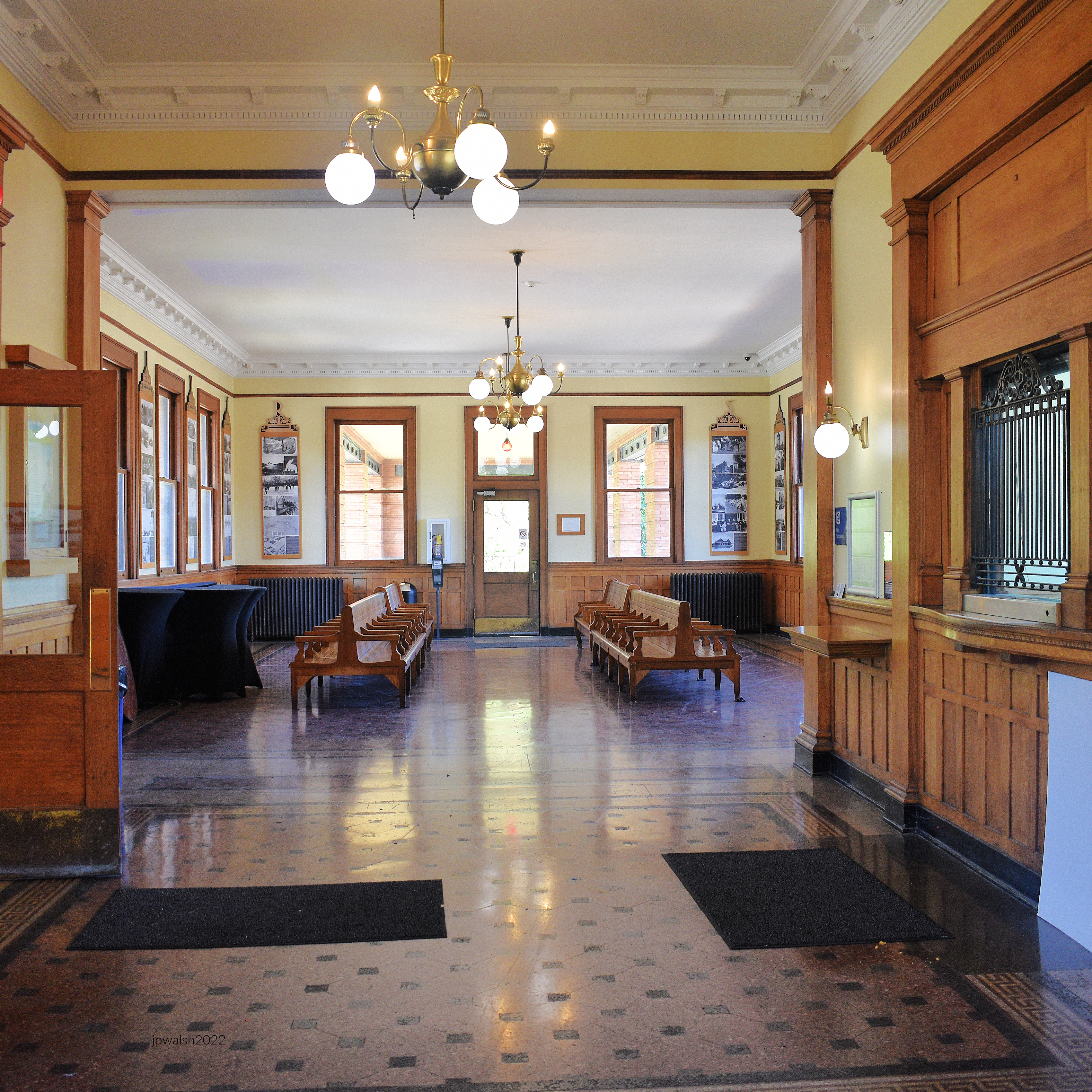
Interior, Riverside Train Depot, c. 1901, includes a waiting room and, at right, ticket agent window. The ceiling has wainscotting and there are period light fixtures to accent the natural light pouring in from the series of encased large rectangular windows.
On the brick-paved platform, another of the train depot’s open covered extensions.
The Lake House, a 2006 fantasy romance film from Warner Brothers, was shot in Riverside, Illinois. A doctor (Sandra Bullock) who occupied a lakeside home exchanges letters with its newest resident, an architect (Keanu Reeves). When they discover that they’re actually living two years apart, they must try to unravel the mystery behind their romance before it’s lost in the midst of time.
While several scenes in the movie were shot in Riverside, Illinois—including at the local train station and the bridge on Riverside Road—the lake house was built from scratch for the movie and its scenes were filmed on the shores of Maple Lake within the Palos Forest Preserve in nearby Willow Springs.
Riverside Town Hall, 27 Riverside Road, Riverside, Illinois, 1895, designed by George Ashby.
In 1891, the Village of Riverside and Riverside Township reached an agreement so that the village donated the land for a town hall and the township paid for its construction.
In 1893 the township authorized $15,000 for construction (about $500,000 today) and this picturesque and stately building, designed by George Ashby, was completed in 1895. The clock was added to the main tower in 1941.
The building is Richardsonian Romanesque at a time when that style, very popular in the 1880’s, had begun to wane among contemporary architects in preference for the Beaux-Arts.
There is a steeply pitched hipped roof with brick for the top floor and rough faced stone for the ground floor. The turret is polygonal and the windows are of various sizes on all three floors. There are many delicate design elements such as copper cornices, colonettes, stringcourses and dressed stone.
Arcade Building, 1 Riverside Road, Designed and built c. 1871, Frederick C. Withers.
The Arcade Building is the first commercial building built in Riverside following Olmsted and Vaux’s plan and is associated with the village’s original developers, the Riverside Improvement Company.
The Arcade Building – a multi-color brick and limestone building with pointed arches and projecting cornices and stringcourses – is High Victorian Gothic. It was designed by architect Fredrick C. Withers, an associate of Olmsted and Vaux. With its mansard windows between tower pavilions, the simple building references the elaborate and decorative Second Empire architecture.
Riverside Presbyterian Church, 116 Barrypoint, 1872, Frederick C. Withers.
The church building was designed by Fredrick C. Withers who designed the Arcade Building at around the same time. Like that early commercial building the church is an amalgam of styles and forms, including Gothic Revival and Italianate.
The stone building has a series of pitched gable roofs that cover and form the transepts and chancel. The corner tower rises to a timber belfry with moldings and pointed arch openings whose original manual pull bell as well as modern chimes still mark the hours. Extensions to the left and right are mid-20th century additions done in harmony with the original design.
100 Fairbank Road, 1869, by Calvert Vaux.
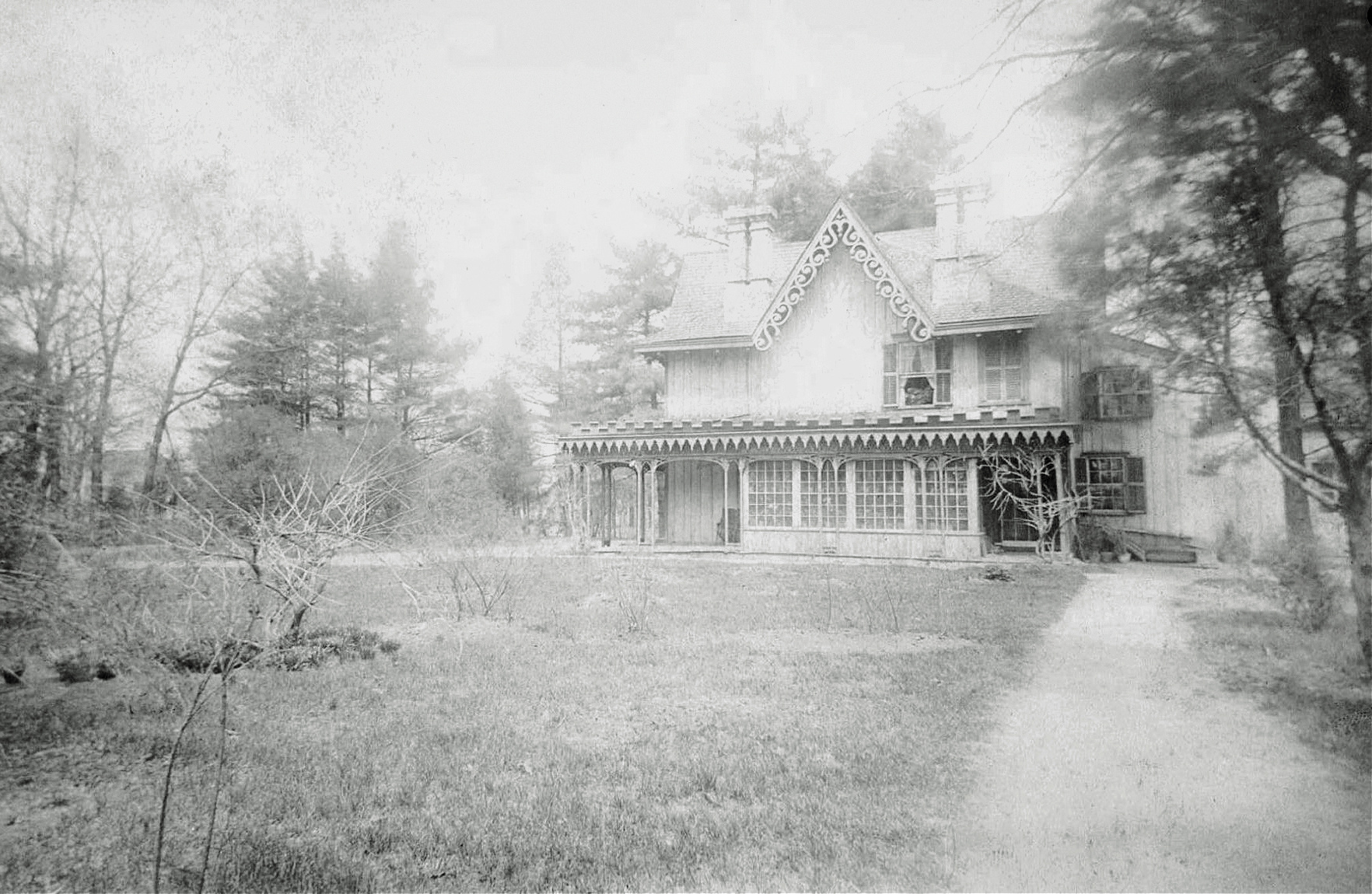
This clapboard Carpenter Gothic style house was designed as a model home for the Riverside Plan by that plan’s designer, Calvert Vaux. It is an example of East Coast architecture transplanted into the heart of the Midwest. The ground floor is higher than the second floor. The low-pitched roof is punctuated by a projecting porch with Gothic Revival carpentry supported by struts and a gabled roof.
Two other second floor porches are on the short sides of the building extending across that width above a ground-floor projecting bay. The clapboard sheathings are meticulously and variedly cut for decorative effects throughout the building’s exterior.
Curved sidewalks follow their own direction and along a mostly wooded landscape.
107 Bloomingbank Road and 111 Bloomingbank Road, both c. 1890.
This neighboring pair of Queen Anne style homes are variations of the same building design. The buildings’ design shares a porch across the entire front, arched enclosed second floor porch, and front-facing attic windows. Both share the same kind of clapboard and shingle sheathing.
Houses on Bloomingbank Road face the Des Plaines River.
The Des Plaines River has flooded Riverside repeatedly, causing major damage at least seven to ten times in modern history. Record-setting floods struck in April 2013, August 1987, September 1986, and September 2008. Additional significant flood crests reached major or moderate flood stages in 2007, 2017, and 2020. As suburban development and impervious surfaces such as concrete have expanded throughout the surrounding region, flood risks and impacts within the village have generally increased over time. February 2023. Author’s photograph.
143 Bloomingbank Road, c. 1869.
This house is set back from the road and built in 1869 which was the year that Olmsted and Vaux were commissioned to design the suburb. The Italianate-style house has tall windows and large brackets with feet and shoulders for their jambs and segmental points. The second-floor windows are met by a first-floor transomed window. A steeped pitched roof and complex massing is Gothic Revival. A subdued color palette blends into the natural surroundings. The porch veranda is original.
201 Bloomingbank Road at Scottswood, c. 1870.
The above 1870 house is a T-shaped Gothic revival with the stem of the “T” facing the street. The stem is surrounded by a veranda whose porch columns are Italianate with Gothic style “carpenter” capitals. The tall windows and lintels are Italianate. The façade’s windows are under a hood molding and the attic has a small window with a pointed lintel. The T-stem’s pitched roof in the Gothic Revival style is slightly lower than the T-cross’s pitched roof behind it.
213 Bloomingbank Road, c. 1905.
A frame clapboard and shingled 4-square cube from 1905. There is a front porch held up by four huge piers with ornamental moldings that cover expansive first-floor polygonal bay windows. Below the hipped roof are two center windows with round heads. The painted dark green and yellow mix is stately and blends into the nature setting.
253 Bloomingbank Road, c.1890.
The Queen Anne house from 1890 has a lot of windows. It is a basic cube with a gambrel roof with a wing that also has a gambrel roof. The front porch is covered on one side with a flared roof and on the other side with a pitched gable roof. The second floor has an open porch that looks over the Des Plaines River. The original clapboard and shingles have been covered on the first floor by later stucco.
Bloomingbank Road, Riverside, Illinois.
Riverside’s architecture remains inseparable from its landscape setting, fulfilling the original vision of a “perfect village in a perfect setting.”
Riverside, Illinois. June 2022. Author’s photograph. 6.21mb.
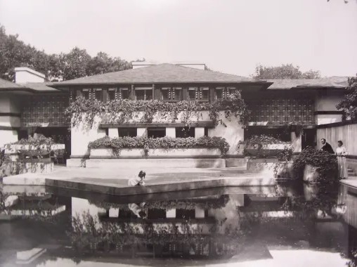
Avery Coonley Estate, 1909, Frank Lloyd Wright.
Avery Coonley House, 300 Scottswood Road, 281 Bloomingbank Road, Riverside (Cook County, Illinois), 1910. Public Domain.
281 Bloomingbank Road, 1909.
281 Bloomingbank Road, 1909. From the street.
What became the nationally-recognized Avery Coonley School was founded in 1906 to promote the progressive education theories of John Dewey (1859-1952). It was founded as The Cottage School by Queene Ferry Coonley (1874-1958) on her estate in Riverside, Illinois, for her 4-year-old daughter.
The school, which continues to thrive today, has occupied several structures in its history. This included a literal small cottage on the Coonley Estate in Riverside to larger buildings designed by Frank Lloyd Wright in 1909. The school moved to Downers Grove in 1916 and, on a 11-acre campus there designed by landscape architect Jens Jensen (1860-1951), became the Avery Coonley School in 1929.
This section of Wright’s 1909 design is set back well off the street and mostly hidden by trees. Behind an iron fence, it is difficult for the public to perceive the full extent of the estate. Wright’s design begins at the street with a low stone urn.
On June 11, 1978, the courtyard’s swimming pool heater exploded and started a fire. The fire destroyed the main house’s living room and a bedroom. The exterior was later meticulously restored to its original appearance which included the school’s stucco walls, simple board trim and multi-color tile façade, all beneath a broad, tiled, hipped roof. At the time of the restoration the swimming pool was re-converted to its original function as a lily pond.
The Avery Coonley Estate represents one of the finest Prairie School expressions in suburban America.
336 Coonley Road, 1909, is another major section of the Coonley estate.
290 Scottswood Road, after 1909.
A free-standing L-shaped domestic structure with a broad hipped roof, the house was added sometime after 1909. Within its setting in the highly-designed suburb of Riverside, this Prairie style house sets a template and direction for much of what would be 20th century suburban development across the country.
300 Scottswood Road, 1909.
This is the main block of the Avery Coonley estate. The house is the epitome of the Prairie School style of broad horizontals, here using stucco boards, tile and glass beneath a low hipped roof. Wright’s design starts at the street with the low stone urn.
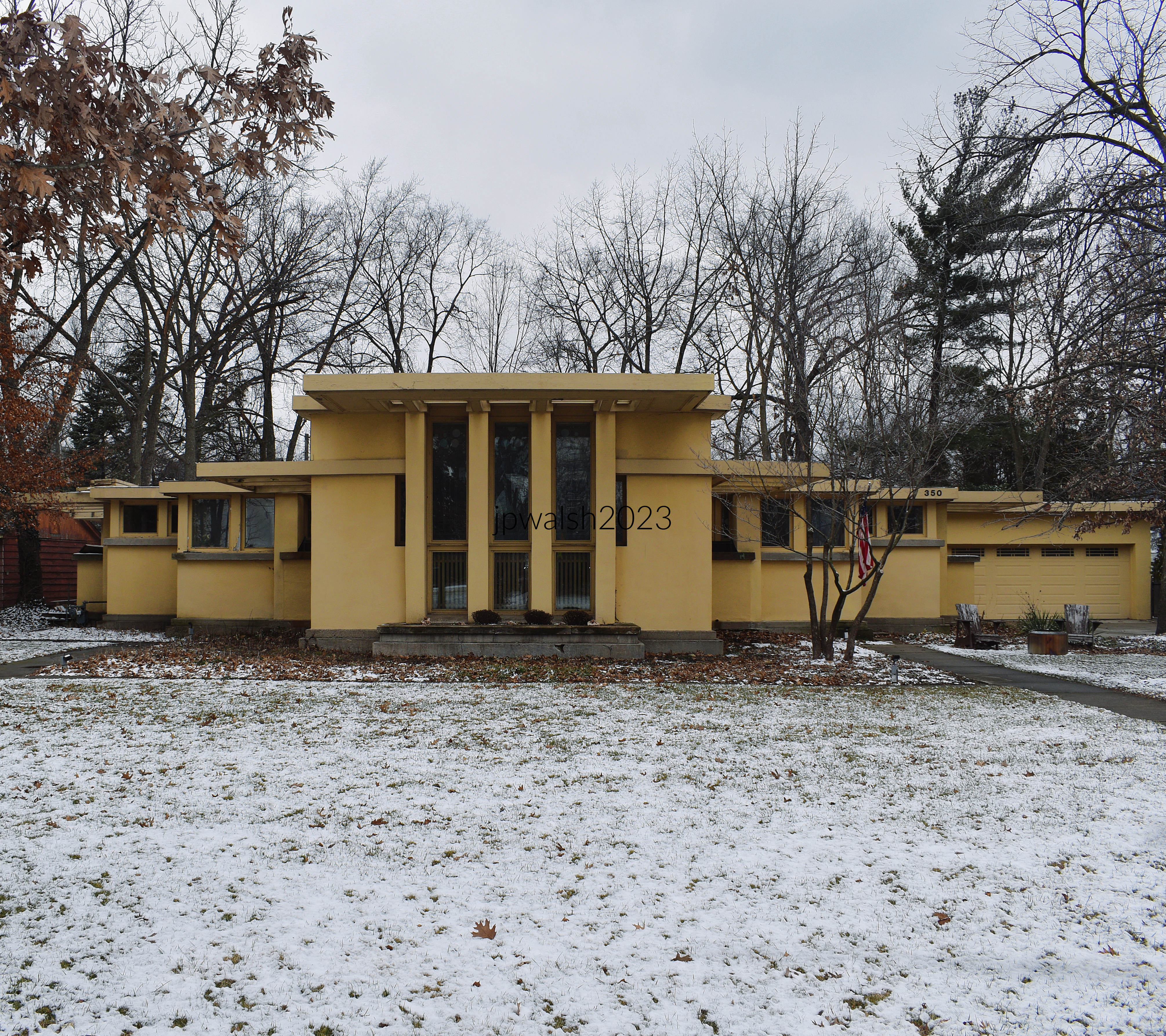
Avery Coonley Playhouse, 350 Fairbank Road, Riverside, Illinois, 1909, by Frank Lloyd Wright.
Avery Coonley Playhouse, 350 Fairbank Road, 1909, by F. L. Wright.
Basic plan of the playhouse (above) is a T-shaped building with higher T-stem to the street. A simple stucco structure, the playhouse’s flat roof and lower wings provide the Prairie style’s broad horizontality. Flat roof of the T-stem extends over three elongated windows while lower wings have clerestory windows.
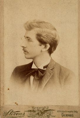
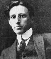
William E. Drummond (1876–1948). Public Domain.
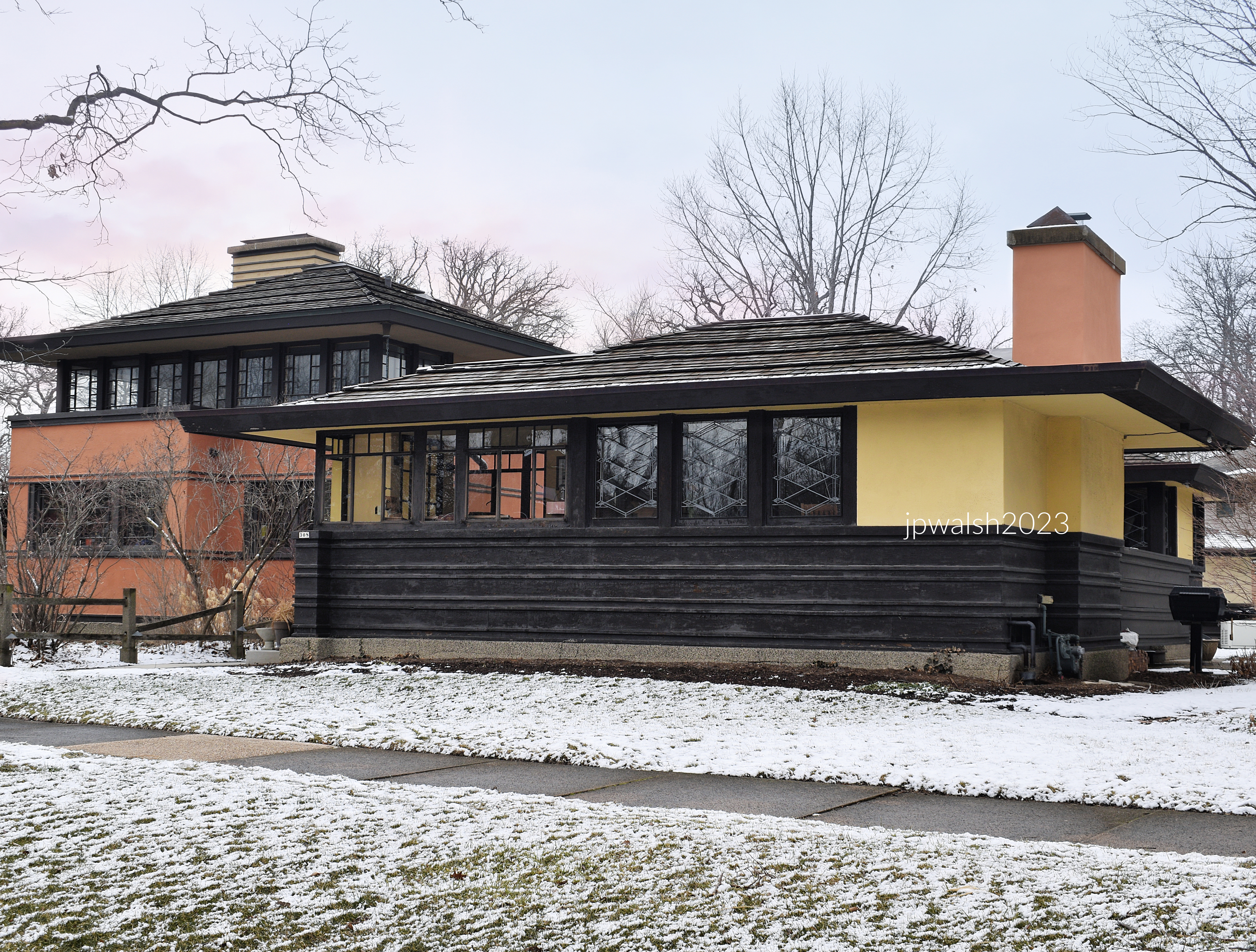
308 Fairbank Road, Riverside, Illinois, c. 1910, Guenzel and Drummond.
Drummond began his career working for architect Louis Sullivan (1856-1924). Later, working for Frank Lloyd Wright, Drummond became the chief draftsman for many of Wright’s well-known commissions. In 1912 Drummond went into partnership with Louis Guenzel who had been a draftsman for Dankmar Adler (1844-1900) and Louis Sullivan (1856-1924).
The house is a one story hipped roofed cube or block with a broad brow of stucco soffits with eaves. The original casement windows include three in the front for the living room with geometric Prairie patterns. The lower portion of the façade is board siding and the top section is stucco.
314 Scottswood Road, Riverside, Illinois.
322 Scottswood Road, 1897.
The simple stone house in an English country cottage style was built in 1897. It has diamond-patterned casement windows and a single half-timbered gable poking out of a gambrel roof. The timber entrance porch that abuts stone achieves an overall craftsman effect.
144 Scottswood Road, c. 1870, William LeBaron Jenney.
Attributed to William LeBaron Jenney, the house is an early building in Riverside. It is a fusion of two styles – the Stick Style and Gothic Revival. The carpentry is solidly masterful. The roof has a low pitch and is punctuated with a massive chimney, dormers and gables with filets, spars and kingposts. The spurs or brackets supporting the overhanging eaves rest on boards intersecting with the clapboard. There is a broad veranda with turned posts supporting a lintel that supports small pointed arches with struts. The porch railing has tightly aligned balusters extending to a below-porch skirt with complementary cut-out patterns. The veranda roof extends over the angled main entrance to become a porte-cochère for the driveway.
124 Scottswood Road, 1871, William LeBaron Jenney.
In the Gothic Revival style, the design and board-and-batten construction of the house is grand and appealing. With steeply pitched roofs, there are several gabled wings of varying distances and directional faces from the building’s core. Windows include long tabernacle windows and others with more elaborate extending jerkinhead roofs that are supported by boards incised with decorative cuts. There are pointed head windows on the second floor over the main entrance while the veranda stretches across two sides of the house supported by slope cut square posts with milled brackets. These and other rare trim and other details, including two massive chimneys, have survived in this house that is today over 150 years old.
118 Scottswood Road, 1880s.
112 Scottswood Road, 1870s.
SOURCES:
Book (with Page Range)
Bach, Ira J. A Guide to Chicago’s Historic Suburbs on Wheels and on Foot. Athens, OH: Swallow Press/Ohio University Press, 1981, 664–679.
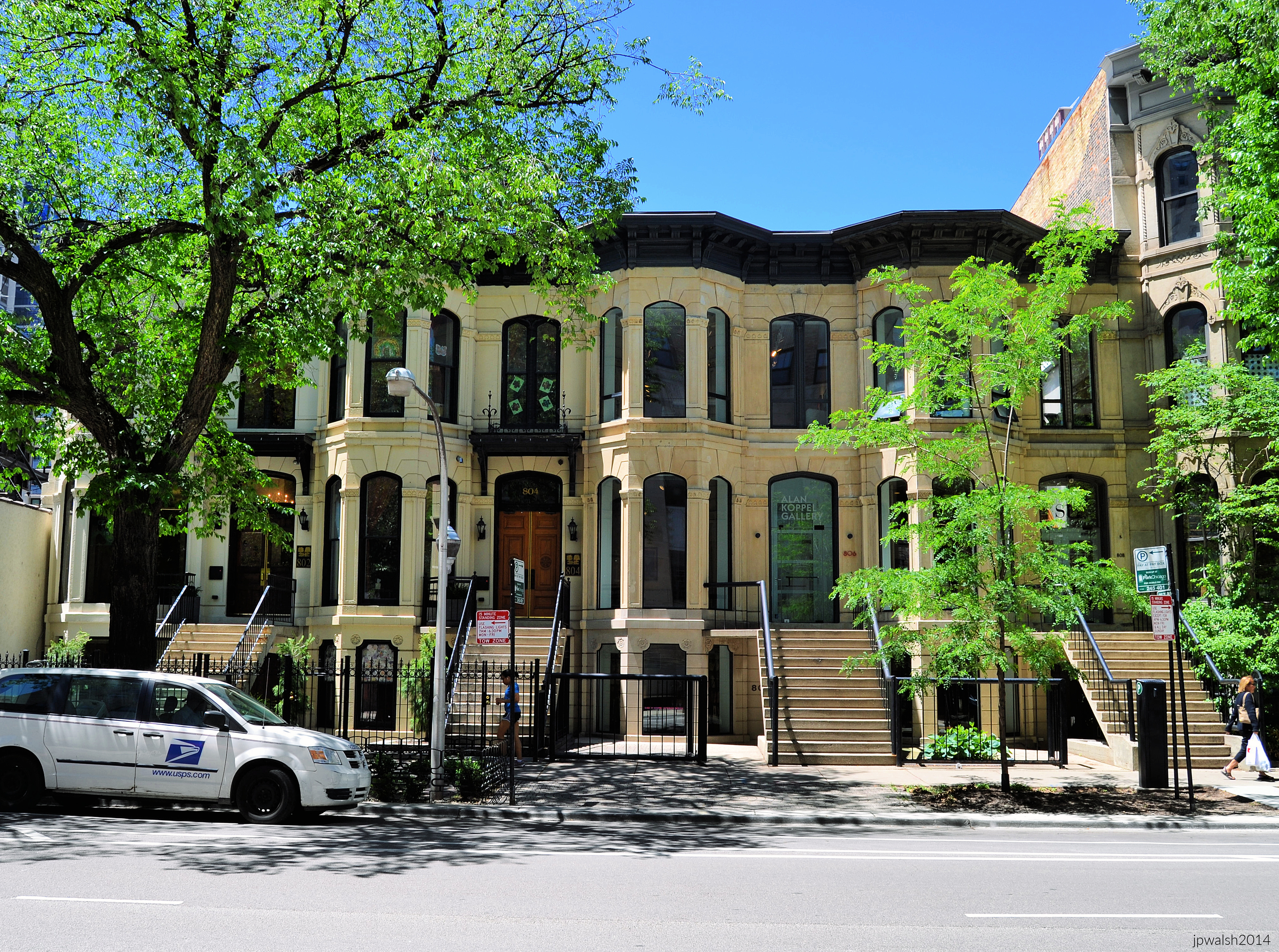
FEATURE Image: Row Houses, c. 1873, 802-812 N. Dearborn Street, Chicago. June 2014. Author’s photograph.
The row houses at 802-812 N. Dearborn Street stand as rare survivors of post-Fire Chicago, illustrating how nineteenth-century urban residential architecture helped shape the city’s transformation from a rebuilding frontier metropolis into a sophisticated national center of commerce, culture, and residential life.
These early row houses were developed in Chicago’s Gold Coast/River North neighborhood in the early 1870s immediately following the Great Chicago Fire.
That tw-day conflagration began on October 8, 1871 at 137 DeKoven Street (around 1100 South) and blew its destruction north through Downtown and into the Gold Coast area. The fire petered out to the north of Fullerton Avenue (2400 North). The area of devastation was a swath of over four miles (see map below).
The fire’s aftermath sparked an intense period of rebuilding, especially in Downtown Chicago, less than one mile to the south of these row houses. This flurry of building activity, particularly of needed housing, may be partly why the architect is unknown for these three- and four-story Italianate buildings, all of which are well preserved.
The three-story row houses to the south have neo-Grec ornament which was in vogue by 1872. It included incised carved detail on window ledges and door frames.
Among the oldest surviving residential buildings in downtown Chicago, the 1873 Dearborn Street row houses offer a remarkable glimpse into the city’s resilience after the Great Chicago Fire and the architectural character of the emerging Near North Side.
The four-story row houses to the north (partially pictured) have more lavish Second Empire exterior decoration.
Like the Italianate style, the Neo-Grec–style row houses have a smooth brownstone front with a pronounced deep cornice, heavy entryway and window details. The contrast was in their ornamentation: Neo-Grec’s simple, precise lines and geometric Greek influence varied from Italianate ornamentation of curved and organic lines and forms.
Italianate curved window and door frames are replaced by Neo-Grec’s right-angles. Lintels are replaced by rectangular blocks. Entryway steps had baluster cast-iron railings that ended in squared-off linear and geometric incised ornament.
Constructed in 1873, shortly after the Great Chicago Fire, these rare surviving examples of nineteenth-century Chicago row-house architecture demonstrate the city’s rapid physical and economic recovery after the Great Fire.
Vintage map of Chicago Great Fire (detail).
CHICAGO POPULATION GROWTH 1860-1980
Chicago’s Explosive Growth Before the Great Fire Chicago was growing exponentially by 1870. In 1860 the city had a little over 112,000 residents and ranked 9th on the list of largest U.S. cities. By the time of the Great Fire in 1871, Chicago had grown to nearly 300,000 and ranked 5th on the largest U.S. cities list.
Equally significant is that the city’s size also doubled in those same ten years from 17,492 square miles in 1860 to 35,172 square miles in 1870. Busy with rebuilding, the city did not expand again in square miles until the 1880’s, though its population continued to soar. When these Italianate row houses were built, Chicago was growing towards becoming the 4th largest U.S. city with a population of over 500,000.
Housing a Booming Metropolis In the early 1870’s with rebuilding and augmenting population density the demand for housing was high. Chicago’s population would continue to grow with each decade until 1980.
The North Dearborn Street row houses were among the residential buildings constructed to meet that demand, reflecting both the city’s remarkable recovery after the Great Fire and its emergence as one of America’s great urban centers.
OCCUPANTS TODAY INCLUDE A CONTEMPORARY ART GALLERY AND THE ALLIANCE FRANÇAISE DE CHICAGO FOUNDED IN 1897
Today, at 806 N. Dearborn is Alan Koppel Gallery which has, for over two decades, introduced contemporary international artists to Chicago audiences.
At 810 N. Dearborn is the main entrance to the Alliance Française de Chicago. Founded in Paris in 1883. the Alliance Française de Chicago is part of an international network of over 1,100 Alliances around the world which promotes French language and francophone culture. Chicago’s Alliance Française was founded in 1897. Offering French language classes and a full range of cultural events, the Alliance Française de Chicago is the second oldest Alliance in the U.S. and the second largest in the U.S. after the French Institute Alliance Française in New York City. The Alliance Française de Chicago is headquartered in two renovated architecturally historic buildings, including the 1870’s row house on Dearborn Street and, connected by an interior garden, a building on Chicago Avenue.
Pridmore, Jay, and George A. Larson. Chicago Architecture and Design. New York: Abrams, 2018, p. 42.
Randall, Frank A. History of the Development of Building Construction in Chicago. 2nd ed. Chicago and Urbana: University of Illinois Press, 1999, p. 5.
Sinkevitch, Alice, ed. AIA Guide to Chicago. 2nd ed. Orlando: Harcourt, Inc., 2004, p. 134.